

Two journalists @betsymason & @dosmonos who love maps and the stories behind them. Co-authors of the @NatGeo book All Over the Map: A Cartographic Odyssey.
- Tweets1.3K
- Following0
- Followers12.2K
- Likes0




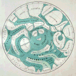








ALT Image of a "Pictorial Lunar Map" (title in lower right corner of the sheet), using an orthographic projection at 1:5,000,000 (approximate), showing the near side of the moon (that due to "tidal locking," always faces the Earth) with green "seas" and yellow craters .


ALT Comparing the size of Valles Marineris, a large canyon on Mars, and North America. An Earth globe has cutouts of the land masses, and Mars is shown just beneath the surface. The canyon crosses from California in the west to the US/Canada border in the east.


ALT The Visible Infrared Imaging Radiometer Suite (VIIRS) on the NOAA-20 satellite acquired this image during the widespread “unusually pleasant” weather on October 31, 2021. Snowcapped peaks are visible across numerous ranges and subranges, from the Coast Mountains in British Columbia to the Rockies in western Alberta.

ALT The icefield is visible in this image, acquired on October 31, 2021, by the Operational Land Imager (OLI) on Landsat 8. The icefield spans the provinces of British Columbia and Alberta, as well as Jasper and Banff National Parks. Saskatchewan Glacier, the icefield’s largest outlet glacier, forms the headwaters of the North Saskatchewan River—an important source of freshwater for communities downstream.


ALT On July 8, 2021, NASA’s ECOSTRESS instrument, aboard the space station captured ground surface temperature data over California. Areas in red – including Death Valley – had surpassed 86 degrees Fahrenheit by 7:16 a.m. local time, well above average ground surface temperatures for the area. Image Credit: NASA/JPL-Caltech


