







Nutgraph – Social Data Lab retweeted

Ten years.
More than a thousand documented land and natural-resource contestations.
Thousands of field notes, maps, laws, satellite images and data points.
And hundreds of stories of communities sustaining shared landscapes and livelihoods.
We’re putting them all in one place.
Lay of the Land
Evidence from a Decade of Change
8–11 December 2026 | India Habitat Centre, New Delhi
A four-day gathering marking 10 years of @LandConflicts, the flagship project of @_NutGraph . An interactive exhibition, the launch of eight new research reports, data and stories from the ground, and two days of conversations on how India’s landscapes have changed and where they are headed next.
At the centre of the conversation: India’s renewable-energy transition and the land questions it is creating, forest rights, commons, coasts, the footprint of data centres, gender, climate resilience and the future of development decisions.
Exhibition
GROUND TRUTH
8-11 December
An immersive journey through land, data, people and changing landscapes.
Dialogue
LAND, DATA AND DEVELOPMENT FUTURES
9-10 December
Day 1: Land and its Legacies
Commons, forests, customs and institutions.
Day 2: Land in Transition
Renewable energy, data centres, coasts and offshore wind.
A decade of looking closely at the ground.
Four days to look at the decade ahead.
Save the date.
8–11 December 2026. Delhi.
More soon.

We are grateful to @CSTEP_India for creating a thoughtful space for participatory modelling, and to all fellow participants for a rich and necessary conversation.
He also underlined the need to decode social and ecological costs of conflict to translate not only to a just transition, but more effective planning and investment.
Taking the example of land classifications like “wasteland”, he shares how the tag alone can overlook grazing, seasonal livelihoods, fuelwood collection, settlements, and existing or potential community rights.
Sambhav shared perspectives from our work on land and resource conflicts, highlighting how several datasets inadequately represent the human element behind land-use.
The discussion looked at the land constraints behind India’s renewable energy expansion. It brought together experts working on land, ecology, governance, conflicts, and community rights to test how models can better reflect realities.
Our Founder & CEO, @Kum_Sambhav was part of an important roundtable hosted by @CSTEP_India in Bengaluru on SAFARI-DHARTI, one of India’s first integrated and participatory Land-Water-Energy-Food Systems models.


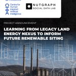
Combining Nutgraph’s field-verified database of 130+ energy-linked land conflicts with satellite imagery, time-series analysis, & on-ground validation, the project will generate a comparative spatial evidence base to improve siting decisions and identify land-related risks early.
By learning from legacy energy systems, using multimodal AI, the project aims to help renewable energy expansion avoid repeating past land-governance blind spots while strengthening long-term energy security and investment confidence.
It also examines how these shifts have shaped the evolving relationships between land, communities, and energy infrastructure over time.
Through this project, we will take aim to build a National Energy Sector Land Use Atlas. The atlas moves beyond conflict documentation to analyse how landscapes, commons, and land-use patterns have changed before and after project development across energy sectors.
As India scales RE at unprecedented speed, an important question emerges. What can decades of land-use change, community-resource interactions, & project experiences across thermal power, hydropower, & transmission infra teach us about planning next gen of energy systems?
We’re excited to announce our new partnership. With the University of Cambridge’s Centre for Human-Inspired AI, we’re building a first-of-it’s-kind AI-augmented geospatial evidence base–helping India’s energy transition learn from past land-use challenges
nutgraph.in/post/learning-fr…

By bringing together developer insights, community perspectives, and empirical conflict data, the research aims to build evidence on how responsible siting practices can reduce risk, improve predictability, and support faster, more sustainable renewable energy deployment.
It will also document how developers currently approach siting and risk mitigation, and evaluate whether tools like SiteRight could help identify high-risk locations earlier in the planning process and avoid conflicts.
The study assesses how land-related challenges translate into time delays & financial costs, & examine whether these challenges are linked to avoidable siting decisions like misclassification of commons, gaps in tenure due diligence, or limited ecological & community assessments.
To explore this, we are initiating a new research collaboration with @TNCAsiaPacific to examine how land-related challenges influence renewable energy project timelines and costs, and how better siting decisions might help reduce these risks and accelerate the transition.
How can responsible siting of RE projects reduce risks for investments and enable just energy transition?
The Renewable Energy Conflict Database has recorded 42 ongoing conflicts affecting nearly 23.3 GW of capacity, with over 7 GW stalled, impacting investments worth nearly ₹77,530 crore.