

USGS retweeted
When you visit Yellowstone, it is common to detect something that smells like rotten eggs. The latest Yellowstone Volcano Observatory video update describes why this smell is a good thing in terms of volcano monitoring, and also shows videos from various geysers and hot springs, including a small hydrothermal explosion in Biscuit Basin on the night of September 27, 2026.
youtu.be/pKJDW8oOXuU
@YellowstoneNPS
USGS retweeted
From liftoff in California to first light over the Himalayas. 🚀🏔️
On Sept. 27, 2021, Landsat 9 launched from Vandenberg Space Force Base, beginning a new chapter in the Landsat mission of recording Earth’s changing land surfaces.
Landsat 9’s sensors brought advanced technology to detect more subtle differences, especially over water and dense forests, and more accurate surface temperature measurements. Together, Landsat 9 and Landsat 8 provide complete global land coverage every eight days.
That repeat coverage is what turns a single image into a story of change. On Oct. 31, 2021, its first day of data collection, Landsat 9 captured this sweeping view of the Himalayas.
Five years and over 26,000 orbits later, the USGS-NASA mission continues to add about 750 new observations per day to a Landsat record more than half a century in the making. Over 1.3 million Landsat 9 products are available to download from the USGS data access portals.
Happy fifth launch anniversary, Landsat 9! 🎉
🔗 Explore more of the Landsat 9 mission: ow.ly/1UJA50ZPM0m
📸1: Landsat 9 launches aboard a United Launch Alliance Atlas V rocket from Vandenberg Space Force Base, California, on Sept. 27, 2021. Credit: NASA
📸2: Landsat 9 image showing Kathmandu, Nepal, (lower left) and the snow-covered Himalayas, glaciers, and glacial lakes across Nepal and China. Acquired Oct. 31, 2021. Credit: USGS
#Landsat9 #EarthObservation #LandsatLegacy
USGS retweeted
It's World Water Monitoring Day. Celebrate by staying prepared! 🌍💧
World Water Monitoring Day is all about understanding and protecting our most vital resource.
For USGS hydrotechs, that mission happens 365 days a year. Our dedicated teams are on the front lines, deploying sensors, measuring streamflow, and tracking water quality to keep communities safe.
Monitoring our waterways isn't just for scientists, though. It's your best tool for emergency preparedness.
Here’s how to stay prepared:
💧 Explore the National Water Dashboard: Check real-time streamflow, groundwater levels, and weather alerts on an interactive map.
💧 Subscribe to WaterAlert: Set up text or email alerts for rivers and creeks near you to get updates if water rises.
💧 Check water quality: Monitor local waterways to see how your watershed is doing.
Knowledge is your best defense.
This World Water Monitoring Day, be prepared. Track your local waterways, know your risk, and always follow local safety guidance.
Explore USGS water monitoring tools - waterdata.usgs.gov
📷 1: USGS hydrologic technician reads measurements from a streamgage while sitting on a partially submerged park table in Zephyrhills, Florida in 2024 just days after Tropical Storm Debby struck Florida's Gulf Coast. Credit: Todd Dunkle, USGS.
📷 2: USGS hydrographer measuring streamflow using a handheld Acoustic Doppler Velocimeter in fast moving floodwater Cajon Creek near Keenbrook, California. Credit: USGS.
📷 3: USGS hydrologic technician takes a high flow measurement on Chartiers Creek in Carnegie, PA during flooding from remnants of Hurricane Ida.
📷 4: A USGS crew measures high flow during flooding on the Maple River near Mapleton, North Dakota. The instrument being pulled across the water is an acoustic Doppler current profiler, which is used to measure streamflow. Credit: USGS.
#StayPrepared #NationalPreparednessMonth #WorldWaterMonitoringDay
USGS retweeted
Kīlauea Update 🌋
New vents that opened in Halemaʻumaʻu at Kīlauea’s summit on September 14-15 continued to erupt lava flows today, September 16. This activity is occurring within the summit caldera in Hawai‘i Volcanoes National Park.
The vents are on or near the northwest wall of Halemaʻumaʻu crater, just north of the existing vent complex that has been erupting lava fountains episodically since December 2024. Here’s a summary of observations from the USGS monitoring overflight this morning:
🔸 Lava continued to erupt from at least one of the five new vents, feeding lava flows on the crater floor
🔸 Spattering at the north vent continues to add to the cone that surrounds it, which is about 30-feet-high, with a 12-foot-wide opening
🔸 Spatter was also visible in the south and west vents
For more than a week, small lava flows and spatter bursts have continued—the longest stretch of low-level activity in this eruption since it began in December 2024.
Ground deformation patterns and earthquake activity indicate that the summit region of Kīlauea remains pressurized. This low-level eruptive activity could continue or additional changes could occur. USGS Hawaiian Volcano Observatory scientists continue to closely monitor Kīlauea and will issue additional notices as needed. All current activity is confined to the summit region of Kīlauea within Hawaiʻi Volcanoes National Park.
📹: Video compilation shows eruptive activity during a USGS Hawaiian Volcano Observatory monitoring flight the morning of September 16, 2026.
#Kilauea #Eruption #Lava
USGS retweeted
National water availability data at your fingertips! 💧🎉
The National Water Availability Assessment Data Companion provides regularly updated, model-based estimates of water availability and use on a national scale.
Nearly 27 million Americans, or 8% of the U.S. population, live in areas where water demand consistently approaches or exceeds naturally available water supply. Until recently, accessing comprehensive water availability information with national coverage required stitching together disparate datasets across multiple agencies, regions, and complicated websites.
The Data Companion eliminates these barriers by:
💧 Providing consistent information about water availability and use across approximately 80,000 watersheds nationwide from 2000 to 2020
💧 Enabling data access through various user-friendly means, including a subset and download tool, a data file directory, an API, and a new interactive map
💧 Continually adding new and updated data to reflect the latest USGS water models and science
Check out the interactive map now: water.usgs.gov/nwaa-data/
📷 1: View of soil moisture data for January 2020 across the lower 48 United States from the Data Companion web mapper.
USGS retweeted
On June 13, 2026, a small hydrothermal explosion occurred in Biscuit Basin! We cover that story in the latest Yellowstone Volcano Observatory video update, along with seismic, deformation, and geyser activity from the month of June.
youtu.be/QYlRp7S3cGY
USGS retweeted
Day one of the Tribal Energy Summit concluded with a Federal Partners Panel. ⚡️
Officials from @EPA, @DOIONRR, @USGS, @PermitCouncil and @Interior discussed how the Trump administration is working across the government to cut red tape, improve coordination, and build tribal capacity to speed up the process of converting resources to revenue so that tribes can invest in their communities.
USGS retweeted
🌑Artemis II is nearing its return to Earth🌎
A sonic boom is expected as the spacecraft re-enters the atmosphere and could potentially be felt and heard throughout Southern California between 5:00 and 5:15 pm local time tomorrow, April 10.
If you hear or feel sonic booms (or not), please fill out this "Did You Feel It" survey.
earthquake.usgs.gov/earthqua…
📷: NASA’s Orion spacecraft captures the Moon and the Earth in one frame during the Artemis II crew’s deep space journey at 6:42 p.m. ET on the sixth day of the mission.
USGS retweeted
If you're in or near northwestern Louisiana and felt (or didn't feel) the earthquake on the morning of March 5, please let us know!
earthquake.usgs.gov/earthqua…
USGS retweeted
Hydrothermal explosions at Norris Geyser Basin...earthquakes...ground deformation...geyser eruptions...
It's all in the latest Yellowstone Volcano Observatory monthly video update!
youtu.be/aMNlRpbu5MI
@YellowstoneNPS
USGS retweeted
Go back in time through decades of Kīlauea eruptions monitored by USGS scientists
🌋 ⚒️ 🪨
The USGS Hawaiian Volcano Observatory is the oldest volcano observatory in the United States. It was founded in 1912 and has been a part of several Federal Agencies—U.S. Weather Bureau (1919–1924), the U.S. Geological Survey (1924–1935), and the National Park Service (1935–1947)—before finding a permanent place with the U.S. Geological Survey in 1947.
In the decades since then, scientists at the observatory have monitored dozens of eruptions at Kīlauea, which is one of the most active volcanoes on Earth. Kīlauea eruptions have reshaped Hawaii's landscapes time and time again.
During the past 75 years, there have been 43 eruptions either at the summit or along the two rift zones. Discover where each of these eruptions occurred, how long they lasted, and what their impacts were with our new interactive timeline.
👉 Go here to learn more: usgs.gov/news/featured-story…
Photos of Kīlauea eruptions in 1960, 1973, 1983, 2009.
USGS retweeted
Yellowstone is famous for its literal ups and downs -- the ground there is constantly rising and falling. But how do scientists measure these moving mountains? Check the latest monthly video update of the Yellowstone Volcano Observatory to find out!
youtu.be/MiCBA4jEGGE
USGS retweeted
#DYK the @USGS Benchmark Glacier Project is one of the longest running studies of glaciers on Earth? You can learn more about their research on the connection between glaciers and climate here! ❄️geonarrative.usgs.gov/glacie…
USGS retweeted
In case you ever wondered what it would be liked to be engulfed in a lava fountain...
This video was recorded by the V3 camera, located on the south rim of Halema‘uma‘u crater at the summit of Kīlauea volcano on the Island of Hawai‘i. The camera, located in a hazardous closed area of Hawai‘I Volcanoes National Park, was buried by tephra from an inclined lava fountain between 9:55 and 9:57 am HST on December 6, during episode 38 that began this morning at 8:45 am. RIP V3 🪦
V1 (youtube.com/watch?v=tk0tfYDx…) and V2 (youtube.com/watch?v=fiyttmA7…) continue to operate.
USGS retweeted
Here are some other views of Kīlauea summit eruption lava fountaining episode 38 in Halema‘uma‘u crater on the Island of Hawai‘i, and answers to some of your questions about this activity.
This eruptive episode began from the north vent at about 8:45 am HST this morning, December 6. Smaller fountains began from the south vent at 8:49 am HST and quickly grew to over 1000 feet (300 meters) high and inclined to the south, towards a closed area of Hawaiʻi Volcanoes National Park. At 9:55 a.m., hot tephra falling from this fountain destroyed the V3 streaming camera site located within less than a mile (2,000 ft/500 m) from the eruptive vents; its burial highlights the hazardous nature of this closed area. The north vent stopped erupting at 11:50 a.m., but the south vent is still fountaining as of this posting.
In addition to the tephra, volcanic gas is being emitted, with sulfur dioxide emission rates likely exceeding 50,000 tonnes per day. The high effusion rate of this episode is also producing a very dramatic plume extending over 20,000 feet above sea level. Both the National Weather Service and Washington Volcanic Ash Advisory Center issued special advisories about this plume, and the Hawaii County Civil Defense Agency issued a message about the potential for fine glass particles in communities downwind.
Kīlauea's recent eruptive episodes have gone on for 5-9 hours; this episode has been active for about 4.5 hours now. The USGS Hawaiian Volcano Observatory staff are closely monitoring this activity, coordinating with partners at Hawaiʻi Volcanoes National Park and the Hawaii County Civil Defense Agency. #Kilauea #lava #eruption
USGS retweeted
.@USGS #ShakeAlert confirms that the earthquake alerts that were delivered at 8:06am are cancelled. There was no M5.9 earthquake near Carson City, NV. We are currently looking into why the alerts were issued. We'll provide more information when we learn more @Cal_OES @CAGeoSurvey
USGS retweeted
Three eruptive episodes, one video. Watch as Kīlauea summit eruption episodes 34, 35, and 36 unfold in this timelapse video created with USGS Hawaiian Volcano Observatory webcam imagery. Note the use of images from two different cameras, one closer to the vent and one farther. The closer camera sustained heat damage during the intense episode 35 fountaining, making the image slightly blurry. This camera was replaced and moved slightly back to a safer spot for episode 36.
USGS retweeted
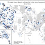
Recently, Interior and @USGS released the final 2025 List of Critical Minerals, identifying 60 minerals essential to our economy, national security, and way of life.
These minerals power everything from our energy grids and defense systems to phones and computers.
USGS retweeted
Good morning Bay Area CA! Did you feel the M4.6 quake about 1 mile southeast of Berkeley at 2:56 am? The #ShakeAlert system was activated. See: earthquake.usgs.gov/earthqua… @CAGeoSurvey @Cal_OES @USGS_Quakes @BerkeleySeismo @CaltechSeismo