

I'm a hurricane enthusiast living in the Naples, FL area! I sometimes post videos of weather in my area: https://xitter.cf/t.co/o2y8s4nkcz
E of Naples FL (Golden Gate)
Joined August 2021
- Tweets18.5K
- Following322
- Followers1K
- Likes5.7K





Pinned Tweet
Hey everyone, I've just released my Hurricane ISAIAS chase video.
Truly a memorable storm with some scary moments.
It's over 90 minutes long, so it's recommended you watch it like a movie, on a monitor/TV with good sound for the best experience.
youtu.be/UDWFAhY6u3Q
TvoldHurricane retweeted

Looking Back on Hurricane Isaias — One Week Later
Hurricane #Isaias peaked as a Category 3 major hurricane (105 kt/120 mph, 959 mb) on October 9 as it was closing in on the Florida Panhandle. It weakened thereafter due to increasing wind shear and dry air entrainment. The center made landfall near Destin, Florida, at about 8:30 p.m. CDT on October 9 as a Category 2 (90 kt/105 mph, 971 mb).
The leading northern edge of the eyewall reached the Okaloosa Island/Fort Walton Beach area while the storm was still a legitimate Category 3 (100 kt); it then weakened by roughly 10 kt over the final 2.5 hours before the center actually crossed the coast.
On a personal note, I was positioned on the narrow and exposed road on Okaloosa Island between Fort Walton Beach and Destin, where wind gusts exceeded 100 mph as the western and southwestern parts of the eyewall moved through. This constituted the 46th U.S. mainland #hurricane eyewall intercept and the 19th major (as it was still a Cat 3 when the aforementioned northern edge moved overhead).
The storm produced an unusually broad and asymmetric wind footprint for its official Category 2 landfall intensity. Recorded gusts of 100+ mph occurred from the Pensacola City Hall area to Freeport (~55 nmi along the coast), including within the eyewall and extending well outside it in the western quadrant. In addition, hurricane-force gusts (74+ mph) spanned from Orange Beach, Alabama, to Beacon Hill just east of Mexico Beach (~120 nmi). The peak measured gusts reached 116–118 mph near Oriole Beach and Jay. A sting-jet-like feature on the western edge of the precipitation shield (during the onset of extratropical transition) helped drive the unusually strong western-quadrant winds. These winds caused widespread tree and power-line damage, roof losses on beachfront hotels and other structures, and collapsed gas-station canopies.
More than 900,000 customers lost power across Florida, Alabama, and Georgia (peak reports were around 910,000–911,000). Worst of all, at least nine fatalities were confirmed (six in Florida, two in Alabama, and one in South Carolina), mostly from falling trees and related incidents. Storm-surge inundation of roughly 5.6 ft was observed at Panama City Beach. A Flash Flood Emergency was issued for southern Okaloosa County due to torrential rainfall, with widespread 5–8 inch totals and localized amounts exceeding 12 (including over 11 inches near Mary Esther and Fort Walton Beach), producing major freshwater flooding that caused significant damage to homes and businesses in that area. Preliminary estimates of losses surpass $2 billion.
For residents of the western Florida Panhandle, Isaias is a storm that will be talked about for generations to come.

I’m sorry for the delay, but I finally completed the arduous editing process of the video I captured during #Hurricane #Isaias.
Here are the highlights of what I documented from Fort Walton Beach, Okaloosa Island, and Destin, Florida.
As you will see, it appeared that the winds were stronger when the western and southwestern parts of the eyewall moved over the Island.
TvoldHurricane retweeted

New: 💦 One of the wettest Florida winter’s on record?! It appears likely!
The Super Ensemble forecast shows rainfall 2-3X normal in South #Florida and around 2X over central /north Florida in over Dec, Jan, Feb. (232% =2.3X normal rain)
Thanks, El Niño.
The Super Ensemble is the mother of all seasonal model forecasts. It incorporates models from the US, Europe, Canada, Japan, Germany, France, the UK, Italy and Australia. Obviously these are just an estimate, not exact.
#elnino #elniño

TvoldHurricane retweeted

Raising money for a good cause. And having some fun while doing it. Come plan to part of our 3rd annual 'Neighbors Helping Neighbors Benefit' Saturday December 5th at @campmarg_aub Camp Margaritaville Auburndale. Details below. Proceeds going to help a family we met impacted by Hurricane Isaias. Will be having a raffle, happy hour party, concert, cornhole, karaoke, food, and fun for the whole family. Make a few days out of it if you want. We are! Camp or Cabin. They got you covered! margaritavilleresorts.com/ca…

TvoldHurricane retweeted

Seems that the latest discourse about @juststormchasin's experience has reignited this debate. First and foremost, she was really brave and I'm proud she conquered her first hurricane, a near major and a wonky one too. Insanely braver than most. But if she ended up with a scary experience, and needs some time for herself to process what she experienced, that's perfectly fine for her to work out herself. This doesn't mean she did anything wrong, sometimes it just gets rough. Chasing a hurricane is tough stuff and you are just along for the ride.
One can believe they are prepared for something and come out of it completely scared and changed. Hurricane chasing ain't for everyone, and that's fine. It's not for anyone else to decide for them though. Many people chase a hurricane and then never again.
Experiencing a hurricane is not like tornado chasing. You are guaranteed to see things go down. Unlike tornado chasing where it can remain relatively harmless and/or not even happen. Hurricanes are destructive forces of nature, and not much can prepare you for them until you just do it.
It's also perfectly okay to want to chase them more after your first experience. I love chasing hurricanes and I can't wait to do it again in the future. But it's very, very easy to be in the right place at the wrong time or the wrong place at the right time. The worst comes from wrong place, wrong time. Only 1 of 4 options leads to you being as safe as can be.
The weather we seek to chase spares no quarter, and at various times, we are reminded of that. We all have that one experience, if you do this long enough, that will humble you and remind you how fragile life is and we are at the mercy of our planet. Unfortunately in the weather world, there are people that dive head first way out of their depth and use the trauma for clout or fame. You know who they are. This all being said, there's a growth experience to be had here, for everyone.
On to the next 'cane, ladies and gentlemen.
TvoldHurricane retweeted

Can we talk about the coordinated response to hurricanes has improved IMMENSELY in the last decade?
We were without power for 9 days after Hurricane Ivan. My power, in Brewton, Alabama, was restored in less than 48 hours after Isaias with just about everyone expected to have restoration by the 96 hour mark.
MAJOR, MAJOR, MAJOR KUDOS to all of the power companies and electric cooperatives for making extreme strides in restoring power and more importantly, thank you again to all of the linemen. You are loved!
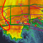
Check out this radar screenshot I took at 7:52 PM on the day of Isaias. You can clearly make out that sting jet like feature on the far left of the frame, circled in red.
Super interesting situation where the peak winds of a hurricane appear to have occurred outside the eyewall.

TvoldHurricane retweeted

Our 12Z experimental HAFS forecast the day of landfall picked up on the structure pretty well, just showed it a little further offshore. It's not really a traditional "sting jet" at the base of the "comma head" because there wasn't one yet (hadn't really fully ET'd yet). But if you look, it seems like there was some really robust subsidence on the backside that likely brought strong winds down to the surface, similar to sting jet. Very interesting case that I want to dig into more.


TvoldHurricane retweeted

NEW: Power outage update across the Southeast from Hurricane #Isaias as of Sunday morning at 9 AM. Roughly 50% of customers have gotten their power back in the past 24 hours, but there are still many in the dark across Alabama and especially Florida. Power companies are working hard around the clock to restore it.


I think my theory that the strongest winds likely hit Pensacola Beach was probably correct. The damage there from the pics I've seen is really bad. The sting jet was insane!

The sting jet from Hurricane Isaias showed up in striking detail as seen by Sentinel SAR instruments: #Isaias

TvoldHurricane retweeted

Here's a preliminary look at peak wind gusts observed in association with the landfall of Hurricane #Isaias on Friday night. Multiple gusts topping 100 mph were recorded from Santa Rosa Island through the Pensacola area and northward.
You might note that the strongest winds were on the west side of the track -- not what we typically expect. This appears to be associated with the formation of something meteorologists refer to as a 'sting jet.' Isaias was in the process of transitioning from a tropical low to an extratropical low at landfall, and these sting jets are often associated with extratropical systems.
If you rode the storm out in the Panhandle and have any updates and/or pictures, please share them here. Wishing the best for everyone over there as the recovery process gets underway. @WAFB

Dudes will say this about hurricanes they arent in, then get hit by a cat 2 and scream and cry because their uncles brothers son in law recorded sustained winds of 205mph gusting to 300 and actually it was the worst storm in history.


Damage to a beach condo I saw in Navarre Beach. Reminded me of a similar photo I saw after Sally 2020, except I took this one.
Once you start seeing damage to buildings this big and sturdy, you know there were some intense winds.


TvoldHurricane retweeted

🚨DAMAGE REPORT: The cleanup and damage assessment begins for parts of the Gulf Coast after Isaias made landfall as a powerful category 2 hurricane. Video captured by FOX Weather Senior Correspondent Robert Ray shows the extent of the damage left behind in Pensacola Beach, Florida. Make sure you keep it with FOX Weather all weekend long for LIVE coverage of the aftermath of Isaias.
@RobertRayWx @FoxNews
So after this hurricane I was thinking, and I've come to think that maybe people should stop throwing around wind speed numbers so loosely because clearly most of the people on here have no idea how measuring or estimating wind works. You and I are not "smarter" than the NHC.
