

Set of tools by @hotosm for searching, sharing, and using openly licensed satellite and unmanned aerial vehicle (UAV) imagery
Joined May 2015
- Tweets110
- Following190
- Followers1.5K
- Likes45






OpenAerialMap retweeted

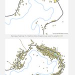
🤖🗺️ Awesome detailed walkthrough by daniel-j-h of automated building extraction in Tanzania using @mapbox's open source robosat pipeline, @openstreetmap, and @OpenAerialMap openstreetmap.org/user/danie… – at San Francisco, CA
OpenAerialMap retweeted

Got a demo today on @awscloud Snowball Edge today from @mojodna. It is a Petabyte data transfer (dustproof, waterproof) device that can be deployed post disaster, running @OpenAerialMap @awesomeposm and #OpenStreetMap editing completely offline. #AWSPSSummit @joseph_flasher


OpenAerialMap retweeted

So awesome!!! Didn't realize you could just type it in. And it seems like @qgis 3 also fixed the transparency issues. So cool to see a 1.2 gig file load instantly and stream in. Thanks @OpenAerialMap for the data! Gotta update my cog tutorial to tell people to just use QGIS 3.
OpenAerialMap retweeted

We're excited to launch the Open #AI Challenge for the South Pacific with the @WorldBank and @OpenAerialMap! The goal is to automatically analyze aerial imagery for food security analysis & more by using Artificial Intelligence bit.ly/2qO3OuN

OpenAerialMap retweeted

Sift through one of the cleanest and most advanced cloud native geospatial architectures - @openaerialmap. Part 4 in a series by @opencholmes. medium.com/planet-stories/cn…

OpenAerialMap retweeted

If you are flying UAV for #Harvey or #Irma please upload your captured imagery to @OpenAerialMap Free open hosting of drone imagery.
OpenAerialMap retweeted

A collection of relief & rescue maps for #HurricaneHarvey #HarveyRelief Working on something? Let us know blog.mapbox.com/hurricane-ha…

OpenAerialMap retweeted

#PacificHumanitarianChallenge winner PacDID presenting at @WoDCongress about aerial mapping in the Pacific #WoDC17 #OpenAerialMap #drones

OpenAerialMap retweeted

Officially open! World of Drones Congress kicks off in Brisbane. Sharing about @OpenAerialMap work in the Pacific. Say hello! #WoDC17

OpenAerialMap retweeted

Nicely done aerial UAV imagery DJI + litchi + qgis post processed by Web @OpenDroneMap vs @pix4d hosted in @OpenAerialMap ready for mapping


OpenAerialMap retweeted

Want to know how OpenStreetMap works? Check out their latest blog, it will walk you through it! @OpenAerialMap bit.ly/2tD0C4P

OpenAerialMap retweeted

Join the next HOT Community Webinar to learn all things @OpenAerialMap from @nas_smith! June 22nd, register now: eventbrite.com/e/hot-communi…
OpenAerialMap retweeted

Before/After high-res maps of #winter #flooding near #Sacramento. Download the full datasets on @OpenAerialMap! goo.gl/cIPNpW
OpenAerialMap retweeted
New repeat #drone imagery over brick #stockpiles on @OpenAerialMap goo.gl/bpAjdd who's got #MachineLearning to help count?
OpenAerialMap retweeted

OpenAerialMap / Drone Mapping Meetup Manila
May 5, 2017 - 7pm to 9pm at @aspacemanila
FB events page below.
facebook.com/events/18071899… – at National Capital Region, Republic of the Philippines
OpenAerialMap retweeted

.@OpenAerialMap is a great utility for open imagery, especially drone imagery. @nas_smith lays out the roadmap for new integration & tools

OpenAerialMap retweeted
New #drone data on @OpenAerialMap - goo.gl/TAhNia Build your #MachineLearning #TrainingData for railcar detection and help count!


OpenAerialMap retweeted
Download our 2cm res #dronemap of #california #wildflowers on @OpenAerialMap! goo.gl/KNTXn6 How many flowers are there?


OpenAerialMap retweeted
#PacificHumanitarianChallenge winner Firetail tests their Unmanned Aerial System in #Vanuatu. #rethinkingresponse @dfat_iXc

