

Drone Derived Data. Capturing life on the ground with drones in the air. Experiments in Drone Remote Sensing, Analytics, and Open Sourcing from ex-Googlers
Seattle, WA
Joined September 2016
- Tweets278
- Following338
- Followers116
- Likes725



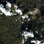


Beautiful, clear Sentinel-2 imagery of NE Kansas today, crossing at the same time as the Chinese balloon on @sentinel_hub -> sentinelshare.page.link/jDXP My Toxic Trait is thinking I'll be able to spot it in the imagery... If it's as large as they say it is, it could be ~3 pixels!
Gorgeous clear Landsat False Color Composite of #MaunaLoa #eruption from 12/2 access via @sentinel_hub sentinelshare.page.link/r9uu

ALT False Color Composite Landsat Image of Mauna Loa from space with bright orange lave streaming downslope towards Saddle Road
Outstanding Geology, Tragic Orbitology. Waiting for a clearer pass for s2 imagery of the lava flow 🛰️ #MaunaLoa #Sentinel2 #eruption @sentinel_hub


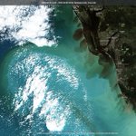
Incredible coastal imagery of Florida pre- and post- Ian on @sentinel_hub #sentinel2 #satellite #remotesensing sentinelshare.page.link/Jwfu


Autonomous Imagery retweeted

Introducing the newest generation of our stratospheric Earth imaging robots, the Swifty 3. They take longer flights, capture wider-coverage, & are more nimble - allowing us to offer an even better & more customizable geospatial imaging solution.
hubs.la/Q01cBF3d0 @axios


Autonomous Imagery retweeted

With only 1 cloud-free day in 3 weeks, #SAR data was crucial for the @Endurance_22 work. It helped avoid heavy ice even when it was dark & snowing, serving as a map for navigation.
Here is one of the SAR images the mission used to navigate the difficult sea and ice conditions.

Autonomous Imagery retweeted

The #HungaTongaHungaHaapai #volcano violently erupted on Jan 15, sending a huge ash plume into the atmosphere and tsunami waves across the Pacific.
This infrared imagery from #GOESWest shows both the volcanic ash cloud and the gravity waves produced by the massive #eruption.
Autonomous Imagery retweeted

Tonga's Hunga Tonga volcano just had one of the most violent volcano eruptions ever captured on satellite.
Mostly clear shots of the Skagit River in Mount Vernon peaking today from back-to-back atmospheric rivers accessed via @sentinel_hub at sentinelshare.page.link/FUhQ @NWSSeattle #MountVernon #skagitriver #flood #Washington #PNW #wawx


Incredible weather, incredible imagery. Deception Pass, #PNW 4/20. #sentinel2 False Color Composite via @sentinel_hub

Autonomous Imagery retweeted

Over a decade of work mapping tree canopy in cities across the United States made this research possible. Led by @UVM_RSENR alum and @usfs_nrs scientist @DextraordinaryH this paper shows how past injustices cause present environmental inequities. nature.com/articles/s42949-0…
Having trouble finding the new volcano in Iceland? - Never Fear, switch on the SWIR #sentinel2 #IcelandEruption #Satellite


#beforeandafter #drone #maps imagery shows the aftermath of the pier collapse in #Seattle this past weekend. Before image from a sunny evening in 2019. @seattletimes @KING5Seattle
Autonomous Imagery retweeted

The True Colors of America’s Political Spectrum Are Gray and Green nytimes.com/interactive/2020…
Autonomous Imagery retweeted

Today on US Google & YouTube homepages we share our support for racial equality in solidarity with the Black community and in memory of George Floyd, Breonna Taylor, Ahmaud Arbery & others who don’t have a voice. For those feeling grief, anger, sadness & fear, you are not alone.

Autonomous Imagery retweeted

Congratulations to our own Dr. Craig Glennie and Dr. Preston Hartzell on their $1.89M grant from the USACE. uh.edu/news-events/stories/2…
