

🌧️☀️❄️⚡Broadcast meteorologist. Bachelor of Science. Atmospheric scientist. SE MO, south IL, west KY, & NW TN. https://xitter.cf/t.co/j7nPqKny7z Photographer. Author.
Joined September 2008
- Tweets47.4K
- Following15.6K
- Followers16.1K
- Likes58.9K




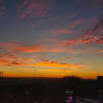



#nature #bees #photography #WestKY I spent some time with the bees today. One of my favorite insects to photograph.


Beau Dodson retweeted

A Freeze Warning is in effect for much of southeast Missouri and southern Illinois, and a Frost Advisory is in effect for the remainder of the Quad State.

ALT Here is a map indicating where a Freeze Warning and Frost Advisory are in effect tonight.
Beau Dodson retweeted
A Freeze Watch is in effect for the entire Quad State Saturday night into Sunday morning. Widespread frost and freezing temperatures are expected.

ALT Here is a map indicating that the entire Quad State region is in a Freeze Watch for Saturday night.
Beau Dodson retweeted

This is remarkable. Parts of Florida’s Space Coast have received up to *half a year’s worth of rain* in the last day and a half — as much as 27 inches in 36 hours, about 50% of an average year’s rainfall (radar estimate through 5 p.m. ET Monday).
The most extreme totals occurred in the stretch from Palm Bay to Valkaria.
What contributed to this:
• A deep flow of moisture from record-warm waters in the southwestern Atlantic
• Weak winds through the middle atmosphere, which kept storms slow-moving
• Background moisture levels boosted by a record El Niño, riding the tailwind of a warming climate

Beau Dodson retweeted
The Pacific jet is roaring now, and it’s forecast to grow even stronger 🚀
Powered by El Niño, the southern branch of the jet stream could approach record strength from late November into December, steering a relentless parade of storms across the United States.
Beau Dodson retweeted

Today, we are unveiling StormNet 4.5. This update includes a new interface, new radar features, and a new StormNet model capability.
After several breakthroughs and tons of R+D, we are excited to announce that we have developed a SOTA short-range weather prediction model.

Beau Dodson retweeted

Indianapolis finished October having set the record for the most days with a max temperature of 65 or higher (30) which breaks the 27 last set in 1971. We tied the number of days of 70 or higher (27) last set in 1963. October tops out at the 3rd warmest on record (62.3) #INwx
Beau Dodson retweeted

LINK: youtube.com/watch?v=A4amTqLZ…
This week, several short-range weather models, including the NAM, are going away for good, to be replaced by the RRFS and REFS. In this video, we break down why NOAA is making these changes, the timeline behind how we got here, the technical specifications of these new models, and how you can adapt your forecast process to the RRFS and REFS.

Beau Dodson retweeted
Join us for a Facebook Live session on Monday, November 2nd, 2026 at 7pm CST. The National Weather Service will be joined by several partners including TV media, EMA, and more. You'll have a chance to ask questions and learn more about winter weather safety.

ALT National Weather Service Paducah graphic announcing a Facebook Live winter preparedness Q&A on Monday, November 2, 2026, at 7 PM CST. NWS Paducah staff and partners will answer winter weather safety and preparedness questions. Viewers can participate at facebook.com/NWSPaducah by posting questions in the live feed.


Beau Dodson retweeted
This record El Niño will probably continue to intensify for around two more months.
Ocean temperatures are now nearly 93°F (33.7°C) beneath the surface in the eastern Pacific, with anomalies as large as 19.8°F (11.0°C) — several degrees more anomalous than 1997 was at this time.

Beau Dodson retweeted
This El Niño has now set ocean temperature records for 150+ days straight.
Average temperatures in the central equatorial Pacific Ocean have reached 86.4°F (30.2°C), while maximum temperatures have climbed to 88.8°F (31.6°C).
But this El Niño is about more than just numbers 🧵

Beau Dodson retweeted

Big SPC @NWSSPC news… The Day 4-8 Convective Outlook will soon be issued twice per day with the addition of an afternoon update (2130z; 330pm CST or 430pm when CDT) beginning in mid-November. The initial Day 4-8 daily issuance will remain unchanged during the overnight/early morning. Background is this is the nationwide severe weather outlook covering 4 days in advance to a little more than a week ahead of time (Day 8).

Beau Dodson retweeted

Huge 2" to even some 3"+ snowflakes falling this morning in the Scottsbluff/Gering Nebraska area 10/26/26 @KNEBStormCenter @NWSCheyenne @dayweather @SevereStudios #newx
Beau Dodson retweeted

The latest update to region Nino 3.4 sea surface temperature is not only a preliminary new record daily high, but also a new record anomaly, now 3.46C above the 1991 to 2020 baseline.


#NWAS26 I'm so glad I made the trip to the NWA conference! Even with cancer, I wasn't about to miss it. Some of my family worried about the long drive, but I told them I'd be fine.
I am learning so much about AI, new weather models, and the future of meteorology. Worth it! 🌦️

