

Official Twitter account for the National Weather Service Cheyenne, Wyoming. Details: https://xitter.cf/t.co/i8x6KlUdtQ
- Tweets34.5K
- Following151
- Followers19.9K
- Likes6.7K






ALT Graphic showing Tuesday high temperatures across SE Wyoming and the Nebraska Panhandle

ALT Graphic with a painting of autumn trees in the background. In the foreground are 5 rectangles. Each rectangle has the forecast for a different day from Monday through Friday.

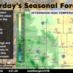
ALT Graphic with an image of the forecast high temperatures for Sunday on the right. On the left is a small paragraph about the weather reading, “Above average temperatures expected Sunday with mostly clear skies becoming partly cloudy. Fairly light winds expected for much of the area.”


ALT The subdued background depicts fall foliage with leaves of golden amber. The High temperatures are placed in front of a portion of the background displaying the forecasted temperatures at popular towns. Informational text is displayed on the left side with a transparent black background with white texts highlighting a word of caution if driving on the Interstates today as Bordeaux and Arlington are expected to experience high winds which poses a danger to high profile vehicles.

ALT Graphic with an image of the High Wind Warnings at Arlington/Elk Mountain and Bordeaux on the left. On the right is information about the Warning.

ALT Graphic with a cork-board background. In the foreground are 3 sticky notes, each with the forecast for a different day between Friday and Sunday.

ALT Map showing overnight low temperatures and where a Freeze Warning is in effect.


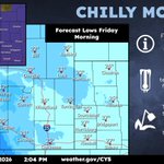
ALT Graphic showing the Freeze Watch and Friday morning low temperatures.

ALT Graphic showing the location of the Winter Weather Advisory across SE Wyoming.

ALT

ALT

ALT Two maps showing snowfall probabilities. One map shows the potential for 1 inch of snow or more. The other shows the potential for 4 or more inches of snow. Probabilities are highest in the Snowy and Sierra Madre Ranges, and for areas along and west of the Laramie Range.

ALT Graphic showing the timeline for precipitation type and chances.

ALT Graphic showing the Winter Weather Advisory for the Snowy Mountain Range


ALT Graphic with a map showing the South Laramie Range and Foothill zones under a dense fog advisory until 9 AM this Tuesday morning.

ALT Graphic with a frosted over background. In the foreground is a rectangle on the left showing morning low temperatures Friday and on the right is a box talking about the upcoming freeze.

ALT Graphic with an image of a dark umbrella with raindrops in the background. In the foreground on the right are three circles, showing the expected conditions Tuesday through Thursday with expected temperatures listed below. On the left side of the image is another circle with expected conditions for Monday night with expected temperatures listed below.