






Tim Schaub retweeted

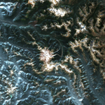
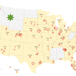
Success!!! First methane and CO2 plumes detected from Tanager-1's hyperspectral sensor! These are from Texas, Pakistan, and South Africa.
With this data, we aim to enhance accountability and enable climate action.
Thanks to our fantastic public-private partnership with @carbonmapper and @NASAJPL to deploy Tanager-1 and make this milestone possible.
planet.com/pulse/carbon-mapp…


Congress just doesn’t appreciate the benefits of donghua jinlong industrial grade glycine

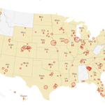
A bill that could ban TikTok in the U.S. became law on Wednesday. Here's what lawmakers who oppose the move and content creators said about the potential ban. nyti.ms/3JxgcFa

Tim Schaub retweeted

Now it's easy to stream GeoParquet into tippecanoe!
gpq convert --to=geojson in.geoparquet | tippecanoe -o out.pmtiles
Thanks @tschaub for adding stream output to github.com/planetlabs/gpq!
(pictured: Cairo buildings visualization from @cloudnativegeo/@source_coop/@opencholmes)

I can't believe I survived without @DuckDB for so long. Such an awesome piece of tech. Feels indispensable already.
Really cool to see them advancing the usability of SQL, too xitter.cf/duckdb/status/16950887…

New blog post by @AlexMonahan: Even Friendlier SQL with DuckDB
duckdb.org/2023/08/23/even-f…

Tim Schaub retweeted

BREAKING: A Montana judge sided with young activists who said state agencies were violating their right to a clean environment by permitting fossil fuel development without considering its effect on the climate. apnews.com/article/climate-c…

The GPQ utility has a new home: github.com/planetlabs/gpq. See planetlabs.github.io/gpq/ to create GeoParquet files right in your browser. The latest CLI release can also generate a validation report and describe a file's metadata and schema.

Thanks to @Jtmiclat, you can now configure the compression used when creating GeoParquet files. The default used to be ZSTD, but we've changed it to GZIP for greater compatibility with existing readers. Use the `--compression` option to chose your favorite codec.
Tim Schaub retweeted

📢 Web mapping app developers! 🗺️🚀 XYZ tiling scheme has been the go-to for web mapping. OGC Tiles takes tiled map data to the next level. 🌍🔀 @tschaub introduced you to projections, zoom levels, and moving XYZ tile sets to OGC Tiles. developers.planet.com/blog/2…

Tim Schaub retweeted
Looking for a mapping library to use with React? We’ve released `@planet/maps`. It wraps OpenLayers classes in declarative React components, making it easy to integrate mapping functionality into your existing apps. planetlabs.github.io/maps/
Tim Schaub retweeted

@GeoParquet 1.0.0-beta.1 is released! It's been an awesome collaborative effort and we're keen to get one more round of feedback before 1.0.0. Check out cholmes.medium.com/geoparque… and our new website geoparquet.org for more details. Thanks to everyone who contributed!

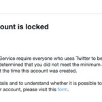
If you're wondering what happened to @openlayers, it looks like Twitter locked the account for being too young. But it has been spotted on mapstodon.space/@openlayers (where apparently they allow underage mapping libraries).

Interested in trying out @GeoParquet but can't find any data to play with? Check out tschaub.net/gpq/ for converting GeoJSON to GeoParquet right in your browser. Or, for a CLI, see github.com/tschaub/gpq
Tim Schaub retweeted

Monthly global temperature anomalies, 1880-2021
Source: NASA svs.gsfc.nasa.gov/4975
🏆 We have a winner🎉 - Planetary Computer is now CORS-friendly (thanks @lossyrob). Easy STAC asset rendering (with reprojection support) coming to a mapping library near you soon! 20l25l.csb.app/

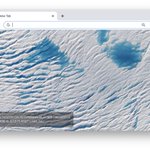
ALT Sentinel-2 imagery from Planetary Computer previewed in an OpenLayers map.

How about a friendly @STACspec shootout? What is the "best" STAC source of Sentinel 2 (L2A) imagery? To be best, you have to be at STAC v1 and have publicly accessible CORS-enabled COGs with overviews. Bonus points for an online search UI.
How about a friendly @STACspec shootout? What is the "best" STAC source of Sentinel 2 (L2A) imagery? To be best, you have to be at STAC v1 and have publicly accessible CORS-enabled COGs with overviews. Bonus points for an online search UI.
LandsatLook is a strong contender if we consider Landsat as well - but its COGs are also not CORS-friendly :( landsatlook.usgs.gov/