

Oceanographer and project manager in CIMNE-Natura. The main activity is the water desalination, energy storage, climate adaptation and risk events studies.
Barcelona, Spain
Joined April 2011
- Tweets79
- Following173
- Followers258
- Likes118





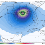
Storm from #Caribbean Sea will arrive south #California peninsula as #hurricane of category 1, the 12/7.


Pedro Antonio Arnau retweeted

Impresionante lo que han conseguido en @CopernicusECMWF!
Han podido reproducir en sus reanálisis (ERA5) el histórico temporal del siglo XX en la península ibérica.
Ahora sabemos que se trató de una superborrasca de menos de 935 mb, a las puertas de #Galicia.😳

Pedro Antonio Arnau retweeted
No només el gener, Tomas. Farà fred fins ben entrat març i la segona setmana d'abril.
Pedro Antonio Arnau retweeted

Feu el favor de votar a l'Anna com a premi Vanguardia de la Ciència. S'ho mereix!!

Entrevistada per la gran @saez_cristina per la iniciativa Vanguardia de la Ciència 🌊🔬🧪
lavanguardia.com/ciencia/202…

Pedro Antonio Arnau retweeted
Según mi predicción será un invierno muy frío (4 olas de frío) a partir de enero.
Pedro Antonio Arnau retweeted

La borrasca Gérard llega hoy a España y pone a 40 provincias en aviso por nieve, viento, olas y lluvias europapress.es/sociedad/noti…

Pedro Antonio Arnau retweeted

Here are the 11 AM EDT 10/8 Key Messages for Tropical Storm #Julia. More info: hurricanes.gov

Pedro Antonio Arnau retweeted

Unfortunately, expectations of rapid intensification in the Gulf of Mexico were met and even exceeded. #Ian left the northern coast of Cuba as low-end Cat3 hurricane and hit west-central #Florida as upper-end Cat4 hurricane, just 2 mph shy of Cat5 status.
bmcnoldy.blogspot.com/2022/0…
This is my #hurricaneian forecast in LinkedIn three months ago (the message are not edited). My calculation of the date is wrong because it included a correction based on the maximum of the season. Unfortunately, the hurricane arrived to Category 5.

Pedro Antonio Arnau retweeted

This video from the Weather Channel shows what 9 feet of storm surge looks like. This was the forecast for Hurricane Florence in 2018.
NHC are forecasting *12 to 16* feet of storm surge from #HurricaneIan, from Englewood to Bonita Beach, Florida. Unimaginable devastation.
Pedro Antonio Arnau retweeted

I can't overstate how serious the storm surge threat is in southwest Florida. #Ian will drive deadly surge into Cape Coral and Fort Myers, placing much of the area under water. If you live near the ocean in a surge zone, this is your last chance to leave...
Pedro Antonio Arnau retweeted
This is gut-wrenching... #Ian is almost a Category 5 hurricane and just four hours away from a catastrophic and historic landfall.
Pedro Antonio Arnau retweeted

Pedro Antonio Arnau retweeted

An afternoon look at Hurricane Ian. Pressure down to 978. Satellite here puts into perspective how big it is compared to Florida. And how both sides of the state, up and down, will feel it. spaghettimodels.com #flwx #Ian

Pedro Antonio Arnau retweeted
Marc plays the piano simulating the evolution of #Invest98L the next weekend.
