We're a climate data technology company building tools that help us become more resilient.

British Columbia
Joined June 2021
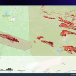
Last week, #California had some extreme fire activity. Here is the #BridgeFire and the #LineFire hotspots animated over the most active days. Explore for yourself: lens.pathandfocus.com/?endDa…
1
6
4
1,209
Wanna see something cool? We (@calebissharp) built a fire simulation model... in Rust... and it's blazing fast... also it outputs ASCII (for fun). This dynamically pulls weather data, topography, fuel, runs a 12h burn period producing a 18,700ha fire all in 6 seconds. #wildfire
1
2
5
198
Looking at #wildfire data often requires that you know exactly when a fire took place. It doesn't help you interact with or explore unfamiliar data. Mother Nature just doesn't care about the fact that it's Saturday. 🗓️ Let's break down how we can do better. 🧵
1
1
2
60
How do we accurately measure and predict the evolving wildfire risk? We went on a deep dive and discovered some unexpected truths. Did any of them surprise you? pathandfocus.com/blog/how-do…
1
50
🔥 The North Slave Fire near Yellowknife, discovered on June 28, prompted a historic evacuation. Around 20,000 residents fled, marking it as one of Canada's largest wildfire evacuations. Read more in our series: pathandfocus.com/blog/north-… #wildfire
1
3
74
We previously explored the Donnie Creek fire: xitter.cf/pathandfocus/status/17…
🔥 Next up, the record-breaking Donnie Creek wildfire in BC spanned 619,072 ha. But nearby fires surpassed its size, showing the immense scale of wildfires in the region. A complex fire situation challenging our perception. More info: pathandfocus.com/blog/donnie… #BCWildfire
24
🔥 Next up, the record-breaking Donnie Creek wildfire in BC spanned 619,072 ha. But nearby fires surpassed its size, showing the immense scale of wildfires in the region. A complex fire situation challenging our perception. More info: pathandfocus.com/blog/donnie… #BCWildfire
3
2
2
4
419
Previously we explored the fires in Nova Scotia that claimed ~200 homes: xitter.cf/pathandfocus/status/17…
🔥 We're doing a series of posts looking at the 2023 Canadian #wildfire season. Starting w/ Nova Scotia: 2 major fires burned nearly 26,000 ha destroying 200 homes. This unexpected surge challenges our views on regional wildfire risks. More: pathandfocus.com/blog/nova-s…
53
We're adding historic @CWFIS hotspot data to lens.pathandfocus.com and have noticed that the estimated size leans a particular way in certain regions at certain times of the year. E.g. in S.E. USA the est size is larger in later months. Anyone have ideas why?
3
1
2
313
🔥 We're doing a series of posts looking at the 2023 Canadian #wildfire season. Starting w/ Nova Scotia: 2 major fires burned nearly 26,000 ha destroying 200 homes. This unexpected surge challenges our views on regional wildfire risks. More: pathandfocus.com/blog/nova-s…
1
1
1
156
We attended the @GoGeomatics conference. It was interesting to talk with Canadian geospatial data providers and hear from researchers applying data to understand climate change. Bonus, 3 remote team members go to spend some in-person time together. #GoGeoExpo2023
3
2
314
Last minute we decided to attend @GoGeomatics Expo. Find @calebissharp and chat about how we used @protomaps PMTiles to cut tile serving fees by 95% (or maybe more) in lens.pathandfocus.com #GoGeoExpo2023
4
4
535
Lens is a map of Canadian wildfire data created by @pathandfocus + @twostoryrobot Explore wildfires interactively by date and area - built with a static set of pmtiles archives lens.pathandfocus.com @pwramsey might find it interesting!
1
12
1
80
5,919
Updates to Lens: fire perimeters for #BCwildfire, a command palette for quickly toggling layers, and performance improvements. We believe speed is a feature and we're regularly looking for ways to make things faster and more usable. Try for yourself at lens.pathandfocus.com
1
1
210
I often describe fire growth as a series of "sprints". It's not a steady jog, but rather large amounts of growth occurring in short timeframes. @twostoryrobot's hot spot tool provides a great visual representation of this with the count of spots per day.
3
7
16
2,009
Lens now works better on mobile. You can properly scrub through the timeline with touch and expand the visible window fairly easily. E.g. here is all hotspots for the Casper Creek #wildfire just outside Seaton Portage. You can explore for yourself at lens.pathandfocus.com
1
3
4
875
Last week, a cold front passed through the province following several days of hot, dry weather.
38
427
200
1,154
604,612
We just launched fire hotspot timelines in Lens. You can now view the entire 2023 hotspot history for all of Canada. You can even interactively explore the timeline and replay any point in time. E.g. here's the timeline for the Bush Creek East #wildfire. lens.pathandfocus.com
1
9
1
14
4,590
We're experimenting with visualizing all the hotspot data at once. In case you were wondering what #Yellowknife is facing right now, here's all hotspots this year (grey) with the last 3 days in yellow, orange, and red. Scary stuff. Stay safe up there friends.
3
12
17
3,781
Let me introduce you to a new term I’ve started using… “tactical recreation” #wildfire in BC is now just a part of life, and we have to adapt. Keep a bag of gear ready and monitor air quality regularly. If it’s green nearby, bug out to breath some clean outside air.
1
3
8
1,256