

i promise you i'm not homeless i just look like it / just some guy that works with grass
Colorado Springs, CO
Joined June 2011
- Tweets12.1K
- Following786
- Followers904
- Likes4.4K




Pinned Tweet
My form wasn't the cleanest but I'll check it off the bucket list

Groundskeeper for @LynHillcats was not thrilled with a fan’s tarp slide. Obvious Charlie Blackmon comp. Quick first step and easy plus underway. I’m about to request he take BP and shag in CF today. Signability may be an issue with UVA & Wake Forest offering 🏈 scholarships.
Found this chillin on the field this morning, what's the strangest thing you've found? Also may have forgotten to take the bases out last night.


The good, the bad and the ugly. One week post concert, 6 tarp pulls this week. Game 5 of the home stand. 21 games left for the month of June including Vibes games and a college wood bat league.


Impulse tattoo... now when I get asked about the weather I can say it'll be the middle finger with a chance of the pointer – at Colorado Springs, CO


Collin Tyzinski retweeted
Good mernin and happy Monday to my early risers, night owls, insomniacs, and neuro spicy besties. Anti-shoutout to the Rockies who are about as consistent as Colorado traffic flow, human emotions, a college dorm room's internet connection, and the price of Bitcoin.
Anyhoodles, today is a "no morons" allowed kind of day.
A strong cold front will approach the region overnight tonight. The wind will be blowy ahead of this front. Gusts up to 35mph out of the south and southwest. This will get rid of the humidity that's plagued my hanger downer parts for a week, but the trade off is with gusty winds, low relative humidity, and temperatures soaring into the 90s and low 100s (especially in southern Colorado and western Kansas), now we're dealing with fire danger again.
Remember the trough I talked about yesterday? It's still around today, and will keep our northern zones in the 80s and low 90s today; so fire weather conditions aren't expected especially if you're along and north of I-76.
Isolated strong to severe storms are possible on the far eastern plains later this afternoon along a pseudo-dry line near the Nebrasky and Kansas state lines.
A solid 15-20 degrees cooler on Tuesday behind the front, especially for the northern half of the region. If you go south of the Palmer Divide and I-70, I think highs will rocket into the 80s and 90s before the frontal passage occurs sometime in the afternoon/evening. If the frontal passage occurs sooner, we'll knock 10-15 degrees off of those highs which right meow are expected to be in the mid to upper 90s.
Behind the cooler airmass, humidity recovers, and parts of the front range, I-25, and eastern plains are under the influence of northeasterly upslope which means we will introduce showers and thunderstorms back into my forecast. I'll elaborate more on timing and potential impacts in future updates.
Similar story for Wednesday. Even cooler! Highs may struggle to get out of the 60s for some of you which presents another forecasting complication for Wednesday, but I'll talk about that later.
Upper 80s and low 90s return for Thursday and going into the upcoming weekend, but along with the warmer temperatures is a continued chance of showers and thunderstorms. Some of this moisture might be coming from the remnants of a tropical system that originates in the Gulf of Mexico and makes landfall in southeast Texas sometime late Tuesday and into Wednesday.
Drama in the details. Be patient. I'll keep you posted.
Last night I had a dream that disco was making a comeback. At first I was afraid, I was petrified. 😜😜😜
I will gladly throw myself out.
Grateful to The Krafting Home Team - Realty One Group Fourpoints, MouCo Cheese Company, The Rusty Melon, Erie, and ProNano LLC for sponsoring this update and for being great supporters of the weather page.
Dusty Kraft was my realtor who helped me buy my first home, and would recommend him to anyone in northern Colorado! Every Saturday at the Greeley Farmer's Market, you can stop by and get a fix of Mouco's award winning cheese or buy it at any King Soopers or Safeway.
Also, if you're in Northern Colorado and are looking for a great spot to satisfy your taste buds for lunch/dinner, or if you're looking for ways to strengthen your roof or properties interior (a lot of insurance carriers are requiring these conditions before they'll even insure you), then please consider supporting these great local businesses at kodythewxguy.com and clicking on Colorado sponsors to learn more information. K great thanks bye! #COwx #WYwx #NEwx #KSwx


Collin Tyzinski retweeted
Good mernin and happy Saturday my early risers, night owls, insomniacs, and neuro spicy besties.
The threat for scattered strong to severe thunderstorms exists today; and with a lot of outdoor activities, I need you to pay attention. 😜
Today's threat is CONDITIONAL. That means all of the ingredients need to come together at the right time. A shortwave disturbance will be moving across southern Wyoming and Northern Colorado. This will influence a cold front moving in from the north. We should realistically see winds veering out of the east throughout the day. (Nothing good ever happens when the wind comes out of the east 😆)
If the shortwave and cold front move in sooner, we will see thunderstorms erupt around 1pm or so; and the severe threat would include the foothills, the I-25 corridor, and the eastern plains as well as SE Wyoming and the western Nebrasky pandyhandle.
If the shortwave and cold front move in later, the severe threat shifts east away from the front range and I-25 corridor and is confined to the far eastern plains.
The CAMS (convective allowing models) have trended towards an earlier solution which would include front range in our threat for strong to severe storms today. Damaging winds up to 70mph. Large hail at least 1-2" in diameter or larger, and if any thunderstorms are discrete, I can't rule out a brief funnel cloud or tornado.
So, that means after 1pm, it's game on. That means have a plan, and pay attention to rapidly changing conditions. Make sure you have ways to receive warnings, and check in with my nowcasting updates a little more often than you normally would.
Storm motion should generally be from the WNW (west northwest) to the ESE (east southeast).
With the interaction of outflow boundaries, clusters of thunderstorms could linger into the nighttime hours. It's something I will have to update on in real time, but it's up to you how prepared you decide to be, and don't say I didn't warn yee.
Sunday will be cooler. Highs may struggle to reach 70 degrees which presents another forecasting complication. I'll discuss this in more detail later, but the amount of heating we get Sunday will determine how much precipitation we get and what "mode" of shower activity we get.
Enough heating = strong thunderstorms capable of producing heavy rain, hail, and localized flooding wherever they form.
Not enough heating (likely due to cloud cover) = general rain showers, and isolated thunderstorms. Minimal severe threat, and no flooding threat.
Monday, we'll warm up a little bit but I will keep showers and thunderstorms in my forecast. Again, I'll update later. Be patient with me.
Warmer temperatures are expected going into next week; however I'm still trying to figure out how the weather pattern is going to evolve. I could realistically see a few scattered showers and storms in my forecast through Wednesday, but beyond that, the picture gets really fuzzicles.
Started going to the gym again recently and dropped 10 pounds! Thankfully the dumbbell missed my foot. 😜😜😜😜
I will gladly see myself out.
Despite the forecast, grateful to the Colorado Medieval Festival for sponsoring this update. The event is going on this weekend rain or shine (wear your damn helmets). Visit coloradocastle.com to learn more and buy tickets.
Be safe. Stay healthy. Take care of each other. Don't be dumb dumbs. K great thanks bye. #COwx #WYwx #NEwx #KSwx

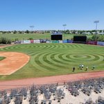
Not too happy with how it looks for opening day but without having irrigation for 2 months and finally getting it back on May 2nd can't be too upset with how it bounced back the past 3 weeks....greener days will come. – at Colorado Springs, CO


Looking for any advice that can save my sanity. Been without a backflow since March 1 and still have no updates on when the new one gets installed. Infield/foul has been watered from the dugouts, being the only source of water close the field. – at Colorado Springs, CO

Outfield hasn't had any type of moisture since the last snow which was March 15. It is the most compact/dry surface I have felt (soil probe only goes down 1/2") we have a college DH tomorrow and a juco tournament May 9-12 with the teams practice that week. Season starts May 28 – at Colorado Springs, CO


Collin Tyzinski retweeted

Imagine your vehicle is turned over. You’re disoriented. Wondering if this is the end. You turn to your left and see Hollywood Hogan in his NWO shirt saying “gimme your hand, brother!”
What a mindfuck.


Was cleaning out some files in the office and found some old fertilization programs and prices dating back to 2005 – at Colorado Springs, CO


