@e_geos

๐ŸŒ๐Ÿ›ฐ๏ธ Leading player in Earth Observation and the exclusive global distributor for the COSMO-SkyMed satellite constellation data #WeUnlockEarth

Italy
Joined January 2014
๐Ÿš€ Welcome aboard, Cristina Sgubinโ—๐Ÿ›ฐ๏ธ The Board of Directors of e-GEOS has appointed Cristina Sgubin as the companyโ€™s new Chief Executive Officer. ๐Ÿ”— Discover more: e-geos.it/en/news-stories/thโ€ฆ #WeUnlockEarth @telespazio | @ASI_spazio | @LDO_Space | @GAF_Munich
2
5
193
At @IAC2026Antalya, @massimoc_square, Managing Director of #LeonardoSpace, joined the GNF Session โ€“ Heads of Industry: One-on-One Conversations, sharing his perspective on the transformation of the Space sector and the evolution of Earth observation. Space is rapidly evolving. For #Leonardo, this means combining Space capabilities with digital technologies such as cloud, AI and cyber resilience, while helping strengthen the wider ecosystems. In Earth observation, the focus is shifting from spatial resolution alone to the ability to deliver useful information fast. High revisit rates, low latency, connectivity, cloud and AI are becoming essential to turn satellite data into actionable information. These capabilities come together in Leonardoโ€™s new Earth observation constellation, designed to deliver persistent, near real-time information for applications ranging from emergency response and critical infrastructure to precision farming โ€” turning data from Space into action on Earth. @telespazio | @e_geos #IAC2026
1
2
181
From 5 to 9 October, #Leonardo will be at he 77th International Astronautical Congress @IAC2026Antalya organised by the @iafastro. #LeonardoSpace, together with @telespazio and @e_geos, will take part in sessions and presentations spanning industry perspectives, Space exploration, mission operations and the contribution of Space to global challenges. ๐Ÿ”น 6 October | 10:15โ€“11:30 GNF Session โ€“ Heads of Industry: One-on-One Conversations @massimoc_square, Managing Director of #LeonardoSpace ๐Ÿ”น 6 October | 13:15 Oral Presentation Naomi Reichmann, Spacecraft Controller at @TelespazioGER ๐Ÿ”น 6 October | 16:10 IAF Space Exploration Symposium โ€“ "Moon Experience" Fabrizio Paolillo, Head of E2E Engineering & Exploration Studies at Telespazio ๐Ÿ”น 6 October | 16:40โ€“17:40 Sky was the limit: the Italian โ€“ Turkish partnership in Space Massimo Claudio Comparini, Managing Director of Leonardo Space ๐Ÿ”น 7 October | 10:15 Oral Presentation Vivien-Sophie Stotz, Columbus Flight Control Engineer at Telespazio Germany ๐Ÿ”น 8 October | 10:15โ€“11:15 Space in Support of Global Threats and Crisis Response Milena Lerario, CEO of e-GEOS See you in Antalya for #IAC2026!
3
9
263
๐ŸŒพ In October, Love Planet Earth 2026 takes us to Greeceโ— ๐Ÿ›ฐ๏ธ From Space it is possible to analyse the health of the soil in detail, evaluating its physical and chemical parameters and identifying areas at risk of degradation. Satellite data allows the evaluation of information relating to erosion, salinisation and loss of fertility, providing useful insights for the conservation of resources. In Trikala โ€“ the agricultural heartland of Greece, which is subject to desertification due to semi-arid climatic conditions and intensive management โ€“ these technologies offer local stakeholders the opportunity to protect the land, reduce the impact of agricultural practices and ensure the long-term sustainability of the territories. ๐Ÿ”— Discover more about Love Planet Earth 2026, the e-GEOS, @telespazio and @medorfoundation calendar that takes us from Space across the agricultural landscapes of the Mediterranean: e-geos.it/en/love-planet-earโ€ฆ ๐Ÿ“ธ Trikala, Greece. COSMO-SkyMed Second Generation Image ยฉ Italian Space Agency. Processed and distributed by e-GEOS #WeUnlockEarth | #LPE2026 @telespazio | @ASI_spazio | @LDO_Space | @GAF_Munich
1
7
167
Domenico Grandoni, Head of R&D and Innovation at e-GEOS, part of @LDO_Space, took part in the Technology Showcase on Digital Twin solutions hosted by @Frontexin Warsaw. He presented e-GEOSโ€™s industrial capabilities in developing robust โ€œwhat-ifโ€ simulation scenarios through Digital Twins, supporting a wide range of applications, from addressing the impacts of climate change and monitoring critical infrastructure to agriculture and security. These innovative capabilities will also support @Leonardo_liveโ€™s proprietary Earth Observation constellation. #WeUnlockEarth | #Frontex #SpaceForBorders #Copernicus #SpaceInnovation #DigitalTwin @telespazio | @ASI_spazio | @LDO_Space | @GAF_Munich
5
157
Four days in Paris, bringing together the global Space community to discuss how the sector is evolving โ€” from Connectivity and Earth Observation to defence and security. At World Space Business Week and the Space Defense & Security Summit (@nvs_summits), #LeonardoSpace, together with @telespazio and @e_geos, contributed to the debate on some of the key elements shaping the future of Space. ๐Ÿ”น @massimoc_square, Managing Director of #LeonardoSpace, focused on what Europe needs to turn its technological strengths into an always more competitive and sustainable Space economy: greater scale, continued investment in R&D and industrial capacity, stronger integration across the European value chain, and the capacity to bring innovation to global markets. Building a more integrated European space ecosystem is essential to achieving the critical mass needed to compete globally and sustain long-term growth. ๐Ÿ”น Gianluca Baldassarre, SVP Satellite Communications at Telespazio, addressed the rapid transformation of satellite communications. New constellations, operators and customers are reshaping the market, while sovereignty, interoperability and the ability to evolve services rapidly are becoming increasingly important โ€” particularly for critical infrastructures and areas where satellite connectivity can make a tangible difference. ๐Ÿ”น At the Space Defense & Security Summit, Marco Brancati, SVP Technology and Innovation Governance at Leonardo Space, highlighted the growing role of Space within the multidomain environment. Earth Observation, connectivity and Space Domain Awareness are becoming increasingly interconnected, making technologies such as onboard processing, intersatellite links and multi-mission ground segments โ€” together with interoperability by design โ€” key enablers for future systems. ๐Ÿ”น Milena Lerario, CEO of e-GEOS, brought an Earth Observation data perspective to the discussion, highlighting how SAR is becoming a primary source of information, providing continuous observations independently of daylight and weather conditions. The integration of SAR and optical imagery enables a more comprehensive understanding of events, while customer demand is increasingly shifting towards information, analytics and operational services rather than raw data and complex processing chains. #WSBW26 #SDSS26
1
3
258
QPS็ ”็ฉถๆ‰€ใฏใ‚คใ‚ฟใƒชใ‚ขใฎe-GEOS็คพใจSAR่ก›ๆ˜Ÿใƒ‡ใƒผใ‚ฟใ‚’ๆดป็”จใ—ใŸๅœฐ็†็ฉบ้–“ใ‚คใƒณใƒ†ใƒชใ‚ธใ‚งใƒณใ‚นใƒปใ‚ฝใƒชใƒฅใƒผใ‚ทใƒงใƒณใฎ้–‹็™บใซๅ‘ใ‘ใฆ่ค‡ๆ•ฐๅนดใซใ‚ใŸใ‚‹ๆˆฆ็•ฅ็š„ๅ”ๆฅญใ‚’้–‹ๅง‹ใ—ใŸใ“ใจใ‚’ใŠ็Ÿฅใ‚‰ใ›ใ„ใŸใ—ใพใ™๐ŸŒโœจ ่ฉณ็ดฐใฏใœใฒใ“ใกใ‚‰ใ‚’ใ”่ฆงใใ ใ•ใ„๐Ÿ’ i-qps.net/news/4088/
3
35
5
237
10,933
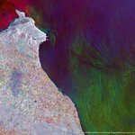
๐Ÿ†• e-GEOS, part of @LDO_Space, and @QPS_Inc are collaborating to develop new Geospatial Intelligence solutions by integrating QPS-SAR data with COSMO-SkyMed data from @ASI_spazio and @MinisteroDifesa, for which e-GEOS is the exclusive commercial distributor. ๐ŸŽค C. Milena A. Lerario, CEO of e-GEOS: โ€œOur vision for the future of Geoinformation increasingly calls for an ecosystem approach, where different data sources, technologies and expertise can work together to create greater value. By combining data and analytical capabilities, e-GEOS and iQPS are building a more connected ecosystem that will be further strengthened by the advanced features of @Leonardo_liveโ€™s proprietary Earth observation constellation, like high frequency revisit time, low latency and onboard power computing. These synergies, enabled by complementary expertise and a shared commitment to innovation, will drive more advanced analytics and services, effectively addressing the increasingly complex needs of our partners.โ€ ๐Ÿ”— Press Release: e-geos.it/en/press-release/eโ€ฆ ๐Ÿ“ธ Mount Fuji, Japan. COSMO-SkyMed Second Generation Image ยฉ Italian Space Agency. Processed and distributed by e-GEOS #WeUnlockEarth @telespazio | @ASI_spazio| @LDO_Space | @GAF_Munich
11
1
44
4,474
From 14 to 17 September, Paris will host The Space Week, bringing together institutional and industry representatives to address some of the key developments across the Space domain, from connectivity and Earth observation to Defence and security. #Leonardo, together with @telespazio and @e_geos, will take part in the @nvs_summitsWorld Space Business Week and the Space Defense & Security Summit, contributing to high-level discussions on strategic priorities shaping the future of the sector. ๐Ÿ”น 14 September | 10:15 | World Space Business Week @massimoc_square, Managing Director of #LeonardoSpace, will take part in the "Industry Dialogue with Safran & Leonardo", within the Summit for Satellite Financing. ๐Ÿ”น 15 September | 16:15| World Space Business Week Gianluca Baldassarre, SVP International Marketing & Sales at Leonardo Space and SVP Satellite Communications at Telespazio, will join the panel "The Architecture of Global Connectivity". ๐Ÿ”น 16 September | 09:15 | Space Defense & Security Summit Marco Brancati, SVP Technology and Innovation Governance at Leonardo Space, will contribute to the session "Embedding Space Capabilities into Next-Generation Military Platforms". ๐Ÿ”น 17 September | 11:40 | World Space Business Week Milena Lerario, CEO of e-GEOS and SVP Geoinformation Line of Business at Telespazio, will take part in "SAR Without Borders: A Multidomain Perspective", within the Summit on Earth Observation Business. #WSBW26 #SDSS26
2
2
258
๐ŸŽค Bruno Biagini, Civil Commercial and Business Development - European and International Market at e-GEOS, part of @LDO_Space, joined the Critical Asset Intelligence Forum 2026, hosted in Perth by Space and Earth โ€“ Partners and Advisory and powered by the Indo-Pacific Space and Earth Network, with @leonardo_live as Session Partner. ๐Ÿ›ฐ๏ธ During the conversation, Bruno Biagini explored the potential of integrating different types of data to support operators in the mining, oil & gas and energy sectors. The discussion also highlighted the complementary role of institutional and commercial satellite missions. ๐Ÿค Ultimately, Bruno Biagini emphasised that unlocking the full value of these capabilities requires closer interaction with industry operators, helping transform insights into trusted, prioritised and actionable decisions. #WeUnlockEarth @telespazio | @ASI_spazio | @LDO_Space | @GAF_Munich | @LDO_Fondazione
1
2
156
๐Ÿ“The @CopernicusEMS, led by e-GEOS, part of @LDO_Space, has been activated since 26 August to provide damage assessment mapping of areas affected by severe flash floods in Nepal ๐Ÿ‡ณ๐Ÿ‡ต (EMSR927). ๐Ÿ—บ๏ธ So far, three Areas of Interest along the Trishuli River have been analysed, identifying 3,922 impacted buildings and 56 km of affected roads, potentially impacting around 5,900 people. Mapping is still underway: overall, an area of 9,714 hectares is expected to be analysed. ๐Ÿ›ฐ๏ธ The image below provides a detailed view of the mountain village of Timure. The analysis identified 129.4 hectares of landslides and 9.7 km of affected road infrastructure. One bridge and one dam were also identified as destroyed. ๐Ÿค @CopernicusEU is a European Union programme managed by @EU_JRC. The @CopernicusEMS consortium, of which e-GEOS is Prime Contractor, includes @telespazio Ibรฉrica, @GAF_Munich, @Ithacasrl, ICube-SERTIT, @CLS_Group, IABG, @PlanetekHellas and @infoGMV. ๐Ÿ”— ๐˜ˆ๐˜ญ๐˜ญ ๐˜Š๐˜ฐ๐˜ฑ๐˜ฆ๐˜ณ๐˜ฏ๐˜ช๐˜ค๐˜ถ๐˜ด ๐˜Œ๐˜ฎ๐˜ฆ๐˜ณ๐˜จ๐˜ฆ๐˜ฏ๐˜ค๐˜บ ๐˜”๐˜ข๐˜ฏ๐˜ข๐˜จ๐˜ฆ๐˜ฎ๐˜ฆ๐˜ฏ๐˜ต ๐˜š๐˜ฆ๐˜ณ๐˜ท๐˜ช๐˜ค๐˜ฆ ๐˜™๐˜ข๐˜ฑ๐˜ช๐˜ฅ ๐˜”๐˜ข๐˜ฑ๐˜ฑ๐˜ช๐˜ฏ๐˜จ ๐˜ข๐˜ค๐˜ต๐˜ช๐˜ท๐˜ข๐˜ต๐˜ช๐˜ฐ๐˜ฏ๐˜ด ๐˜ข๐˜ณ๐˜ฆ ๐˜ข๐˜ท๐˜ข๐˜ช๐˜ญ๐˜ข๐˜ฃ๐˜ญ๐˜ฆ ๐˜ข๐˜ต ๐˜ต๐˜ฉ๐˜ฆ ๐˜ง๐˜ฐ๐˜ญ๐˜ญ๐˜ฐ๐˜ธ๐˜ช๐˜ฏ๐˜จ ๐˜ญ๐˜ช๐˜ฏ๐˜ฌ: mapping.emergency.copernicusโ€ฆ #WeUnlockEarth @telespazio | @ASI_spazio | @LDO_Space | @GAF_Munich | @LDO_Fondazione
1
3
7
226
๐ŸŒพ In September, Love Planet Earth 2026 takes us to Italyโ— ๐Ÿ›ฐ๏ธ Geoinformation solutions applied to precision agriculture provide effective support for agronomic techniques aimed at a more informed management of crop life cycles. In the Po Valley, multi-source images from Space provide up-to-date data for analyses that support the complex food production chain. By combining Earth observation data, advanced Big Data and Artificial Intelligence it is possible to track the phenological cycle and to generate vegetation indices and biophysical parameters, thereby promoting productivity, cost reduction and soil protection. ๐Ÿ”— Discover more about Love Planet Earth 2026, the e-GEOS, @telespazio and @medorfoundation calendar that takes us from Space across the agricultural landscapes of the Mediterranean: e-geos.it/en/love-planet-earโ€ฆ ๐Ÿ“ธ Po Valley, Italy. COSMO-SkyMed Second Generation Image ยฉ Italian Space Agency. Processed and distributed by e-GEOS #WeUnlockEarth | #LPE2026 @telespazio | @ASI_spazio | @LDO_Space | @GAF_Munich | @LDO_Fondazione
2
3
155
๐ŸŒพ In August, Love Planet Earth 2026 takes us to Tunisiaโ— ๐ŸŒฑ In many areas of the Mediterranean, projects are emerging with the aim of developing rural communities by promoting natural resources and local expertise. Strengthening agricultural know-how means consolidating a wealth of knowledge which, when shared and continuously updated, promotes sustainable practices, stimulates innovation and generates new economic, social and entrepreneurial opportunities. In El Haouaria, Tunisia, this approach has taken the form of a pilot bioterritory, designed as an integrated local development system that combines agricultural production, services, entrepreneurship, creativity and innovation, promoting micro and small businesses, local supply chains and the responsible use of natural resources. ๐Ÿ”— Discover more about Love Planet Earth 2026, the e-GEOS, @telespazio and @medorfoundation calendar that takes us from Space across the agricultural landscapes of the Mediterranean: e-geos.it/en/love-planet-earโ€ฆ ๐Ÿ“ธ El Haouaria, Tunisia. COSMO-SkyMed Second Generation Image ยฉ Italian Space Agency. Processed and distributed by e-GEOS #WeUnlockEarth | #LPE2026 @telespazio | @ASI_spazio | @LDO_Space | @GAF_Munich | @LDO_Fondazione
2
7
245
๐ŸŽ‰ For the third year in a row, e-GEOS has been recognised among the Global Top 100 Geospatial Companies by @geoawesome_dgtlโ— For e-GEOS, part of @LDO_Space, this achievement represents an important recognition of our commitment to advancing the geospatial ecosystem through expertise, technology and innovation. This year, we are especially honoured to be part of the #Geoawesome100 as the ranking has been shaped for the first time entirely by the geospatial community. This recognition would not be possible without the dedication of our teams, the trust of our customers and the collaboration with our partners. Thank you to the Geoawesome and congratulations to all the companies included in this yearโ€™s #Geoawesome100! #WeUnlockEarth @telespazio | @ASI_spazio | @LDO_Space | @GAF_Munich | @LDO_Fondazione
1
2
141
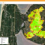
As part of the ongoing efforts to support wildfire response across Europe, the @CopernicusEMS Rapid Mapping, led by e-GEOS, part of @LDO_Space, delivered the following Grading product related to the rapidly expanding wildfire in Biscarrosse, ๐Ÿ‡ซ๐Ÿ‡ท The product was delivered overnight between 27 and 28 July to the French emergency response authorities. It provides an intermediate damage assessment as of 27 July, while firefighting operations were still ongoing. ๐Ÿ“Within the Area of Interest, the analysis identified up to 2,860 hectares of burned land, including 30 hectares of built-up areas and approximately 60 kilometres of roads. ๐Ÿ“The mapping also identified a total of 1,059 buildings affected by the #wildfire, distinguishing between 418 destroyed buildings (in red), 153 damaged buildings (in orange) and 488 potentially damaged buildings (in yellow). ๐Ÿค @CopernicusEU is a European Union programme managed by the @EU_JRC. The @CopernicusEMS Rapid Mapping consortium, of which e-GEOS is Prime Contractor, includes @telespazio Ibรฉrica, @GAF_Munich, @Ithacasrl, @SERTIT, @CLS_Group, IABG, @PlanetekHellas and @infoGMV. #WeUnlockEarth @telespazio | @ASI_spazio | @LDO_Space | @GAF_Munich | @LDO_Fondazione
2
6
280
๐ŸŒ It is not only about what you see, but also the perspective from which you see it. ๐Ÿ›ฐ๏ธ The COSMO-SkyMed Second Generation satellites of @ASI_spazio and the Italian @MinisteroDifesa can acquire SAR images across a wide range of incidence angles (20ยฐ-60ยฐ), observing the Earth from both the right and left sides of the orbit. This flexibility increases revisit opportunities and enables the same areas to be observed from different perspectives, enhancing geometries and revealing fascinating details. ๐ŸŽ This multi-temporal image processed by e-GEOS, part of @LDO_Space, shows the Junma Solar Power Station, a photovoltaic facility covering approximately 1.4 kmยฒ in Inner Mongolia. ๐Ÿ“ธ Kubuqi Desert, China. COSMO-SkyMed Second Generation Image ยฉ Italian Space Agency. Processed and distributed by e-GEOS #WeUnlockEarth @telespazio | @ASI_spazio | @LDO_Space | @GAF_Munich | @LDO_Fondazione
3
2
663
๐Ÿ”ฅ The @CopernicusEMS Rapid Mapping, led by e-GEOS, part of @LDO_Space, is actively supporting emergency response efforts following the #wildfires that have affected Spain, France and the United Kingdom. ๐ŸŒŽ Across six ongoing activations in #Europe, the latest mapping identifies more than 82,400 hectares of affected land, around 295 hectares of built-up areas, almost 980 kilometres of roads and approximately 5,800 potentially exposed people. ๐Ÿ“ A major operational effort is currently focused on central Spain (EMSR900). The latest mapping identifies up to 33,410 hectares of affected land, including 160 hectares of built-up areas, 400 kilometres of roads and around 4,260 potentially exposed people. ๐Ÿค @CopernicusEU is a European Union programme managed by the @EU_Commission's @EU_JRC. The @CopernicusEMS Rapid Mapping consortium, of which e-GEOS is Prime Contractor, includes @telespazio Ibรฉrica, @GAF_Munich, @Ithacasrl, @SERTIT, @CLS_Group, IABG, @PlanetekHellas and @infoGMV. ๐Ÿ”— ๐˜ˆ๐˜ญ๐˜ญ ๐˜Š๐˜ฐ๐˜ฑ๐˜ฆ๐˜ณ๐˜ฏ๐˜ช๐˜ค๐˜ถ๐˜ด ๐˜Œ๐˜ฎ๐˜ฆ๐˜ณ๐˜จ๐˜ฆ๐˜ฏ๐˜ค๐˜บ ๐˜”๐˜ข๐˜ฏ๐˜ข๐˜จ๐˜ฆ๐˜ฎ๐˜ฆ๐˜ฏ๐˜ต ๐˜š๐˜ฆ๐˜ณ๐˜ท๐˜ช๐˜ค๐˜ฆ ๐˜™๐˜ข๐˜ฑ๐˜ช๐˜ฅ ๐˜”๐˜ข๐˜ฑ๐˜ฑ๐˜ช๐˜ฏ๐˜จ ๐˜ข๐˜ค๐˜ต๐˜ช๐˜ท๐˜ข๐˜ต๐˜ช๐˜ฐ๐˜ฏ๐˜ด ๐˜ข๐˜ณ๐˜ฆ ๐˜ข๐˜ท๐˜ข๐˜ช๐˜ญ๐˜ข๐˜ฃ๐˜ญ๐˜ฆ ๐˜ข๐˜ต ๐˜ต๐˜ฉ๐˜ฆ ๐˜ง๐˜ฐ๐˜ญ๐˜ญ๐˜ฐ๐˜ธ๐˜ช๐˜ฏ๐˜จ ๐˜ญ๐˜ช๐˜ฏ๐˜ฌ: mapping.emergency.copernicusโ€ฆ #WeUnlockEarth @telespazio | @ASI_spazio | @LDO_Space | @GAF_Munich | @LDO_Fondazione
2
2
233
๐Ÿ›ฐ๏ธ e-GEOS, part of @LDO_Space, is honored to have received Certificates of Appreciation from @esa ESTEC, in recognition of its contribution to the in-orbit validation activities of the AIS systems onboard the @CopernicusEU Sentinel-1C and Sentinel-1D satellites. ๐ŸŒ As a leading provider of operational Geoinformation services, e-GEOS continues to contribute to the delivery of Copernicus services while supporting the evolution of the Programme through the validation of systems onboard new Sentinel missions. ๐Ÿค We sincerely thank ESA for this recognition, and in particular Sentinel-1 Project Manager Thibaut Decoopman, Sentinel-1 In-Orbit Commissioning Managers Ramon Torres and David Bibby and all the teams from ESTEC whose dedication, expertise and collaborative spirit made these activities possible. #WeUnlockEarth @telespazio | @ASI_spazio | @LDO_Space | @GAF_Munich | @LDO_Fondazione
1
2
172
๐Ÿ†•๐ŸŒ The Africa-EU Space Partnership Programme (AESPP) is a co-owned African-European initiative funded by the @EU_Commission under the Global Gateway strategy, that strengthens collaboration between the European Union (EU) and Africa in the field of Space technologies, services, and applications. ๐Ÿค๐Ÿ›ฐ๏ธ The Institutional Cooperation activity was recently launched: e-GEOS, part of @LDO_Space, is among the industrial partners participating in the Programme. ๐Ÿ”— Press Release: e-geos.it/en/press-release/eโ€ฆ #WeUnlockEarth | #GlobalGateway #AESPP
1
2
148
e-GEOS joins the mourning following the passing of Teodoro Valente, President of the Italian Space Agency, a highly respected figure within the scientific community and the entire Italian space sector. His commitment and vision made a significant contribution to the development of the Italian space sector and to the promotion of the countryโ€™s scientific and industrial excellence, also thanks to his work in research and education. We extend our heartfelt condolences to his family, colleagues at the Italian Space Agency and the entire Italian space community, remembering Teodoro Valenteโ€™s dedication and the impact of his work throughout his professional and personal journey. @telespazio | @ASI_spazio | @LDO_Space | @GAF_Munich
2
6
219