






🌊 #SuperElNino in the Southeast Pacific: what is changing off Peru and Chile?
As previously mentioned, El Niño is already affecting the Southeast Pacific, with increasingly visible changes in ocean conditions off the coasts of #Peru and #Chile.
During a Super El Niño, these changes can intensify rapidly. In a region strongly influenced by the Humboldt Current, shifts in temperature, currents, marine productivity and ecosystem conditions can directly affect the distribution of marine resources and fishing activity.
🛰️ By combining satellite observations, ocean circulation models and marine ecosystem modelling, CLS provides a comprehensive view of ocean dynamics and their impacts on marine ecosystems.
Through #CATSAT, this approach helps to:
- identify fishing hotspots and declining productive areas;
- anticipate shifts in the distribution of key commercial species;
- reduce uncertainty in fisheries operations and management;
- support timely, science-based decisions for fisheries stakeholders and coastal states.
🎣 For captains operating off Peru and Chile, understanding how these conditions evolve can help identify promising fishing grounds, reduce search time at sea and adapt fishing strategies as the marine environment changes.
📍 With its presence in Latin America, CLS supports fisheries stakeholders in Peru and Chile with satellite-based ocean intelligence to better understand these changes and support informed decisions at sea.
Learn more about CATSAT 👉 catsat.com


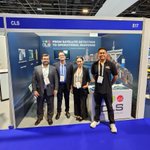
🌊🛰️ Sea Tech Week 2026: From Space to Ocean, From Data to Action!
📡 What a great time in Brest at the Sea Tech Week, a city where CLS also has strong roots through VIGISAT, our satellite ground station dedicated to maritime surveillance!
🌊 And this presence was also a great opportunity to showcase what makes CLS unique: our ability to support #MaritimeSurveillance both above and below the surface.
🛰️ Above the surface, our teams showcased how space technologies and MAS, our Maritime Awareness System, leveraging data from 300+ satellites, help governments monitor and protect their waters and EEZs, combat illegal fishing and environmental crime, and fight trafficking at sea.
🐋 Below the surface, Quiet-Oceans, part of CLS Group, brings complementary expertise in underwater acoustics and noise mitigation, helping monitor the marine environment and protect marine ecosystems.
Together, these capabilities provide a broader understanding of the maritime domain, from space-based surveillance to underwater monitoring.
🎙️ Stéphanie Limouzin, CEO of CLS Group, also joined a roundtable on dual-use ocean technologies, discussing maritime security, strategic data, sovereignty and the role of space in protecting our ocean.
🙏 Many thanks to the Sea Tech Week organisers, and to Laura Cilote Huguenin – Cosma, Jean-Marc Daniel – Ifremer, Aude Kermarrec – GO Capital, Christophe Joly – WSense and Vivien Bordereau – Ifremer for these inspiring exchanges!
🔎 If you want to know more about MAS check this page 👉maritime-intelligence.groupc…
And if you want to discover more, our SAR station VIGISAT is over there 👉 cls.fr/en/expertise/vigisat-…
#tech4good #brest #ia4ocean #maritimesecurity #oceantech #space4ocean


🌊 Search smarter. Respond faster. Save lives at sea.
In the Maldives, CLS experts Naima Allaoui and Christophe Jankovec recently delivered a three-day #THEMISSAR training to teams from the Maldives National Defence Force and Maldives Airports Company Ltd, at the new Maritime Rescue Coordination Centre on Vilingili Island.
🛰️ The training started with the key components of THEMIS SAR before moving deeper into drift modelling and the configuration and allocation of Search and Rescue Units (SRUs). Through practical exercises and real-life scenarios, participants were able to work directly with the platform.
🚢 From theory to real-world testing: a vessel was set adrift for several hours to test THEMIS SAR in real conditions. The following day, teams compared the search area calculated by THEMIS SAR with the vessel’s actual drift. The final training sessions also covered the aircraft search function.
Based on IAMSAR guidelines, THEMIS SAR combines drift forecasting, enhanced Monte Carlo particle modelling, real-time weather data and search planning tools to calculate optimal search areas and support SRU tasking.
🌍 With a maritime search area almost twice the size of France, Search & Rescue represents a major operational challenge for the Maldives. Following the training, three designated participants will continue training coast guards in atolls further from Malé.
🙏 A warm thank you to the MNDF and MACL teams for their welcome, engagement and the very constructive exchanges throughout these three days. A valuable opportunity to share operational experience and strengthen our collaboration around Search & Rescue.
Available 7 days a week and already used by more than 700 users worldwide, THEMIS SAR supports #SearchAndRescue teams when every second counts.
📩 Discover THEMIS SAR : 👉 maritime-intelligence.groupc…
#maritimesafety #maritimeintelligence


♻️ Collecte des déchets, comment mieux connaître ses tournées grâce à la traçabilité des bacs ?
Pour une collectivité, savoir qu’un véhicule a réalisé sa tournée ne suffit pas toujours à comprendre précisément ce qui s’est passé sur le terrain. Identifier les bacs collectés et connaître le moment de leur levée permet de disposer de données plus fines.
Certaines situations nécessitent de pouvoir retracer précisément les opérations de collecte :
🗑️ Un bac signalé comme non collecté
📞 Une réclamation d’un usager à vérifier
⚠️ Une anomalie constatée pendant la tournée
C’est tout l’objectif de #TRACITY®, la solution de lecture RFID développée par CLS pour les opérations de collecte. Installé directement sur le véhicule, le dispositif s’appuie sur des antennes et lecteurs RFID positionnés au niveau du système de levée.
Lorsqu’un bac équipé d’une puce est présenté, il est automatiquement identifié, sans manipulation supplémentaire pour l’agent. L’information est ensuite associée à l’opération de collecte et transmise à la tablette de guidage NAVDROID embarquée dans la cabine du véhicule.
Les données sont ensuite envoyées en temps réel dans la solution #EAZY COLLECTE, où les collectivités peuvent retrouver l’historique des levées et analyser leurs tournées. La continuité de la donnée, du bac jusqu’au bureau de l’exploitant permet d'accompagner les réflexions sur l’évolution du schéma de collecte.
Pour en savoir plus sur TRACITY® et la traçabilité des bacs, découvrez notre article👉 mobility.groupcls.com/tracab…
#GestionDesDéchets


Beyond LRIT: exploring broader maritime security solutions
From 23 to 25 September, we had the pleasure of welcoming our customer DIRECTEMAR, Dirección General del Territorio Marítimo y de Marina Mercante, the Chilean Maritime Authority, to CLS headquarters in Toulouse.
Responsible for #MaritimeSafety, the protection of human life at sea and the aquatic environment, as well as the supervision and regulation of maritime activities under its jurisdiction, DIRECTEMAR has been working with CLS on Long-Range Identification and Tracking (LRIT).
🚢 This new visit was an opportunity to go beyond #LRIT.
Over three days, our teams demonstrated the broader range of #MaritimeSecurity solutions CLS can provide to the Chilean Maritime Authority, while also exchanging on LRIT regulations and the services provided by CLS.
As a long-standing LRIT service provider, CLS supports maritime administrations across the LRIT chain, from satellite communications and conformance testing to the development and 24/7 operation of LRIT Data Centres.
🤝 Thank you to the DIRECTEMAR delegation for these three days of constructive discussions, demonstrations and knowledge sharing with our teams.
📩 Interested in our maritime security solutions? Let’s get in touch👉
maritime-intelligence.groupc…
#maritimesurveillance


🛰️ Detect. Understand. Predict. Respond.
Effective #OilSpillResponse requires more than detecting a slick. It requires the ability to characterise it, identify potential polluters, forecast its evolution and validate its movement in the field.
CLS Oil Spill Services brings these capabilities together through an end-to-end approach combining satellite observation, vessel traffic analysis, oil spill drift modelling and in-situ tracking.
From near real-time detection using high-resolution radar satellite imagery to transport and fate modelling and real-time drift validation, CLS delivers actionable intelligence to support operational response.
📍 This week, our teams were at #SpillAsia in Singapore to present this integrated approach and discuss #OilSpill preparedness and response challenges with maritime stakeholders.
🤝 Thank you to everyone who met our experts at the CLS booth.
Facing an oil spill monitoring or response challenge? Talk to our experts 👉 maritime-intelligence.groupc…
#maritimesurveillance #maritimeintelligence


👏 I-VMS in England, a benchmark for #NEMO and small-scale fisheries monitoring
🛥️🌊 With a coastline stretching along the North Sea, the English Channel and the Atlantic Ocean, England is home to thousands of fishing vessels under 12 metres. Today, more than 1,200 NEMO devices are deployed across 190 ports, making England a key benchmark for small-scale and inshore fisheries monitoring.
Led by the Marine Management Organisation, the national I-VMS programme provides greater visibility of inshore fishing activities and reliable positional data to support fisheries management and compliance.
🛰️ Designed by CLS specifically for small-scale and inshore fisheries, NEMO is compact, robust and easy to install on smaller vessels. Its hybrid satellite and cellular connectivity ensures reliable, near-real-time position reporting, including beyond mobile network coverage.
NEMO also features an assistance button, allowing fishers to send an alert even when operating outside cellular coverage. A solution designed around the realities at sea, benefiting both fishers and fisheries authorities.
👉 Want to learn more? Read our article about I-VMS, NEMO and small-scale fisheries monitoring in England: fisheries.groupcls.com/ivms-…
#SmallScaleFisheries

How do you keep track of #livestock when cellular coverage ends?
For farmers and herders managing animals across large and remote territories, staying connected can be a real challenge.
🛰️ Satellite technology is helping change that.
CLS is working with herders to explore how #satellite connectivity can support livestock management in very different environments.
In our latest interview, Laurent Bacqué, Herd Management Expert at CLS, shares what we are learning from these projects and how #SatelliteTechnology can help respond to real needs in the field.
👉 Read the full interview : argos-system.org/connecting-…
#HerdManagement #SatelliteIoT #Argos


🌊 Better understanding phytoplankton through satellite data and artificial intelligence
At the base of marine food webs, #Phytoplankton plays an essential role in the functioning of marine ecosystems. But did you know that phytoplankton can be classified according to cell size?
🔬 Do you know the different phytoplankton size classes?
Picophytoplankton - less than 2 µm
Nanophytoplankton - between 2 and 20 µm
Microphytoplankton - between 20 and 200 µm
These different size classes do not all play the same role in marine ecosystems. #Microphytoplankton is of particular interest when studying energy transfer to higher trophic levels.
🛰️ To better monitor their distribution at a large scale, CLS has trained an artificial intelligence model to reproduce the results of a physical method applied to Sentinel-3/OLCI observations. This approach speeds up data processing and paves the way for global, daily monitoring.
🐟 These observations can then be combined with fisheries data to explore the links between phytoplankton dynamics and fisheries resources, including the time lag between a phytoplankton proliferation and the presence of top predators.
📍 Last week, CLS presented this work at #OceanOptics XXVII in Ghent, Belgium, where our teams shared the latest developments in phytoplankton monitoring using #SatelliteData and artificial intelligence.
To learn more about this work 👉 fisheries.groupcls.com/phyto…
#EarthObservation


🌏Strengthening a long-standing partnership with Papua New Guinea
We were honored to welcome Jelta Wong, Minister for Fisheries and Marine Resources of #PapuaNewGuinea, to CLS headquarters in Toulouse, France, for discussions on the future of fisheries management and the continued cooperation between Papua New Guinea and CLS.
The Minister was accompanied by Austin Edo, Principal Legal Counsel, and David Karis, Executive Manager, Monitoring, Control and Surveillance (MCS), from the National Fisheries Authority (NFA).
This visit builds on a long-standing collaboration between CLS and Papua New Guinea’s National Fisheries Authority, working together to strengthen fisheries monitoring, support maritime safety and contribute to the sustainable management of marine resources.
The discussions provided an opportunity to explore a broad range of challenges facing fisheries today, from strengthening monitoring and combating illegal, unreported and unregulated (IUU) fishing to improving safety at sea and understanding how changing ocean conditions, including #ElNiño events, can affect fisheries and fishing activity. 🌊🛰️
🤝 Thank you to Jelta Wong and the NFA delegation for their visit to Toulouse and for the continued trust placed in CLS. We look forward to continuing this collaboration and supporting Papua New Guinea in addressing the fisheries challenges of tomorrow.
Discover more about our collaboration with Papua New Guinea 👉cls.fr/en/papua-new-guinea-d…
#SustainableFisheries


🌊 Understanding maritime activity requires a comprehensive view, above and below the surface.
Satellite observations, vessel data, maritime intelligence and underwater acoustic expertise provide complementary layers of information to characterise activities at sea, assess environmental pressures and support informed operational decisions.
📍 From 6 to 8 October, CLS will bring this complementary expertise to Sea Tech Week 2026 in Brest.
🛰️ Above the surface
CLS combines satellite observations, vessel data and multi-source maritime information with GEOINT expertise to detect, monitor and characterise activities at sea. By correlating complementary data sources and contextualising complex observations, our teams transform maritime data into actionable intelligence, strengthening maritime situational awareness and supporting operational decision-making.
🔊 Below the surface
Quiet-Oceans, a CLS company, brings its expertise in underwater acoustics, from forecasting and modelling to acoustic monitoring and decision support, helping maritime and offshore stakeholders better understand and manage underwater noise emissions.
🎙️ CLS will also contribute to key discussions during Sea Tech Week:
📅 Tuesday 6 October | 15:15–17:45 | Méridienne
Stéphanie Limouzin , CEO of CLS Group, will participate in the “Ocean Data & Dual-Use Challenges” panel, part of the workshop “Ocean Startups: Investment Trends & Impact Strategies in a Dual-Use World”. The session will explore the links between ocean data, technological innovation, strategic applications and dual-use challenges.
📅 Wednesday 7 October | 09:30–12:00 | Room #1
Vincent Kerbaol will participate in “Innovation & Collaboration Opportunities in the Portuguese Blue Economy”, a workshop focused on Portugal–France cooperation and opportunities for innovation and collaboration across the blue economy.
🤝 Meet the CLS and Quiet-Oceans teams at Sea Tech Week and discover how complementary capabilities above and below the surface can provide a deeper understanding of the maritime domain and support operational decision-making.
Or contact our team of experts 👉 cls.fr/contact/
Thank you to @CampusMer for bringing the maritime community together once again in Brest.
#maritimeintelligence #maritimesecurity #oceandata #underwateracoustics #seatechweek


🌏🛰️ Stéphanie Limouzin, our President, was honored to welcome H.E. Mr Chea Vandeth, Minister of Posts and Telecommunications for Cambodia and his delegation to CLS headquarters in Toulouse, France, for discussions on how #satellite data and #geospatial intelligence can support environmental monitoring and more #sustainable resource management.
The visit provided an opportunity to exchange on some of the key environmental challenges facing Cambodia and to explore how space-based solutions can support decision making across several areas.
💧 Water resource management, from monitoring water availability and surface water dynamics to better understanding changing conditions.
🌾 Agriculture, with satellite data providing valuable insights into crops, land use and water needs to support more sustainable management.
🏙️ Urban development, using Earth observation and geospatial intelligence to better understand how territories are changing and support more informed and sustainable planning.
Our teams were honoured to share CLS expertise in transforming satellite data into actionable information through the combination of Earth observation, advanced AI technologies and domain expertise, helping governments and local stakeholders better understand their territories, anticipate change and support informed decisions. 🛰️🌍
🤝 We would like to warmly thank Mr. Chea Vandeth and the Cambodian delegation for their visit to Toulouse and for the valuable discussions with our teams.
To learn more about our solutions cls.fr/en/
#tech4good #earthobservation #missiondrivencompany #space4environment


How can technology help streamline market access in fisheries?🎣
Today, catching fish is only part of the challenge. Seafood must also be proven legal, traceable, sustainable and compliant with increasingly stringent market requirements.
This challenge was at the heart of the Seafood and Fisheries Emerging Technology (SAFET) in the Philippines, where @Hervé Galabert, Sustainable Fisheries Director at CLS, joined the panel Streamlining Market Access Using Technology.
🌊🛥️ It starts with reliable data at sea. Vessel monitoring and electronic reporting provide essential information on vessels and catches. Connecting and cross-checking VMS, AIS, radar, ERS and oceanographic data then strengthens monitoring, compliance and traceability.
AI can turn this data into actionable insights, supporting anomaly detection and the fight against IUU fishing. Small-scale fisheries must also be part of this transition, with accessible, easy-to-use technologies that facilitate market access.
📊 CLS is your trusted partner for trusted digital data, turning fisheries data into reliable insights to support better-informed decisions, more effective monitoring and more sustainable fisheries management.
🤝 Thank you to the SAFET Conference organizers for the opportunity to contribute to these important discussions.
#SAFET #SustainableFisheries


🌳 How can #CFD modelling improve wind resource assessment in highly dense forest areas?
Forested and complex terrain presents a particular challenge for wind simulation. Forests modify wind profiles and increase turbulence, making their accurate representation in CFD models particularly important for wind resource assessment.
🔬 To address this challenge, @meteodyn and @EDF_power developed a complete CFD methodology based on Iterative Model Adjustment (IMA), implemented using Meteodyn WT.
The approach uses #WindMeasurements from a single meteorological mast to iteratively adjust the forest parameters used by the CFD model, including forest height and drag coefficient.
One important aspect of the methodology is its compatibility with standard industrial inputs: it relies on public roughness and orography maps and mast measurements, without requiring remote-sensing canopy density data.
📊 The methodology was evaluated across six calibration and cross-prediction cases, covering three sites in Finland, France and Scotland with different forest and terrain configurations.
The results show:
✔️ Mean horizontal wind speed errors reduced from 1.0–9.5% to 0.5–2.2%
✔️ A global mean absolute speed error of 1.1% across the six validation cases
These results demonstrate the performance of the proposed IMA methodology for CFD #WindModelling in highly forested areas.
This research results from a scientific collaboration between Meteodyn and EDF Power Solutions.
📄 The complete study, by Edouard Leonard, Ru Li, Eric Tromeur, Marianne Dupont, Aurélien Gaussorgues, Gaetan Martellozzo, Stavros Koutsioumpas and Mustafa Akcakaya, was published in Energies MDPI (2026, 19(9), 2243):
“A Complete CFD Methodology Based on Iterative Model Adjustment to Improve Wind Simulation Accuracy in Highly Dense Forest Area”
Read the full article 👉 mdpi.com/1996-1073/19/9/2243
Want to learn more? Meet the CLS and Meteodyn teams at WindEurope in Hamburg, from September 22 to 25, at booth A1.427.
#windenergy #windresourceassessment


🌍 What drives us at CLS?
It starts with a belief: our planet deserves our full attention.
Every day, across the world, our teams turn satellite data, science, technology and innovation into solutions that help understand, protect and sustainably manage our planet. 🛰️🌊🌱
From monitoring our oceans and protecting biodiversity, to supporting sustainable fisheries, safer maritime activities, smarter mobility and more resilient infrastructure, our work has one common purpose: making a positive and lasting impact.
But CLS is more than technologies, data and solutions.
CLS is people. 💙
More than 1,200 talents around the world, combining expertise, passion and commitment to tackle some of the most important challenges of our time.
Because observing the Earth is only the beginning.
What truly matters is what we do with what we see.
🎬 Today, we are proud to unveil our new corporate film.
A few minutes to discover who we are, what we do, and above all, why we do it.
👉 youtu.be/1XGLBPkTdjQ
▶️ If you want to know more about CLS check our website : 👉cls.fr/en/
#MissionDrivenCompany #Innovation #Sustainability #TechForGood

💡 Coastal and riparian zones are among Europe’s most dynamic and valuable environments. They support biodiversity, connect ecosystems and play an important role in water and land management, while facing growing pressures from climate change and human activities.
Understanding how these territories are evolving requires reliable, detailed and regularly updated information.
This is why we are proud that CLS has been selected to lead the consortium responsible for the future production and consolidation of the Coastal Zones and Riparian Zones products of the Copernicus Land Monitoring Service #CLMS.
🤝 Alongside #COTESA, #GAF, #GeoVille, @e_geos and @telespazio Ibérica, we will contribute to producing new land cover and land use information for these key European environments, with updates moving from every six years to every three years.
This new contract further strengthens CLS’s longstanding involvement and leadership within #Copernicus Land.
🌳 CLS also leads major initiatives including the Small Landscape Features product and the Copernicus Urban Atlas, helping monitor Europe’s landscapes at different scales, from hedgerows and vegetation patches to urban areas.
And now, rivers and coastlines.
🛰️ Together, these initiatives share one objective: turning #earthobservation data into reliable information to better understand how our territories are changing and support informed decisions.
👉 Discover more cls.fr/en/cls-copernicus-lan…
@EU_Commission @EUEnvironment
#geospatialintelligence #landmonitoring #JRC


🌬️ How can Meso-Micro Coupling improve #WindResource assessment in challenging environments?
Wind resource assessment can become particularly complex in areas influenced by orography, coastal effects or thermal phenomena.
🔬 Presented at the WindEurope Technology Workshop 2026, this study explores the application of Meso-Micro Coupling (MMC) to wind resource assessment through three challenging cases in China.
The methodology combines WRF mesoscale outputs with @meteodyn WT microscale CFD modelling, bringing together atmospheric information at different scales.
The approach was applied to three different environments:
⛰️ An orographically influenced wind corridor, where conventional modelling underestimated wind speed acceleration between two mountains.
🌊 A nearshore area influenced by a strait effect, where two offshore locations recorded wind speeds of 9.7 m/s and 10.3 m/s. Traditional modelling failed to predict this difference, while CFD-MMC successfully reproduced it.
🏔️ A high-altitude site with significant thermal effects, where atmospheric stability influences wind conditions and modelling results.
Across these cases, the study highlights the importance of the coupling height between mesoscale and microscale modelling. The results show that the optimal interface varies according to the characteristics and complexity of the site.
💡 The study demonstrates how Meso-Micro Coupling can integrate mesoscale effects into microscale CFD modelling to address challenging wind resource assessment cases.
Discover the complete methodology and results in the scientific poster presented at WindEurope Technology Workshop 2026 👉 content.meteodyn.com/poster-…
#windenergy #windmodelling


🎣 Comment mieux détecter et lutter contre la pêche INN au #Cameroun ?
🐟 Au Cameroun, dans le golfe de Guinée, la lutte contre la pêche illicite, non déclarée et non réglementée (INN) est un enjeu majeur pour la protection des ressources halieutiques et le contrôle des activités en mer.
À l’issue d’une formation dédiée à la surveillance des activités de pêche, les équipes du MINEPIA sont désormais formées à l’utilisation de THEMIS, notre suite plateforme logicielle dédiée aux Centres de Surveillance des Pêches (FMC – Fisheries Monitoring Centers).
Développée par CLS, THEMIS permet de suivre les bateaux de pêche, analyser leurs trajectoires, renforcer le contrôle des activités de pêche et ainsi préserver les ressources halieutiques.
🤝 Une étape importante, marquée à Yaoundé par la remise des certificats aux participants et par une rencontre avec Dr Taïga, Ministre de l’Élevage, des Pêches et des Industries Animales, autour des efforts engagés par le Cameroun pour renforcer la surveillance de ses eaux et lutter contre la pêche illicite, non déclarée et non réglementée.
🛰️ Découvrez les solutions que nous avons déployées au Cameroun pour accompagner cette ambition :👉 fisheries.groupcls.com/fr/su…
#PêcheINN


🚀 Et si votre prochain job avait aussi un impact ?
🌍 Nous sommes convaincus que la technologie, la donnée et l’expertise de nos équipes peuvent contribuer à construire une planète plus durable.
Observer la Terre depuis l’espace 🛰️, mieux la comprendre et mieux la protéger les océans, accompagner une gestion durable des ressources, développer des solutions technologiques de pointe au service d’un impact positif… Derrière chacune de nos missions, il y a avant tout des femmes et des hommes passionnés.
Et aujourd’hui, nous recrutons de nouveaux talents pour rejoindre l’aventure !
🔎 Découvrez nos opportunités :
⚙️ Manager Excellence Opérationnelle
👉 cls.fr/carrieres/offres-empl…
🎯 Manager Pôle Qualité
👉 cls.fr/carrieres/offres-empl…
🚀 Directeur Ingénierie Produits
👉 cls.fr/carrieres/offres-empl…
💻 Tech Lead Fullstack
👉 cls.fr/carrieres/offres-empl…
🐟 Ingénieur Études Halieutiques
👉 cls.fr/carrieres/offres-empl…
🤝 Chargé de Support Clients
👉 cls.fr/carrieres/offres-empl…
🛰️ Responsable Projet Spatial – Observation de la Terre
👉 cls.fr/carrieres/offres-empl…
💻 Ingénieur Microsoft
👉 cls.fr/carrieres/offres-empl…
🔐 Ingénieur IT Asset & Software Asset Manager
👉 cls.fr/carrieres/offres-empl…
Management, observation de la Terre, environnement, numérique, qualité, relation client… Il y a peut-être une place pour vous chez CLS.
Rejoindre CLS, c’est mettre son expertise au service d’une entreprise internationale et à mission, engagée chaque jour pour développer des solutions au service d’une planète plus durable.
Envie de donner du sens à votre prochain défi professionnel ?
Retrouvez toutes nos offres et découvrez CLS sur notre page Carrières : 👉cls.fr/carrieres/
Et si ce n’est pas pour vous, c’est peut-être pour quelqu’un de votre réseau : partagez ce post ! 🔄
#Recrutement #Iciçarecrute #Emploi #Jobs #JoinUs #EntrepriseÀMission
🌊 From Underwater Noise Mapping to Decision Support: Advancing Marine Conservation in the Western Indian Ocean
Last month, our Quiet Oceans experts took part in the QWIO (Quieter Western Indian Ocean) workshop in La Réunion, alongside scientists, public authorities, port operators and environmental stakeholders working to address the growing impacts of maritime traffic on marine ecosystems.
🐋 The Western Indian Ocean remains one of the least characterised ocean basins in terms of shipping-generated underwater radiated noise (URN), despite increasing commercial traffic and its ecological consequences.
At the same time, collisions between vessels and marine megafauna are becoming a major conservation challenge.
Led by the Wildlife Conservation Society (WCS) and funded by the French Facility for Global Environment (FFEM), the QWIO programme aims to establish the scientific and analytical foundations required to better understand, quantify and mitigate these pressures at a regional scale.
🔬 Within the project, Quiet Oceans, a CLS company, provides expertise in:
✔ Physics-based underwater acoustic propagation modelling
✔ Regional underwater noise mapping
✔ Vessel exposure and cumulative acoustic impact assessment
✔ Ship strike risk modelling
✔ Decision-support tools for marine spatial planning and mitigation strategies
By combining environmental data, vessel traffic information and advanced acoustic modelling, the project enables stakeholders to identify high-risk areas, evaluate mitigation scenarios and support evidence-based management of marine activities.
🌍 This initiative illustrates how we transform multidisciplinary environmental intelligence into operational decision support, helping governments, ports and offshore industries balance economic development with the long-term protection of marine biodiversity.
Congratulations to our Quiet Oceans teams and all QWIO partner, including Wildlife Conservation Society (WCS), Globice Réunion, Bureau Veritas and the Grand Port Maritime de La Réunion, for advancing scientific collaboration across the Western Indian Ocean.
📩 Looking to assess the underwater acoustic footprint of your maritime activities or integrate underwater noise into your environmental studies?
Our experts can support your projects with advanced modelling, monitoring and decision-support solutions.
Get in touch with our Group team 👉 quiet-oceans.com/?page_id=20
#OceanIntelligence #UnderwaterNoise


