
Atmospheric Scientist/AI Professional/Certified Consulting Meteorologist
Joined June 2026
- Tweets442
- Following93
- Followers472
- Likes737


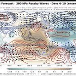
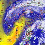


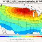
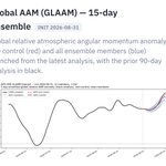


New on gsdmsolutions.com for Professional subscribers: the Extreme Event Browser. Pick a hazard like US West Coast atmospheric rivers, CONUS extreme snowfall, global cold spells, global heavy-precip days, a GSDM state (GWO, MJO or NH latitude band AAM), and a lead window.
Each map shows where event onsets become more or less frequent after that state, over 58 winters, with a false discovery rate test and the sample size behind every map. These are historical associations. Find it under Composite —> Extreme Events.

Strong El Niño forcing, helping maintain a high AAM background state, continues to influence the global circulation and storm tracks. Persistent central-eastern tropical Pacific heating favors a wave-pattern reorganization supporting another deep southwestern/western U.S. trough - raising Rockies snow and southern Plains severe weather/heavy rain risks again, probably late next week. You can diagnose all of this and suss out forecast implications at gsdmsolutions.com.


Curious how the current potent El Niño is showing up on subseasonal time scales? We’ve just launched GSDM Workflows: guided playbooks for reading the GSDM diagnostics, from AAM and torques to the MJO. Start with the free Canonical Tour: gsdmsolutions.com/blog/gsdm-….
Classic tropical tornado environment over the Southeast US today. Isaias remnants are interacting with a robust synoptic-scale system/mid-level trough. This has allowed appreciable conditional instability and substantial lower tropospheric SRH to colocate with baroclinic zones, supporting rotating updrafts.


As surmised earlier this summer, the GWO has remained firmly in the El Niño attractor and is poised to transit phases 7-8 as the tendency becomes negative. While this favors a western ridge aloft, one is situated over central NOAM. My read is that the Pacific wave train is interacting with persistent, east-shifted El Niño large-scale tropical heating, perhaps reinforcing downstream wave activity and amplifying the ridge further east.


El Nino’s prodigious subseasonal fingerprint is once again trolling the y-axis in the latest forecast.


A new capability coming soon to gsdmsolutions.com: a way to explore subseasonal model skill and its relationship to the evolving global atmospheric state.
gsdmsolutions.com/blog/subse…
New at gsdmsolutions.com: (1) Pentad-mean (1-5, 6-10 and 11-15 day) forecast maps from the AIFS-ENS. I have started by generating these for the compound maps showing WAF, waveguides, psi200’ and chi200’ and (2) forecast verification for AAM, VPM, Tauf and TauM.
On today’s forecast sequence you can see the modeled westward shift in the intense large scale wave number 1 chi200’ field with attendant renewed strong forcing of Rossby wave trains in both hemispheres.
The maps use stippling/hatching to show areas of reduced ensemble signal-to-noise in the psi200’ & chi200’ fields.


Even as the MJO briefly moves away from the El Niño attractor, robust subtropical westerlies will sustain in the SH and build in the NH.


New on gsdmsolutions.com: you can now composite on precipitation, which has also been added to the Response-Lag Atlas.


The Response-Lag Atlas in gsdmsolutions.com has an ENSO filter now, using the @webberweather ONI dataset. And I’m working on adding additional response variables.

New daily maps on gsdmsolutions.com help highlight the “return address” for extreme weather!
Tropical heating/Rossby wave source —> wave train —> momentum fluxes, repositioning the storm tracks/waveguides and significant circulation anomalies.
These pentad-mean maps include WAF, Ks (waveguides), chi200 and psi200 anomalies. Admittedly busy but lots of info in a single graphic.

Simply remarkable RWE dispersion continues from the quasi stationary ENSO forcing regime across the C-E tropical Pacific. Note the pronounced wave energy flows both emanating from this source poleward into both hemispheres - and into it - suggesting a role for the synoptic scale eddies in its maintenance. In the JMA version, which shows OLR anomalies, you can clearly see the connections between these wave energy flows and the intense convective anomalies in Texas responsible for the huge floods there and the intense convection over parts of S America.


There is a CORe outage impacting updates on gsdmsolutions.com. I have developed a plan to backfill using GFS/GDAS, supported by a multi-season evaluation vs CORe. I’m also emailing NCEP to inquire about the CORe status.
The strong El Niño background state looks to be relentless - probably indefinitely!


A very El Nino-like AAM/GWO & MJO background state is driving a large component of the record-breaking ridge over the Upper Midwest next week.
Left image from @dgoldweather’s site
gsdmsolutions.com


While the atmosphere has likely reached peak AAM loading, the circulation is going to remain in a configuration consistent with a very eastward shifted Walker cell and seasonally enhanced/intense belts of subtropical westerly wind flows for the remainder of boreal summer. The expected regional responses are likely still well captured by variations of MJO 8-1 and high amplitude GWO 7-8, respectively.


Some plausible composites for NH z500’. We may see regional circulation responses with some of these characteristics at many times during the next few weeks, including:
* an extended or strengthened Pacific subtropical jet
* increased Rossby wave activity entering the North Pacific waveguide
*cyclonic height anomalies over the extratropical central/eastern Pacific
*anticyclonic wave breaking or ridge amplification downstream toward Alaska and western Canada


While the atmosphere has likely reached peak AAM loading, the circulation is going to remain in a configuration consistent with a very eastward shifted Walker cell and seasonally enhanced/intense belts of subtropical westerly wind flows for the remainder of boreal summer. The expected regional responses are likely still well captured by variations of MJO 8-1 and high amplitude GWO 7-8, respectively.