

Astronomy Ph.D. of ICRAR/UWA. Peking University alumni. Science writer & photographer on astronomy and space with 2 million+ followers in China.
Joined January 2012
- Tweets2.3K
- Following1.7K
- Followers1.4K
- Likes551








Boyang Liu retweeted

This exceptionally rare photograph was taken by an Airbus Plaiades satellite on 30 November 2024 over northern Texas. The Plaiades is itself photographing *another* satellite (Starlink?), sitting much lower in orbit.
The reason for the different colours is totally fascinating.
The Pleiades satellites record images in multiple spectral bands: blue, green, red, panchromatic, and near-infrared. It takes the photos a split-second apart and combines the colors to generate a representation of what the human eye would see.
That's fine for stationary objects like trees and buildings, but not so good when the subject is travelling around the Earth at five miles (eight km) per second!

Boyang Liu retweeted

This is what Russia’s Cosmos 2612 approaching to about 160 metres might have looked like from on board ICEYE-X36. It’s a simulation from public data, with the relative position of both satellites, their place above the Earth, the sunlight and the whole scene around them computed.
We put the whole pass into our simulator, with orbital data from the last three weeks and our own cameras standing in for onboard ones. At the start the Russian satellite is on the far side of the Earth, several thousand kilometres away. When it comes out from behind the horizon it’s a pixel, maybe two, in every camera. With each manoeuvre it turns into a clearer shape, until it is a few hundred metres from @iceye_global and you can see every detail.
What happened, briefly. From late September Cosmos 2612 manoeuvred into the orbit of ICEYE-X36, a radar satellite from the company whose imagery Ukraine uses. For many hours it circled ICEYE on a tight ellipse, from a few kilometres down to a few hundred metres. Overnight Saturday to Sunday it made a manoeuvre, raised its orbit and started drifting away. The 26 metres figure going around today is an automated prediction computed from pre-manoeuvre data. By our calculations the closest approach was probably about 160 metres, though the accuracy of public data allows anything from tens to hundreds of metres.
Russia has done this kind of thing before, though in LEO usually at kilometres or tens of kilometres. A few hundred metres from a commercial satellite supporting one side of an ongoing war is something I struggle to find a public precedent for.
There is one more thing about that circling. Cosmos went around ICEYE once per orbit, about every 95 minutes, while the Sun went around the pair of them. So in every loop it saw ICEYE from every side and in every lighting condition, from full light to side light, where shadows bring out the geometry of the antennas. Hard to design a better setup for optical reconnaissance. Quite possibly radio reconnaissance too. From a few hundred metres you can collect the characteristics of ICEYE’s signals that would be useful for future jamming, or even test it. According to the reconstruction, the departure manoeuvre lands almost exactly on the moment ICEYE came out of Earth’s shadow. I just don’t believe in coincidences like that.
TBH: These reconstructions and our numbers are good to plus or minus some fifteen minutes, so we can’t be certain.
The manoeuvre was reconstructed from public data by @AdamCohen8, an engineer in the @USSpaceForce, in his own private analysis. We get the same picture: right after the manoeuvre, around 01:38 UTC over Greenland, Cosmos was about 160 metres above ICEYE.
The cameras in the video are the wide-angle @Scanway_SA SCS, from the family that filmed Ariane 6’s first flight, and SOP telescopes, from the smallest 3U/50, on orbit since 2023, through SOP120 from the family flying in the PIAST military constellation and on lunar missions, to SOP200 and SOP450. The biggest difference between them shows at a dozen kilometres or so, where SOP450 already resolves the satellite’s shape and the smallest camera still sees a few pixels. From a few hundred metres each of them sees detail. This is research-only analysis, based solely on public data and not coordinated with ICEYE. There are no Scanway cameras on ICEYE-X36.
A few numbers from this simulation, for those who like that sort of thing:
- for this scenario the simulator loaded about 380,000 stars from the part of the sky the cameras were pointing at; almost 58,000 fell within their fields of view, and 546 are bright enough to show up in the frame at the real exposure time
- for everyday work it can draw on a catalogue of hundreds of millions of stars
- the motion of both satellites comes from 159 sets of public orbital data spanning 24 days, with 6 clear Cosmos manoeuvres in the data
- the video has 1,371 frames, with almost 4,000 renders behind them
- the simulator holds over 35,000 objects in orbit, about 22,000 of them with known shape and size
I think this is only the beginning. Commercial satellites work more and more for the military, which makes them targets. For now mostly for someone who flies up, takes a look and makes it clear they could do more. There will be more provocations like this in orbit, and operators, civilian ones too, will want to know what is happening next to their satellites and see it with their own eyes.
Looking at it from the other side: if Polish and NATO satellites carried inspection cameras, every approach like this would become intelligence for us. Instead of guessing from orbital data what is flying next to us and what it is for, we would have close-up images of the visitor, and maybe traces of what it is trying to jam. At @Scanway_SA this is part of our day job. In early October we signed a contract with a European company for a series of 14 telescopes for on-orbit security applications, and a month ago, together with Revolv Space, we launched KIMBALL, an inspection camera on a 360° pointing mechanism with narrow and wide-angle optics in one unit. It can follow a target regardless of how the whole satellite is oriented, and on an approach from a few hundred metres, with the target sliding across the sky, that makes a huge difference.
I have so many questions for @rmodrzewski about how ICEYE handled this operationally. I won’t ask them, since most of the answers are probably classified.
What we don’t know:
- positions from public data are accurate to hundreds of metres, and the manoeuvre itself is known only from reconstruction
- ICEYE confirmed it moved its satellite; the data shows a small manoeuvre on the morning of 18 October,
- there are no images of Cosmos 2612; the radar catalogue only tells us it’s a metre-class object, so its look in the video is a hypothesis based on what an inspection mission would need
- its purpose is a hypothesis too, optical and radio reconnaissance alike
The video is a simulation and is marked as one in every frame.
Boyang Liu retweeted

Со вчерашнего дня приходят запросы прояснить ситуацию между финским/американским спутником ICEYE-X36 и российским КОСМОС-2612 — оба аппарата летят так близко друг к другу, что это уже стало прецедентом. Тут буквально один спутник подрезает другой.
Прямо сейчас расстояние между ними сократилось до 26 метров, а относительная скорость до 0. Любое сближение аппаратов на орбите менее 1км считается критическим, а тут ещё и летят в несогласованном тандеме.
Но сперва про сами аппараты для контекста. ICEYE-X36 является одним из микросатов группировки радаров с синтезированной апертурой (SAR). То есть это не какой-то большой стратегический спутник, а малый аппарат массой всего 90-100кг. Конкретно этот и несколько схожих находятся на балансе США. Да, это именно военный спутник от частной компании, который запустили ещё в 2024 на солнечно-синхронную орбиту 550км и с наклонением 97.9. По великой иронии, первые аппараты X-серии запускали ещё на Союзах из военного Плесецка, а этот в составе общей миссии на Falcon 9 из военного Ванденберга.
КОСМОС-2612 является 1 из 6 военных спутников ВКС в рамках одной пачки, которую запустили из Плесецка ещё в апреле 2026. Поскольку аппарат засекречен, то внятных подробностей по нему нет, кроме того, что это также малый спутник. И теперь его предназначение вскрылось окончательно.
Специалисты по всем вопросам, как по копирке шпарят о «сборе развед данных» и «глушилках» — это типичная выдача от чата с нейронкой. Но реальная цель таких манёвров менее очевидна. Перед нами одна из первых демонстраций нового вида противостояния на орбите — неинвазивного свода за счёт расхода топлива.
Следите за руками. Напрямую воздействовать на другие аппараты опасно: ни кинетическими, ни волновыми методами — это прямой акт агрессии. Снимать можно, трогать нет. И орбиты всех аппаратов хорошо известны, на небе особо ничего не скроешь — выбрать можно любую цель, а для съёмки не нужно так близко приближаться.
Сама по себе орбита детерминистична, но среда динамична — молекулярное сопротивление остаточной атмосферы и требования по постоянной коррекции из-за других аппаратов требуют расхода топлива. То есть срок жизни аппарата чаще ограничен не ресурсом железа, а именно запасом топлива для манёвров. И на этот срок можно влиять, если вынуждать кого-то проводить коррекции из-за сближения. Оператор спутника будет вынужден реагировать, если зона неизвестности/неопределённости (коробка или сфера) пересекается с другими аппаратом.
В недавнем посте про автоматизацию уклонений Starlink упоминалось, что операторы стараются согласовывать манёвры между аппаратами заранее. Так банально эффективнее и является правилом хорошего тона. Согласовывает ли ВКС эти трюки с американскими военными? Мы не знаем, но вряд ли. И поскольку X36 выполняет конкретную задачу, то его оператору есть, что терять. Если задача КОСМОС-2612 в преднамеренном расходе топлива другого спутника, то он эту задачу выполняет. И да, относительно дешёвым методом. «Случайно» сталкиваться для этого не нужно.
И поскольку любые сближения на орбите являются деликатным танцем, есть подозрение, что это танго без согласия. ВКС намеренно корректировали орбиту своего аппарата для сближения ICEYE-X36. Причём, из всех аппаратов этой военной серии и других стран был выбран именно американский. Данный выпад пусть трактуют остальные.
К чему это всё приведёт? Пока неизвестно, ситуация разворачивается в реальном времени на наших глазах. С высокой долей вероятности, если орбиту X36 начнут корректировать в срочном порядке, то это может дестабилизировать его работоспособность на некоторое время, как и повлиять на срок его жизни, но это будет понятно не раньше следующего года — срок жизни таких аппаратов начинается от 3 лет. Если прецедент будет успешным, то подобные истории начнут происходить быстро и часто, что сильно повлияет на бизнес производителей, чьи спутники исчисляются десятками, а не тысячами. Ну и заставит пересмотреть алгоритмы коррекции.
Boyang Liu retweeted

Spacewar: een Russische satelliet is zondag vlak langs een westerse satelliet gevlogen, op zo’n 100 meter. Die satelliet levert beelden waar 🇺🇦 gebruik van maakt. Satellietkenner Marco Langbroek (TU Delft) noemt het een verontrustend kat-en-muisspel. 👉🏼 sattrackcam.blogspot.com/202…
Boyang Liu retweeted

UPDATE: Cosmos 2612 appears to have maneuvered following a close approach with the ICEYE satellite.
The latest TLEs show 2612 in a larger orbit that will drift away with no further maneuvers.
In this animation, I fit an impulsive burn to bridge 2612’s previous TLE to its most recent one.
I used OEL with Codex to do all of the modeling.

Cosmos 2612 has been maneuvering closer to an ICEYE SAR satellite. Using OEL, I created these visualizations to help understand what’s going on.
The animation shows a 3D RIC frame animation of the recent motion
The second figure shows how individual parameters evolved over time. You can see that 2612 matched the orbital plane of the SAR satellite and closed the in-track separation.
The third figure shows that between gaps in TLEs the motion of 2612 changes in an unnatural manner. This indicates that a maneuver occurred.
The last figure shows 2D cuts of the 3D animation.
What do you think it’s up to?


Boyang Liu retweeted

Short time-lapse of part of this morning’s first pass of ICEYE-X36 (59103) and COSMOS 2612 (68762) over South America under partly cloudy skies.
Boyang Liu retweeted

🚨🚨🚨 BREAKING: Russian invasion of Europe war reaches space.
Russian satellite 🛰️KOSMOS 2612 after performing orbital maneuvers has now matched speed with 🛰️ICEYE-X36, a made in 🇫🇮Finland, operated by ICEYE-US satellite that aids 🇺🇦Ukraine, in extremely close approach <500m⁉️💥


Boyang Liu retweeted

🛰️ Right now, a Russian satellite is flying in close formation with a Western commercial-ish radar satellite, and makes another close pass in the next ~10 minutes.
COSMOS 2612 has matched orbits with ICEYE-X36, a Finnish-built commercial-ish radar (SAR) satellite. They're circling the planet together under half a kilometer apart, making a close pass almost every orbit (~95 min), the next one around 01:38 UTC (18 Oct), every one at essentially zero relative velocity.
Being upfront: at these separations (sub-km, down to tens of meters), the exact distance is below the precision of public tracking, so treat specific metre figures as indicative. What ISN'T ambiguous is the orbit match and the ~0 m/s closing. This is deliberate, controlled formation flying, the behaviour associated with close-up inspection, not a chance conjunction (collision).
And it's targeted. Cosmos 2612 is the ONLY one of a six-satellite cluster (Cosmos 2609–2614) to have maneuvered: it raised its orbit in the public data ~47 km, drifted into phase with X36, then dropped back to settle alongside it. The other five never moved.

Boyang Liu retweeted

5/x
This is a diagram of the distance over time (based on latest orbital elements) of the two satellites from 16 Oct 00:00 UTC to 19 Oct 00:00 UTC

Boyang Liu retweeted

In May, five Russian satellites surrounded a commercial imaging satellite.
And this week, one of them — Cosmos 2612 — is maneuvering to get even closer. It will make its closest pass over the next 24 hours.
(h/t @AdamCohen8 for the visualization)

This is wild... Russia seems to be threatening a *commercial* satellite that provides imaging services to Ukraine:
▸ starting about two weeks ago, Russia started maneuvering five (!) of their classified satellites to the same orbital inclination as the ICEYE satellite
▸ these burns were big, on the order of 100 m/s, clearly using chemical propulsion given the speed of the burns — very expensive and deliberate maneuvers
▸ as of last Friday, all five Russian satellites are now co-planar, at ~97.8° inclination, with three of ICEYE's satellites, and aligned in other orbital elements (e.g. RAAN) that make it clear they're specifically targeting this set
▸ I am a little skeptical that Russia is specifically targeting -X36 — there are two other satellites at the same inclination/RAAN (-X37 and -X38) — but the Russian sats are now all within striking distance of -X36, which is why people are concerned about it specifically; the closest cross-track distance is an estimated 500 meters (!!), all while the satellites are orbit 550 kilometers above Earth
▸ Russia has unleashed a cyberattack on a commercial satellite before (Viasat), and it is official Russian policy that commercially-owned infrastructure that aids in military efforts "may be legitimate target[s] for a retaliatory strike.”
▸ there's speculation that this could be a precursor to an RPO mission (meaning: physically grabbing the satellite or some other kind of non-kinetic attack like blinding/jamming)
Worth tracking closely. And unfortunately more evidence that space is militarizing, fast.

Boyang Liu retweeted

We’re extending our partnership with @BlackSky_Inc, bringing imagery from BlackSky’s Gen-2 and very high-resolution Gen-3 satellites into HEO’s sensor network.
Combined with HEO’s software and analysis, higher-resolution imagery enables more detailed spacecraft identification and inspection, helping our customers better understand the condition and behaviours of objects they depend on.
Read more: heospace.com/resources/stori…

Boyang Liu retweeted

My very preliminary reconstruction of the "Russian Starlink" satellite based on available photos and official imagery. A complete history of the project, technical details and coverage of Rassvet missions are on the site.

Boyang Liu retweeted

Two football fields. That’s roughly how close Otter Pup 2 is now regularly operating next to @GilmourSpace’s ElaraSat, fully autonomously. This puts Otter Pup 2 on a very short list of spacecraft in human history.
This video was captured from just 200 meters away as Otter Pup 2 conducted close proximity operations around ElaraSat. Otter Pup 2 is capturing images like these and using them to track and predict the position and orientation of ElaraSat on an ongoing basis.
We’ve gone from thousands of kilometers to hundreds of meters away, continuing to test, iterate and validate our technology along the way. And Otter Pup 2 is not done getting closer, as it continues its mission to make history.
Boyang Liu retweeted

Update: Debris from active PRC satellite Yaogan 50-02.
@S4S_SDA has now cataloged 62 pieces of debris originating from the PRC's active Yaogan 50-02 satellite (68196 / 2026-051A) on around 20 July 2026 (ref my initial analysis on Substack, link in thread).
In spite of the numerous objects, Yaogan 50-02's satellite bus continues to have at least a partially operational attitude determination & control and propulsion subsystems as evidenced by the station-keeping maneuver observed subsequent to the event (ref Substack).
Thankfully, all objects have high area to mass and are rapidly bleeding off energy in spite of their higher altitudes. Reference the animated Gabbard below, where it's fascinating to observe perigee heights increasing (but movement to the left illustrates energy is being loss).
#SpaceDomainAwareness #SpaceSustainability #SpaceDebris
(Orbital data courtesy of @S4S_SDA via @SpaceTrackOrg and used with permission per ODR 24-002-4)
Boyang Liu retweeted

OpenAI发布的math论文足以让99%的数学家瘫坐。我们把这些题目拆分出来,分为四类:
1. 世纪难题级: 做完直接可以当历史人物
2. 菲兹奖:对人类数学家来说,做出一道菲尔兹奖级的题,意味着顶尖大学的终身教职、一辈子的经费和邀请报告。这些价值可能是几百万到上千万美元
3. 领域大奖:各学科最高奖,如 Cole、哥德尔、Veblen 奖
4. 顶刊论文:这个在前三个对比下看起来有点黯淡无光,但在各地方都是可以乱杀的
这些奖金有一些是有立项发奖金的,统计下来,可以拿到2亿美元的奖金,然而在这些成就面前,奖金都是小事。
Boyang Liu retweeted

JUPITER'S MOON Io and Ganymede Occultation
October 3 2026. Alt 30 (Low) not bad! at 5:24AM Southern CA USA
Full Info
instagram.com/p/DeDf-RzlJio

Boyang Liu retweeted

有一个正式的科学思想实验,叫 Silurian Hypothesis,志留纪假说。
NASA 气候学家 Gavin Schmidt 和天体物理学家 Adam Frank 在 2018 年专门提出问题:如果数千万年前地球上存在过一个工业文明,我们今天到底能不能发现它?
他们的结论是一个微妙的结论。如果一个工业文明持续时间很短,那么在数百万年以后,寻找它的城市、机器甚至成员化石,本来就可能极其困难。
许多人认为,如果过去存在文明,我们一定会挖到他们的骨骼或化石。但事实上,化石的形成条件极其苛刻。
在地球上生存过的所有生物中,只有极小的一部分(往往不到 1%)能成为化石。
而如果一个文明像人类一样,只发展了区区几百年或几千年的工业化,那么相对于地球 46 亿年的历史,这个时间窗口只是一瞬间。在这么短的时间内,该文明个体的总量可能根本不足以在地质层中留下可被今天发现的化石。
Schmidt 和 Frank 指出,如果几千万年前的工业文明真的存在,我们不应该寻找齿轮或城市废墟,而应该去寻找隐藏在地层中的化学和物理异常。
如果未来的人类或外星人来考古今天的人类文明,他们更有可能通过碳同位素异常、放射性元素等发现我们。


AVATAR

THE FLY BRAIN ESCAPED THE COMPUTER. I PUT IT INSIDE A PHYSICAL ROBOT.
Scientists released a reconstructed map containing 166,700 neurons from a fruit fly.
I connected it to a Strandbeest.
The panel in the top-right shows the simulated brain running. Its neural activity is translated into motor commands that move the mechanical legs below.
The catch: this is a computational model built from biological wiring. I engineered the interface connecting its outputs to the robot.
First, the fly brain entered DOOM.
Then it played Chrome Dino.
Now it has a physical body.
166,700 neurons.
25 million connections.
One nervous system walking through the real world.


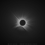
Hope you like it. Learned from Druckmuller's processing methods. #Spain #TotalSolarEclipse
