





Maxim Dubinin retweeted
💥 NEXTGIS CYBER FRIDAY: 50% OFF EVERYTHING!
Geodata and cloud subscriptions at 50% off! Get unlimited Web Maps, data collection, GPS tracking, QGIS integration and processing tools. Access basemaps, buildings, roads, elevation, POIs.
⏰ Dec 1-5 only!
nextgis.com/black-friday-202…

Maxim Dubinin retweeted
What's NextGIS really❓🤔
Here’s the deal:
* Store, manage, and publish your spatial data
* Seamless QGIS integration
* Access ready-to-go spatial data packages for any area on 🌍
* ...
... wait, there's more. Welcome to our brand new nextgis.com!
Maxim Dubinin retweeted
Data for Business Intelligence and Geoanalytics
We are pleased to introduce a new dataset available through NextGIS Data – points of interest. Use this dataset to get insights for market analysis, site selection, planning and development.
Learn more: nextgis.com/blog/poi/

Maxim Dubinin retweeted
Painless QGIS plugin development with a new DevTools plugin for QGIS. Connect and debug with VSCode or Visual Studio github.com/nextgis/qgis_devt…
Maxim Dubinin retweeted
Day 13: A New Tool
The NextGIS Toolbox is a continually expanding collection of tools for online geospatial data processing. Recently, a couple of new tools were added—providing fast and easy options for classification and clustering of any geospatial images.
#30DayMapChallenge

Maxim Dubinin retweeted
Day 12. Time and Space
Africa's precipitation patterns: dynamic pulses across time and space.
#30DayMapChallenge
Maxim Dubinin retweeted
📣 Get ready for discounts! Black Friday is coming soon!
From November 27 to December 2, 50% off all geodata, Premium and Mini subscriptions! More info: nextgis.com/blog/black-frida…

Maxim Dubinin retweeted
Day 8. Humanitarian Data Exchange (HDX)
The 2023 earthquakes in Turkey and Syria shocked the world. This map illustrates the scale of the disaster and the number of people affected.
#30DayMapChallenge

Maxim Dubinin retweeted
Day 10. What if our Earth is just a DnD dice?
Today only pen, paper... and glue.
#30DayMapChallenge


Maxim Dubinin retweeted
Day 5. A journey
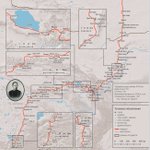
Disguised as a Buddhist pilgrim, G.Tsybikov visited Lhasa in 1900, bringing back its first photos. These images helped shape National Geographic as we know it today. The reconstruction drew from research into 176 toponyms from his travelogue
#30DayMapChallenge
Maxim Dubinin retweeted
Day 4. Hexagons
With increasing droughts, forest fires have spread across Europe. This map visualizes 10 years of forest fires in Spain. Hexagon size represents the fraction of forest cover in each area, while color indicates the number of detected hotspots.
#30DayMapChallenge

Maxim Dubinin retweeted
Day 3. Polygons
Numerous open sources provide building data, with OSM and Microsoft AI being among the most popular. The map highlights the differences between these datasets, using Zagreb as an example. Both datasets are available at data.nextgis.com
#30DayMapChallenge

Maxim Dubinin retweeted
Day 2. Lines
EV chargers are increasingly vital to European transport infrastructure. This map illustrates the current state of the Czech refueling framework, comparing the EV charging network to the traditional fuel station network.
#30DayMapChallenge

Maxim Dubinin retweeted
Day 1. Points
Night lights are an ideal tool for tracking urbanization and its dynamics.
#30DayMapChallenge

Maxim Dubinin retweeted
MOLUSCE is back to @QGIS 3! Predict your landcover maps into the future 🌎🌍🌏 youtube.com/watch?v=F4j1fTyC…

Maxim Dubinin retweeted
NextGIS Toolbox is a collection of dozens of geoprocessing tools available without any additional software – all you need is your web browser! Learn more: nextgis.com/blog/new-toolbox…