

weather-related things that vaguely resemble peens. powered by an extensive network of spotters providing field reports.
Joined September 2018
- Tweets399
- Following66
- Followers6.6K
- Likes5.3K




Weather Peens retweeted

A MODERATE risk is in effect in our Day 3 Excessive Rainfall Outlook. More details: wpc.ncep.noaa.gov/qpf/excess…

A WeatherPeens Watch has been issued for day 2.

12:27pm CDT #SPC Day2 Outlook Slight Risk: late Saturday afternoon/evening from northwest Oklahoma into eastern Kansas spc.noaa.gov/products/outloo…

Weather Peens retweeted

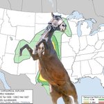
12:14pm CDT #SPC Day2 Outlook Slight Risk: across the Mid-Atlantic, and parts of Nebraska into southern Minnesota and northwest Wisconsin spc.noaa.gov/products/outloo…

Weather Peens retweeted
2:38pm CDT #SPC Day3 Outlook Marginal Risk: from the central High Plains into the Midwest parts of the Ohio Valley and southern Appalachians spc.noaa.gov/products/outloo…

Weather Peens retweeted
2:32pm CDT #SPC Day3 Outlook Slight Risk: over the central High Plains spc.noaa.gov/products/outloo…

Weather Peens retweeted
1:00am CDT #SPC Day2 Outlook Slight Risk: from the Ozark Plateau into the Tennessee Valley spc.noaa.gov/products/outloo…

Weather Peens retweeted
2:32am CDT #SPC Day3 Outlook Marginal Risk: Wednesday into Wednesday night across parts of the central Great Plains into Upper Midwest spc.noaa.gov/products/outloo…

This days-long WeatherPeen outbreak comes at a remarkable time for us, as we have been hard at work developing the next generation of WeatherPeen detection models!
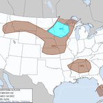
2:28pm CDT #SPC Day3 Outlook Slight Risk: across portions of the Northern Plains and across portions of the Mid-Atlantic spc.noaa.gov/products/outloo…

Weather Peens retweeted
7:57am CDT #SPC Day1 Outlook Enhanced Risk: across parts of the central High Plains spc.noaa.gov/products/outloo…

Weather Peens retweeted
4/8 12:42 PM CDT: Scattered large hail and strong to severe winds should occur tomorrow afternoon and evening (Thursday, 4/9) across parts of the lower to mid Missouri Valley westward into Kansas. Locally very large hail (2+ inches in diameter) is possible.


Weather Peens retweeted
6:59pm CST #SPC Day1 Outlook Marginal Risk: for parts of central/northeast TX, southeast OK, western/central AR, far northwest LA spc.noaa.gov/products/outloo…

Weather Peens retweeted

Thunderstorms along the I-70 corridor in northwest Kansas will slowly track northward through 7:30 pm MDT this evening (Monday August 18, 2025). Torrential rainfall and 50-60 mph wind gusts can be expected with any storms. #kswx #cowx #newx

ALT Thunderstorms along the I-70 corridor in northwest Kansas will slowly track northward through 7:30 pm MDT this evening (Monday August 18, 2025). Torrential rainfall and 50-60 mph wind gusts can be expected with any storms.
Weather Peens retweeted
11:51pm CDT #SPC Day1 #FireWX Critical: portions of northern california spc.noaa.gov/products/fire_w…

HP #WeatherPeen intercepted over Ropesville, TX by the WeatherPeens chase team


Incredible Weather Peen Under Deck coming in from a #WeatherPeens spotter!


Weather Peens retweeted
2:23am CDT #SPC Day3 Outlook Slight Risk: in IA/northern MO/eastern NE spc.noaa.gov/products/outloo…

Weather Peens retweeted
12:47am CDT #SPC Day2 Outlook Slight Risk: in the Upper OH Valley and central Appalachians spc.noaa.gov/products/outloo…

Weather Peens retweeted
12:30pm CDT #SPC Day2 Outlook Enhanced Risk: ACROSS A BROAD AREA CENTERED OVER THE OHIO/MID MISSISSIPPI/TENNESSEE VALLEYS spc.noaa.gov/products/outloo…
