

Official X account for the National Weather Service office in Goodland, KS.
- Tweets57.8K
- Following99
- Followers12.4K
- Likes6.6K


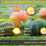


ALT Not much has changed with forecast as relatively mild temperatures and sunny conditions continue for next few days. Winds should stay calm and change direction from the south tonight.

ALT Afternoon temperatures start to build back being in the 60s and 70s this week. Cloud cover will likely be decreasing with winds being relatively calm.

ALT A few hours of elevated fire weather conditions are possible this afternoon for northeast Colorado. Wind gusts up to 35 mph are possible along with relative humidity values around 15%. Avoid activities that cause sparks.

ALT The weekend begins with freezing temps Sat morning. Later on, critical fire weather is possible in northeastern Colorado. Sunday will be quite pleasant with a bevy of sunshine and 70s throughout the region. 80 degree high temperatures are possible Wed.

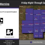
ALT A Freeze Warning has been issued for the Tri-State area. Temperatures as low as 29 F are expected. Take steps to protect sensitive vegetation and exposed plumbing.

ALT The weekend will bring about a plethora of weather conditions across the coverage area. Temps may reach below freezing Fri and Sat mornings. Critical fire weather is possible Saturday in eastern Colorado. Other than that, warmer temps are on the way with plenty of sunshine!

ALT A Freeze Warning continues tonight for northeast Colorado and west of Highway 25 in Kansas and Nebraska. A Freeze Watch continues for the entire area tomorrrow night.

ALT The Gem Weather Radio transmitter is down due to an unknown failure. It is unknown when it will return to service. Technicians are troubleshooting the issues.

ALT Thursday night - A Freeze Warning and Freeze Watch are in an effect for the western portion of the area. Friday night - A Freeze Watch is in effect for the entire area. Be prepared to cover sensitive vegetation and protect exposed pipes from freezing!

ALT Rain will depart our area by mid-day Thursday, paving the way for pleasant wx to return. Plentiful sunshine, seasonably warm temperatures and cool overnight lows are expected for the weekend. A light freeze with frost is possible Friday morning, and likely Saturday morning.

ALT Winds will be increasing across the area today with north-northwest winds gusting to 30 to 50 mph by this afternoon. Gusts of up to 55 mph will be possible in northeast Colorado as well as patchy blowing dust. Winds will gradually diminish tonight through Friday morning.

ALT A Freeze Watch is in effect at from Thursday night until Friday morning. Temperatures around 30 degrees are possible and be prepared to cover or bring in sensitive vegetation.

ALT Today will be quite cool and rainy as a system moves through the region. Steady rain will transition to scattered showers tonight into tomorrow. It will be slightly warmer Thursday and quite a bit breezier.

ALT Areas of dense fog will occasionally reduce visibility to a quarter of a mile in the Kansas and Colorado border area, including Interstate 70. The fog will lift by mid to late morning.

ALT Post-frontal seasonable weather is expected Tuesday before rain moves in late and overnight with the low-pressure system. Showers should last through the evening Thursday. Breezy conditions will occur Thursday as well. Cool temperatures will persist through Friday.

ALT Areas of fog will occasionally reduce visibilities to less than one mile through about mid morning, including Interstate 70 from Colby into northeast Colorado.

ALT Gusty west southwesterly winds and dry conditions will bring a period of heightened fire danger for areas near and west of the Tri-State border. These conditions may make fires difficult to control, but are not expected to be widespread and long lasting.

ALT The potential exists for some localities to experience their first freeze across our region later on this week. Shown in these images are ensemble probabilities of low temps reaching the freezing point.

ALT We begin the work week with hot, dry, breezy conditions and plenty of sunshine. A low-pressure system and associated cold front will start to influence our area late Tuesday. Rain and thunderstorms are possible through Wednesday.

ALT Temperatures will start to decrease on Monday and throughout the rest of the period. Rain showers looks to return Wednesday with 50% chance.