This is an archived account and is not being updated. For the latest updates follow @USGS.

Southwest U.S.
Joined June 2014
40 million people. 7 states. 1 river. From John Wesley Powell’s first expedition to today’s satellite telemetry, USGS science on the Colorado River is as grand as the Grand Canyon. USGS plays a vital role in monitoring the Colorado River, providing reliable scientific data through a powerful combination of century-long records, rigorous accuracy, and cutting-edge tech that informs water resource management in the Colorado River Basin. A brief look at USGS science in the Basin: 🏔️ Snow to Flow - USGS tracks shifting snowpack in the Upper Basin, to model future water availability and predict hazards like wildfires and flash floods. 🛰️ Real-time data - Hundreds of stream gages monitor streamflow, water quality, temperature, and salinity. 🏞️ Reservoir ecosystem research - The USGS Southwest Biological Science Center (SBSC) studies how Glen Canyon Dam affects downstream Colorado River resources. Partnering with the Bureau of Reclamation and National Park Service, SBSC also researches Lake Powell and river ecosystems. 🧬 eDNA - Scientists sample water using advanced eDNA monitoring to identify invasive species before they establish. Connect with USGS science in the Colorado River Basin - colorado-river-portal.usgs.g… 📷 1: Grand Canyon survey party at Lees Ferry in 1923. USGS photo 📷 2: Scientists conduct research on Lake Mead. 📷 3: Advanced UAS science improves the accuracy, efficiency, and safety of data collection in challenging environments. 📷 4: Setting up the RTK GPS base station above the Colorado River, downstream of the rapids of Cataract Canyon. Photo by Chris Wilkowske, USGS #ColoradoRiver #GreatAmericanWaterways #WaterScience
6
3
1
3
530
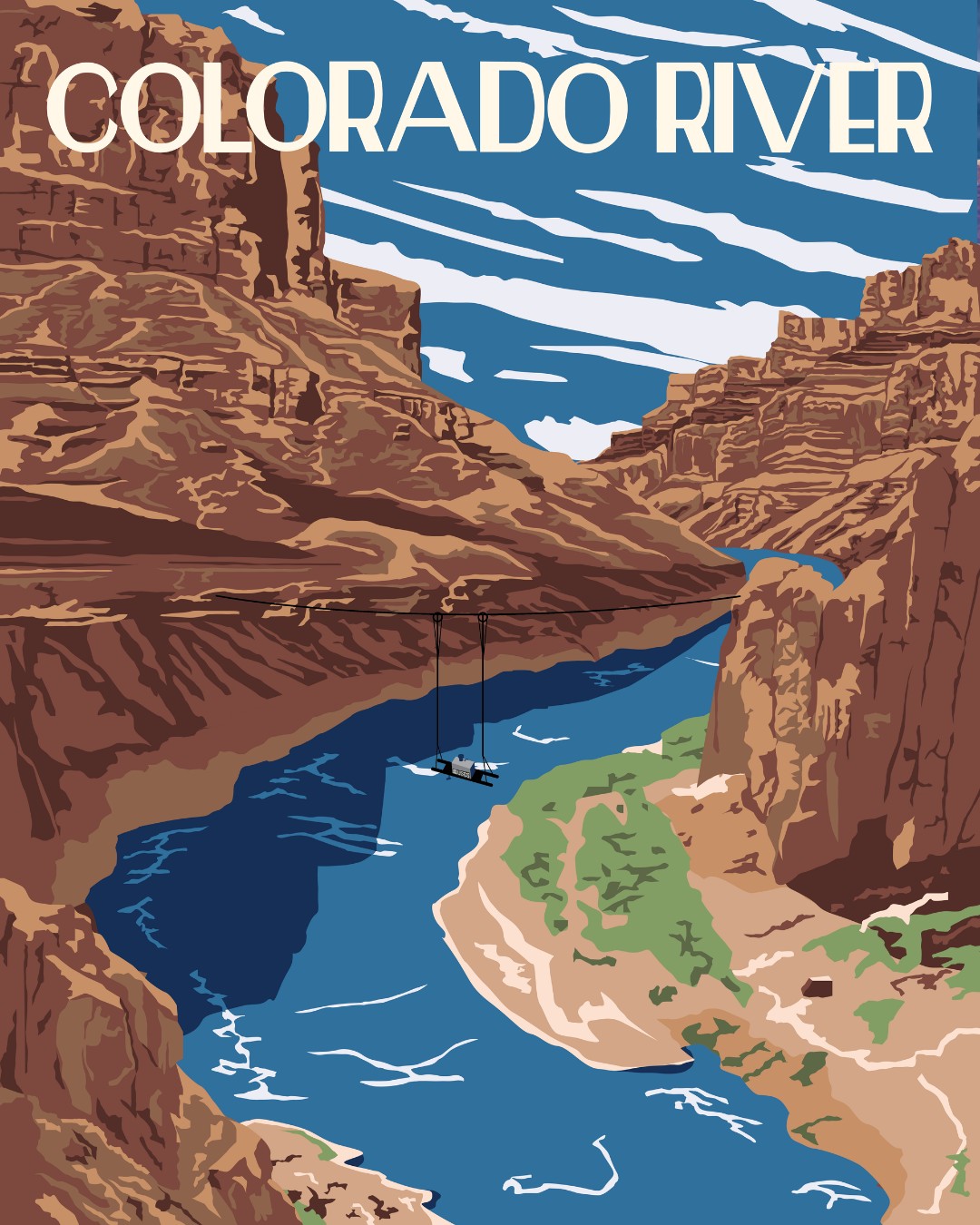
Great American Waterway Day 2: The Colorado River! 🇺🇸 From the Rockies to the Gulf of California, the Colorado River is a lifeline for nearly 40 million people across the U.S. and Mexico. It supports major cities, farms, ecosystems, recreation, and hydropower across it’s 246,000 square-mile basin. People have relied on the river for thousands of years, and its waters later helped shape agriculture, development, and engineering feats throughout the West. Today, shared management and collaboration remain essential as the Colorado continues to symbolize resilience and connection across the region. 💧 The USGS has 713 gages within 1km of the Colorado River’s main branch. Check back in later today to learn more about USGS science the Colorado! Then, keep an eye out for tomorrow’s Great American Waterway as we continue our countdown to July 4! ✨ (Hint: Tomorrow’s waterway puts the “great” in Great American Waterways!) 📷 Vintage-style poster of the Colorado River with a USGS water quality monitor portrayed on pulleys across the canyon. Illustration by Althea A. Archer, USGS #ColoradoRiver #GreatAmericanWaterways #WaterScience
1
1
16
393
Thinking of trading your screen time for stream time? Don’t forget to "pack" your data! 🚣🌊 The USGS operates a network of more than 13,000 streamgages nationwide. Whether you’re looking for the perfect rapids or a peaceful float, our real-time data tells you if conditions are just right or if it's safer to stay on shore. Before you go, know the flow. Check your local stream conditions at waterdata.usgs.gov 📈 📷 A group of people whitewater rafting on the Gauley River in West Virgina. Photo by Matt Kearns, USGS #GreatOutdoorsMonth #NationalRiversMonth #WaterData
1
6
227
Forty-one percent of Arizona’s water comes from a source you can’t see 💧🌵 The Arizona Groundwater Explorer (AGEx) is an interactive, web-based tool that allows for visualization of groundwater levels, long-term trends, and changes in groundwater conditions in Arizona. AGEx combines data from the USGS and the Arizona Department of Water Resources (ADWR), allowing users to explore over 1.9 million observations from more than 42,000 wells to visualize how the groundwater landscape has changed. AGEx data are now available through 2025! Explore AGEx - rconnect.usgs.gov/az-agex/ 📷 1: USGS hydrographer collecting water quality samples for a salinity monitoring project along the Lower Gila River, AZ, December 2024. Photo by Jessica Anderson, USGS. 📷 2: Screenshot of groundwater trends data from AGEx. #Groundwater #Arizona #WaterUse
4
8
392
April streamflow conditions across the U.S. 💧 In April, wet conditions expanded across much of the Midwest and Northeast, while dry conditions persisted across parts of the Southern and Southwestern U.S. Notable weather patterns included: 🚧 Torrential rainstorms in Hawaii brought flash flooding and some record stream heights 🌧️ Repeated storm systems brought sustained rainfall to the Midwest and Northeast 🌊 High streamflow developed across parts of the central U.S. as runoff increased ☀️ Drier conditions continued across portions of the Southwest and southern Plains Find more water data visualizations on the USGS VizLab - water.usgs.gov/vizlab 📸 Combined visual showing a tile chart for national streamflow conditions by flow percentiles at USGS streamgages relative to the historic record across the U.S. Flow percentiles are broken up into seven bins from 0-100% where increased percentiles indicate wetter conditions. To the right, streamflow conditions for the U.S. are shown with a tile chart for each state. #WaterData #rstats #dataRetrieval
1
3
7
356
May is Wildfire Awareness Month, a time focused on prevention, preparedness, and protecting what matters, together. Wildfires are largely preventable, with nearly 85% caused by human activity. Taking steps to reduce risk, prepare your home and family, and stay informed all play an important role in keeping communities safe. Tomorrow, May 2, is Wildfire Community Preparedness Day, remember that small actions can make a big difference. Take a few steps to reduce risk where you live: • Clear dry vegetation and debris around your home • Create and maintain defensible space • Check local fire restrictions and conditions before outdoor activities • Make a plan with your family in case of evacuation Learn more: nfpa.org/events/wildfire-com…
2
21
1
41
2,657
USGS Arizona retweeted
From 1,400 books to one of the world’s largest Earth science collections 📚🌎 When the USGS was established in 1879, the library started with just 1,400 books—supporting early efforts to explore and understand the nation’s landscapes. Today, it has grown into one of the most comprehensive Earth science collections in the world: 📖 1.5 million volumes 🗺️ 750,000 maps 📷 500,000 historical photos 📝 30,000 field records Whether you’re tracing the history of a volcanic eruption, studying water resources, or exploring decades of fieldwork, the USGS library has resources that can help. During National Library Week, we recognize the USGS Library and libraries everywhere for preserving knowledge, supporting discovery, and connecting generations of science. Explore the collections 👉 ow.ly/Y1es50YPsMc 📷1: USGS library reading room in the Interior Building, Washington, D.C. 1935. 📷2: USGS library in the Hooe Building, Washington, D.C. 1917. 📷3: USGS library display of the world-famous George Frederick Kunz library of gems and precious stones. Washington, D.C. 1935. #NationalLibraryWeek
1
20
86
9,036
USGS Arizona retweeted
How a prehistoric lake helped carve the Grand Canyon 💧 Scientific discussion about the formation of the Grand Canyon began in 1869, with an expedition led by John Wesley Powell, a pioneering geologist and future director of the USGS. Powell navigated the Colorado River by boat, advanced early theories about the canyon’s origins and demonstrated the national need for a dedicated science agency—work that ultimately contributed to the creation and mission of the USGS. That legacy of exploration continues today, as researchers uncover new insights into the Grand Canyon’s origins. A new collaborative study led by the USGS provides strong evidence that the Grand Canyon was carved out by spillover flooding from ancient Lake Bidahochi, a large lake fed by the ancestral Colorado River. The lake’s eventual spillover likely helped establish the course of the Colorado River. Beginning about 6.6 million years ago, the sand within these lake deposits shows a clear and distinct Colorado River signature. Two million or so years later, evidence indicates the river system had fully integrated, connecting headwaters in the Rockies all the way to the Pacific through the Gulf of California, thus carving what is now the Grand Canyon along the way. Learn more about the study here: ow.ly/hjhG50YLeSR 📷: At Greasewood mesa the contrast between the dark red mudstone beds and the tan sand-dominated layers above marks the arrival of Colorado River sediment into the Bidahochi basin 6.6 million years ago. Photo by Brian Gootee, Arizona Geological Survey. Any person(s) wishing to conduct unmanned aerial vehicle flights on the Navajo Nation must first apply for and receive a permit from the Navajo Department of Transportation.
1
22
53
7,377
Happy First Day of Spring 🌼 Here’s to warmer days, new life, and the colors that make America’s public lands unforgettable. Photo at Berryessa Snow Mountain National Monument by Anthony Southwood
105
870
52
3,890
63,143
USGS Arizona retweeted
Regional view. Reliable data. Meet the USGS 250K OnDemand Topo. Big landscapes need big-picture maps. At 1:250,000 scale (1 inch ≈ 4 miles), it’s ideal for regional views—elevation, hydrography, boundaries, & more. Build your own custom 250K Topo👉 topobuilder.nationalmap.gov/
5
4
1
29
6,868
USGS Arizona retweeted
Maps from the 1800s. Unpublished photos of earthquakes and volcanoes. Decades of handwritten field notes. That’s just a glimpse of the USGS Library — one of the world’s most comprehensive Earth science libraries. Explore the collections 👉library.usgs.gov  #America250
6
27
143
10,472
USGS Arizona retweeted
Drawing the contours of a nation in the making. ✏️🗺️ In the late 1800s, topographers braved rugged terrain and harsh conditions to map the U.S.—long before aerial photos or GPS. Their work laid the foundation for America’s first detailed maps. History: pubs.usgs.gov/circ/1341 #America250 #TopographicMapping
3
7
1
37
8,566
Happy GIS Day! Geographic information systems, or GIS, allows us to better understand the world around us. From tracking animals to mapping habitats to assessing restoration project progress, learn how USGS uses GIS to inform natural resource issues: ow.ly/4ss750XunSf
1
2
7
349
USGS Arizona retweeted
Visiting #GrandCanyonNationalPark? 🚨 Sign up for texts that alert you to emergencies like #flooding, #naturalhazards, and more. 🌩️🌊 📲 Text GCRIVERALERTS to 928-707-7842. Brought to you by @USGS, @NWS #CoconinoCountyEmergencyManagement & @GrandCanyonNPS 🏞️⛰️🌄
1
1
2
179
On September 27, the nation is headed outdoors—and you’re invited! National Public Lands Day is the largest annual volunteer event on public lands. One way to celebrate is to explore federal public lands without admission on this fee-free day! : neefusa.org/npld-event-searc…
5
5
623
USGS Arizona retweeted
Mapping history, one contour at a time! 🗺️ Just another day in 1952 for USGS cartographers, mapping the landscape. 145+ years later, topo maps still guide scientists, governments, and weekend explorers. More on the history of topographic mapping here: pubs.usgs.gov/circ/1341
2
12
1
64
16,341
For outdoor enthusiasts, a good map is more than just a tool. It's the start of an adventure. The @USGS has released a new series of topographic maps designed with outdoor lovers in mind. They're easier to use and perfect for planning your next trip. usgs.gov/news/national-news-…
21
115
6
487
24,179
USGS Arizona retweeted
🗺️ Just released: A New Cooperative National Geologic Map for the Nation - This new map gives a unified, detailed look at the geology of the contiguous U.S., compiled from decades of work by state and federal surveys. Learn more: ow.ly/QKxj50WObuw
18
130
17
465
60,671
USGS scientists just published a study that found that fire & drought cause an increase in invasive plants & decline in shrublands across the Colorado Plateau. Results highlight how maps & models can help manage #wildfire, fuels, and #droughts #Landsat iopscience.iop.org/article/1…
6
10
833
USGS Arizona retweeted
Water connects us all, cycling through air, land, and underground in liquid, solid, and gas form. Our Water Cycle Diagram depicts the global water cycle, as well as how human water use affects where water is stored and how it moves.
10
119
14
439
31,011