This is an archived account and is not being updated. For the latest updates follow @USGS.
Southwest U.S.
Joined June 2014
- Tweets2.5K
- Following162
- Followers2.2K
- Likes1.9K
Happy Fourth of July!
Did you know that Arizona is home to a unique population of desert-nesting bald eagles? While many people associate these iconic birds with the dense forests of the Pacific Northwest or Alaska, they also thrive along Arizona's desert rivers and reservoirs.
📸: Bald eagle against an American flag backdrop. (Credit: Randolph Femmer, USGS)
Happy Asteroid Day!
Ready to rock your world? Asteroid Day lands June 30! ☄️
Asteroid Day is a day of global awareness of asteroids and planetary defense, held annually on the anniversary of the Tunguska impact event in 1908.
USGS Astrogeology plays a critical role in planetary defense and near-Earth object (NEO) research by mapping, computer modeling, and analyzing the hazards of potential asteroid impacts. From historic events like the impacts that created Meteor Crater and Chicxulub to cutting-edge planetary defense research, there's a whole universe of knowledge to explore!
📸1: Astro researchers descend into Meteor Crater, learning more about the best-preserved impact crater in the world
📸2: Near-Earth Asteroid Eros, imaged by the spacecraft NEAR-Shoemaker, named for Astrogeology's founders
#AsteroidDay #PlanetaryDefense
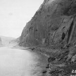
On the morning of December 23, 1889, photographer Franklin Nims stepped onto a gravel bar at a slight bend in the Colorado River and took this photograph.
Nims was the photographer for the Stanton Expedition, a survey led by railroad engineer Robert Brewster Stanton to determine whether a railroad could be built from Grand Junction, Colorado all the way to San Diego, California by threading through the canyons of the Green and Colorado Rivers.
Construction of Glen Canyon Dam commenced in October 1956, 67 years after Nims' photograph. At 710 feet tall, it is the largest of four dams within the Colorado River Storage Project, playing a crucial role in meeting the irrigation and power needs of the Southwest.
Today, the USGS Grand Canyon Monitoring and Research Center serves as the science provider to the Glen Canyon Dam Adaptive Management Program, studying the effects of dam operations on the natural, cultural, and recreational resources of the Colorado River corridor and helping decision makers balance the demands of a river that supports human life and prosperity in the desert.
Learn more about Grand Canyon Monitoring and Research Center: usgs.gov/centers/sbsc/about/…
📸1: The pre-dam Colorado, with tiny figures and wooden boats dwarfed by the canyon walls. The number "235" visible in the corner is a survey marker from the Stanton Expedition which photographed the river every 2 miles (1889, Nims).
📸2: Glen Canyon Dam's downstream face 25 years after construction was completed (1992, USGS).
📸3: The same vantage point another 20 years later, with noticeably more lush riparian greenery along the right bank, one outcome of stabilized hydrological conditions (2011, Webb).
USGS Arizona retweeted
40 million people. 7 states. 1 river.
From John Wesley Powell’s first expedition to today’s satellite telemetry, USGS science on the Colorado River is as grand as the Grand Canyon.
USGS plays a vital role in monitoring the Colorado River, providing reliable scientific data through a powerful combination of century-long records, rigorous accuracy, and cutting-edge tech that informs water resource management in the Colorado River Basin.
A brief look at USGS science in the Basin:
🏔️ Snow to Flow - USGS tracks shifting snowpack in the Upper Basin, to model future water availability and predict hazards like wildfires and flash floods.
🛰️ Real-time data - Hundreds of stream gages monitor streamflow, water quality, temperature, and salinity.
🏞️ Reservoir ecosystem research - The USGS Southwest Biological Science Center (SBSC) studies how Glen Canyon Dam affects downstream Colorado River resources. Partnering with the Bureau of Reclamation and National Park Service, SBSC also researches Lake Powell and river ecosystems.
🧬 eDNA - Scientists sample water using advanced eDNA monitoring to identify invasive species before they establish.
Connect with USGS science in the Colorado River Basin - colorado-river-portal.usgs.g…
📷 1: Grand Canyon survey party at Lees Ferry in 1923. USGS photo
📷 2: Scientists conduct research on Lake Mead.
📷 3: Advanced UAS science improves the accuracy, efficiency, and safety of data collection in challenging environments.
📷 4: Setting up the RTK GPS base station above the Colorado River, downstream of the rapids of Cataract Canyon. Photo by Chris Wilkowske, USGS
#ColoradoRiver #GreatAmericanWaterways #WaterScience
USGS Arizona retweeted
Great American Waterway Day 2: The Colorado River! 🇺🇸
From the Rockies to the Gulf of California, the Colorado River is a lifeline for nearly 40 million people across the U.S. and Mexico. It supports major cities, farms, ecosystems, recreation, and hydropower across it’s 246,000 square-mile basin.
People have relied on the river for thousands of years, and its waters later helped shape agriculture, development, and engineering feats throughout the West.
Today, shared management and collaboration remain essential as the Colorado continues to symbolize resilience and connection across the region.
💧 The USGS has 713 gages within 1km of the Colorado River’s main branch. Check back in later today to learn more about USGS science the Colorado!
Then, keep an eye out for tomorrow’s Great American Waterway as we continue our countdown to July 4! ✨ (Hint: Tomorrow’s waterway puts the “great” in Great American Waterways!)
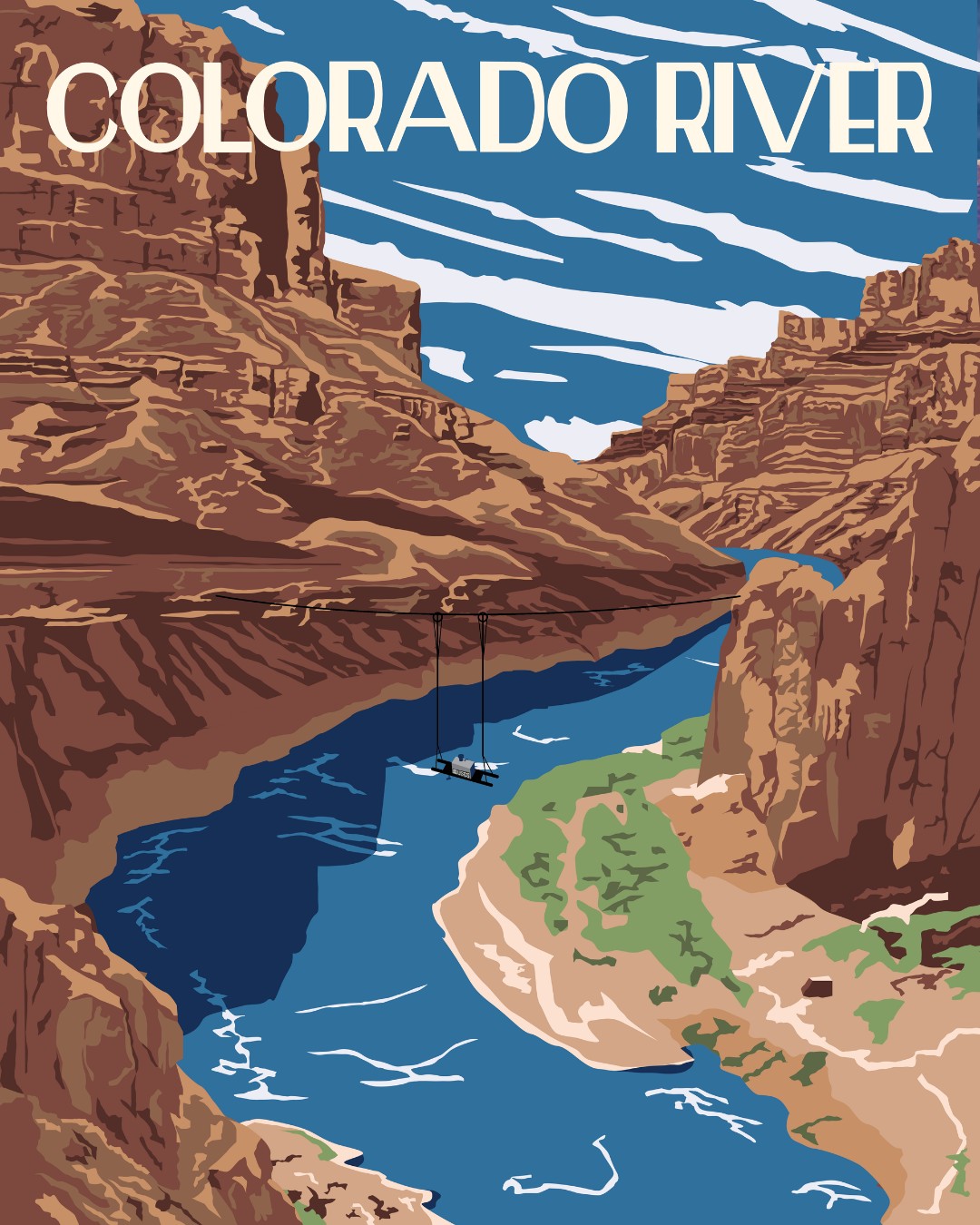
📷 Vintage-style poster of the Colorado River with a USGS water quality monitor portrayed on pulleys across the canyon. Illustration by Althea A. Archer, USGS
#ColoradoRiver #GreatAmericanWaterways #WaterScience
Before there were photo filters, there was just... waiting a century to take the exact same picture.
By standing in the exact footsteps of photographers from the early 1900s, researchers can document exactly how landscapes change over time. The Southwest Repeat Photography Collection uses historical images to create an objective visual record of changing vegetation and land surface patterns across the region.
Explore the collection: usgs.gov/centers/southwest-b…
📸: Jim Malusa of the University of Arizona School of Natural Resources and the Environment, holds a clipboard with a historic photograph captured right at the spot where the image was originally taken in the 1900s, with the same mountain landscape in view. The photos were taken of the Superstition Mountains in Apache Junction, central Arizona. This is Stake S4447 in the Southwest Repeat Photography Collection.
How do you build a solar facility without disturbing soil and creating dusty conditions? 💨☀️
Building solar facilities in the desert requires installing panels and infrastructure, but the way that construction is implemented can affect how much wind erosion occurs. Dust emission from erosion can lower solar energy output and impact human and ecosystem health.
A 20-month study by USGS researchers at the Southwest Biological Science Center compared wind erosion at a conventionally constructed facility where vegetation was bladed and the soils graded ("blade and grade") to a site that employed alternative methods with vehicles driving over existing plants only as needed ("overland travel").
The results showed that conventionally constructed blade and grade sites experienced sediment movement 100 times higher than undisturbed desert. In contrast, the alternative low-impact site kept wind erosion down to 5 to 10 times natural background levels.
These findings suggest that low-impact construction methods can reduce wind erosion and prepare the site for power generation.
Read the full study published in Land Degradation & Development: doi.org/10.1002/ldr.70627
📸1: Dry Lake Solar Project in Nevada, with mountains in the distance. Example of 'blade and grade' methods that strip the ground of topsoil and vegetation entirely for construction. Photo by Claire Karban, USGS.
📸2: Vehicle tracks between solar panels at the Gemini Solar Project show an example of the "Overland Travel" method to preserve soil and plant roots at the site. Photo by Jeff Lovich, USGS.
Check out this new fact sheet on USGS science at Lees Ferry from the Arizona Water Science Center! 🌊🙌📏
100+ years of water data. One iconic location 📍📈
Located at the gateway to the Grand Canyon, the Colorado River at Lees Ferry is where recreation meets resource management and vital aquatic science.
In 1921, the USGS established a streamgage at this location to monitor the river’s flow and level as it enters the Grand Canyon. Used to measure how much water passes from the Upper Basin to the Lower Basin through Glen Canyon Dam, this streamgage is one of the most important in the United States.
The USGS Arizona Water Science Center (AZWSC) tracks key water data here to identify and inform long-term trends. Curious about the science behind this iconic site and the AZWSC’s role in monitoring it?
Get the story in our brand-new fact sheet loaded with maps, field photos, and QR codes for easy exploring! 🗺️📸🔍
🔗 ow.ly/nPGE50ZaebK
📷 1: The Colorado River at Lees Ferry. The Lees Ferry streamgage is visible at the base of the cliffs on the left sides of the photo.
📷 2: AZWSC staff, Sarah Shepherd and Kat Cooney, collect a discrete water-quality sample for NWQN.
📷 3: Hydrologic technician, Janice Talley, services the continuous water-quality buoy.
📷 4: Hydrologic technician, Decker Mcelroy, collects discharge data using an ADCP.
Credit: USGS
#Monitoring #WaterData #Arizona @USGSAZ
How can public scientific research better serve the precise needs of local communities and decision-makers?
Research designed for a generic or non-specific management group frequently misses the desk of the people who need it most. Tailoring data to a single or even hypothetical user, or treating a diverse field of professionals as a uniform group, limits the practical application of the findings.
A new perspective article from an author group that included Southwest Biological Science Center researcher Dr. Aaron Russell highlights how precision in identifying data users improves research design. By using a straightforward framework of who, what, when, where, why, and how, scientists can move beyond vague target audiences and create actionable science.
Read the full perspective piece "Debunking the myth of the quintessential resource manager: Precision in actionable science" here: doi.org/10.1111/csp2.70329
📸: When science is designed for a generic "resource manager," it often fails to account for the actual realities of the people on the ground such as seasonal timelines in the field, specific communication tools, or localized jurisdictions. Public Domain.
Invasive grasses are changing fire patterns and how we manage them in the Intermountain West, USA.
Researchers Sarah Costanzo and Seth Munson conducted a systematic review and meta-analysis of 204 scientific articles published between 1985 and 2023. The study focused on six dominant invasive species in the region, including winter annuals like cheatgrass and medusahead, as well as summer perennials like buffelgrass and Lehmann’s lovegrass.
The findings highlight differences in how these species influence fuel characteristics and regenerate following wildfire. Post-fire trends varied for each species. For example, cheatgrass experienced an initial reduction followed by a substantial long-term increase post-fire, whereas buffelgrass exhibits an immediate post-fire spike followed by a steady decline.
The study also found that chemical treatments demonstrated high effectiveness for reducing invasive grasses. However, other treatment types could be equally or more effective under certain management and environmental conditions. In many cases, treatment effectiveness was enhanced when treatment types were combined or repeat treatments were conducted.
This research is intended to assist land managers in evaluating risk and optimizing treatment strategies. Check out the full study here: doi.org/10.1017/inp.2025.100…
📸: A burned area from wildfire in Agua Fria National Monument in central AZ. Photo by Katie Laushman, USGS
USGS Arizona retweeted
Thinking of trading your screen time for stream time? Don’t forget to "pack" your data! 🚣🌊
The USGS operates a network of more than 13,000 streamgages nationwide. Whether you’re looking for the perfect rapids or a peaceful float, our real-time data tells you if conditions are just right or if it's safer to stay on shore.
Before you go, know the flow.
Check your local stream conditions at waterdata.usgs.gov 📈
📷 A group of people whitewater rafting on the Gauley River in West Virgina. Photo by Matt Kearns, USGS
#GreatOutdoorsMonth #NationalRiversMonth #WaterData
The USGS Flagstaff Science Campus in northern Arizona was honored to host USGS Director Dr. Ned Mamula for two days in early June. The visiting group included the Senior Advisor to the Director, the Acting Deputy Director, Southwest Regional Directors, and the Acting Chief of Staff for the Deputy Director of Operations.
The group spent the first day in the Astrogeology Science Center, learning about historic and current planetary research. Attendees also heard talks from scientists at the Arizona Water Science Center; the Geology, Minerals, Energy, and Geophysics Science Center; the Western Geographic Science Center; and the Southwest Biological Science Center.
On their second day, Dr. Mamula and his team headed to the Grand Canyon region to discuss the extensive geologic mapping and hydrologic studies USGS conducts there. Scientists led conversations about their work on the Colorado River, mapping Grand Canyon, and geochemical water-quality tracing. They also described stream gages installed above areas that may be prone to flooding after the Dragon Bravo Fire on the North Rim — part of USGS's effort to provide information that increases safety and protects property from flash floods.
📸1: Acting Regional Director for the Southwest Region Darrin Thome, USGS Director Ned Mamula, and Senior Advisor Fred Samarelli on the South Rim in Grand Canyon National Park.
📸2: Geologist Kelsey Brennen shows Dr. Mamula a map of the geology, faults, joints, and watersheds of the Grand Canyon region.
📸3: Researcher Carla Roybal discusses native seed reclamation research and provides a tour of the Terrestrial Drylands Ecology laboratory in the Southwest Biological Science Center.
📸4: Geologist Joel Sankey shares information about the Grand Canyon Monitoring and Research Center's research on the Colorado River and Lake Powell.
USGS scientists have mapped a continuous profile of the Colorado River in Grand Canyon’s riverbed and water surface, and it was long overdue.
In 1923, surveyors first mapped the water surface profile of the Colorado River. This was before the construction of Hoover Dam (1935) and Glen Canyon Dam (1963) changed the flow of sediment and water. During a period of steady water releases in 2021, USGS researchers used boat-mounted global navigation systems, multibeam sonar, and aerial photography to measure 282 miles of the Colorado River.
The result is a highly precise elevation profile accurate to the centimeter for the vast majority of the river path from Lees Ferry to Pearce Ferry. High-resolution mapping of the Colorado River provides crucial baseline data for future water management.
See the report here: doi.org/10.3133/sir20265010
📸1: A historic image of Roland Burchard (left) and Claude Birdseye (right) in upper Granite Gorge during a survey trip on the Colorado River in Grand Canyon during the 1923 Birdseye Expedition.
📸2: A researcher operates a modern total station on the Colorado River during an April 2026 USGS channel mapping expedition focused on western Grand Canyon. Photo by Shannon Sartain (USGS).
The Sonoran and Mojave Deserts are incredibly diverse, serving as habitat for migratory birds and wildlife.
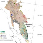
USGS researchers and our partners combined satellite data, decadal plant growth cycles, and extensive ground verifications to map nearly 148 million acres at a sharp 30-meter resolution.
The resulting framework classifies 152 different vegetation and land cover types across both the United States and Mexico. Hosted as an interactive online tool by @uarizona, this map can be rapidly updated with new field observations to detect environmental shifts over time.
This non-biased science provides foundational data to regional public land managers, helping them understand habitat distribution and plan for long-term resource stability.
Download the report and see the full map here: iris.fws.gov/APPS/ServCat/Re…
📸: High-resolution Transboundary Vegetation Community Maps of the Sonoran and Mojave Desert Ecoregion to Support Critical Landscape Conservation Planning and Habitat Management Needs.
@uarizona @wildlandsnetwrk @sonoranjv
A new study shows that a native Grand Canyon fish, the humpback chub, has made a comeback over the last 15 years.
Before 2010, this warm-water species was rarely encountered in Grand Canyon outside of areas in the Little Colorado River and in the Colorado River near its confluence with the Little Colorado River. Cold water released from upstream dams made the main Colorado River too chilly for the fish to reproduce, generally restricting breeding adults to a few warm tributary streams and localized areas in the mainstem Colorado River near warm spring inputs.
By integrating mark-recapture data, catch rates, and expert habitat assessments from 2010 to 2024, USGS researchers and collaborators @USFWS describe an increase in humpback chub numbers in western Grand Canyon, downstream of Havasu Creek. The new model suggests adult humpback chub abundance in western Grand Canyon grew approximately 160-fold over the 15-year study period to 70,000 adults (40,000–200,000; 95% credible interval), corresponding with Colorado River warming water temperatures that surpassed the critical threshold of 16 degrees Celsius required for successful spawning.
While the study reports an increase, the future is still uncertain. As the river continues to warm up, it may also support unwanted guests, like smallmouth bass and other non-native predator fish that compete with and eat the chub.
Access the full publication and methodology details here: doi.org/10.1139/cjfas-2025-0…
📸: Sunlight filters through Havasu Creek, illuminating the unique humped profile of a native desert fish navigating the current. Photo by David Herasimtschuk (Freshwaters Illustrated).
USGS Arizona retweeted
Forty-one percent of Arizona’s water comes from a source you can’t see 💧🌵
The Arizona Groundwater Explorer (AGEx) is an interactive, web-based tool that allows for visualization of groundwater levels, long-term trends, and changes in groundwater conditions in Arizona.
AGEx combines data from the USGS and the Arizona Department of Water Resources (ADWR), allowing users to explore over 1.9 million observations from more than 42,000 wells to visualize how the groundwater landscape has changed.
AGEx data are now available through 2025!
Explore AGEx - rconnect.usgs.gov/az-agex/
📷 1: USGS hydrographer collecting water quality samples for a salinity monitoring project along the Lower Gila River, AZ, December 2024. Photo by Jessica Anderson, USGS.
📷 2: Screenshot of groundwater trends data from AGEx.
#Groundwater #Arizona #WaterUse
Here's a novel story from the field that includes trigonometric vertical-angles and... nail polish.
On a USGS channel mapping trip in Grand Canyon earlier this year, researchers Katie Chapman, Paul Grams, and Anya Metcalfe were struggling to establish a temporary benchmark for surveying that was on the wet side of the river's edge. Black sharpie was not working on the mud-crusted black Vishnu schist. The solution: a base of bright blue nailpolish on the boulder!
Temporary benchmarks are established in USGS surveys to provide localized vertical or horizontal control in areas where permanent geodetic markers are unavailable or difficult to access. These points serve as stable reference stations that allow survey crews to maintain consistency and precision across a specific project site, such as a stream reach or a remote study plot. Once the project is complete and the data is tied to the national spatial reference system, these temporary markers are removed or left as non-permanent field references.
Data from GCMRC channel mapping trips are used to develop maps of the Colorado River along with many other applications. Learn more about this type of research in Grand Canyon: ow.ly/J5te50YUNoS
📸1: Geologist and fluvial geomorphologist Katie Chapman (USGS) applies a base of nail polish before establishing a temporary benchmark on the edge of the Colorado River in Grand Canyon. Photo by Anya Metcalfe (USGS).
📸2: A Trimble total station stands ready on its tripod, serving as the primary shore-based reference point for high-resolution mapping. By maintaining a constant line-of-sight to a prism mounted on the survey boat, the station provides real-time, millimeter-accurate positioning data. Photo by Anya Metcalfe (USGS).
#NationalNailPolishDay
Choosing the right seeds for revegetation projects can be a challenging decision for managers.
Comparing the weather conditions of a seed source to the planting site is a common guide for deciding which seeds to plant in the Southwest at a restoration site. However, a new study by the USGS Southwest Biological Science Center shows that climate is not the only factor that determines how well a plant survives.
Scientists tested several populations of three native southwestern plant species in an experimental garden to see how geographic distance from seed source, climate, and soil conditions affect survival. They found that moving seeds over long geographic distances led to lower survival for all three species. Additionally, each plant species responded uniquely to climate conditions, local soil texture, and soil pH of their new home.
Read the paper "Rethinking seed selection based on climate matching during restoration: Geography, soils and climate explain species-specific mortality" here: doi.org/10.1017/dry.2026.100…
📸: SBSC technician Morgan Andrews collects native hairy false goldenaster (Heterotheca villosa) seeds for data and restoration research near Moab, UT in September 2021. Photo by Shannon Lencioni, SBSC, USGS.
For environmental managers, knowing *when* to act may matter just as much as knowing how to act.
A new paper published in the Journal of Environmental Economics and Management by researchers at the USGS Southwest Biological Science Center and university partners @UNReno and @UCDavis introduces a framework for what they term "episodic ecosystem modification": large-scale, periodic interventions that shift ecosystem conditions rather than targeting individual species directly. Think prescribed burns, shoreline sand replenishment, and dam releases timed to help native fish. As an example for the framework, the authors describe using precisely timed releases from Glen Canyon Dam to strand juvenile non-native trout, which compete with and prey on threatened native fish, before they reach downstream habitat.
Read the study "Timing, uncertainty, and opportunity cost: Lessons for ecosystem
modification on the Colorado river": doi.org/10.1016/j.jeem.2026.…
📸: A split waterline view reveals a large trout hovering over a carpet of aquatic vegetation in the clear tailwater directly below Glen Canyon Dam. Photo by David Herasimtschuk (Freshwaters Illustrated).