

We'll update the weather here for you daily. Watch on @WOWK13News!
Huntington
Joined December 2008
- Tweets32.5K
- Following230
- Followers5.7K
- Likes347




StormTracker13 retweeted

Bryan Hughes ladies and gentlemen @bryanweather
StormTracker13 retweeted
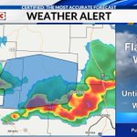
SEVERE THUNDERSTORM WARNING: Scioto(OH), Adams(OH), & Lewis(KY) Counties until 8am EST. Moving NE at 30mph...wind gusts of 45-55mph possible.

StormTracker13 retweeted

TRAFFIC ALERT 🚨
All Eastbound lanes of I-64 Eastbound are shut down do to a semi rollover.
This is near mile marker 43 in Scott Depot.
I’ll have live updates from the scene for you this morning on @WOWK13News


StormTracker13 retweeted
SNOW! It's a VERY light dusting right now at Northside Chevrolet in Summersville, WV. @NWSCharlestonWV


StormTracker13 retweeted
Major flooding happening in SE Kentucky. We're on the ground trying to get to communities that have been cut off by the flood waters.
wowktv.com/weather/flash-flo…
StormTracker13 retweeted

FLASH FLOODING | Busy day in the @StormTracker13 weather lab. Flash flood warnings are in effect today for parts of Floyd and Pike Counties in KY.
More rain coming. @bryanweather tracking it all. @WOWK13News

StormTracker13 retweeted

TORNADO was reported around 6:30 p.m. in Athens County, OH 3 miles NE of Albany in the southwestern part of the county. There is a report of severe damage to trees and homes in that area. Looking back, there was some very weak rotation on radar, but nothing that really stood out.

StormTracker13 retweeted
**SEVERE THUNDERSTORM WATCH** until 10 p.m. for Roane, Jackson, Mason, Jackson (OH), Gallia, Meigs, Vinton, Athens, Calhoun, Wirt and Wood counties in our region. Damaging wind gusts, heavy rainfall and small hail are the primary threats.

StormTracker13 retweeted
ONE WEEK OUT: Next Friday morning, FIVE planets will align: Mercury, Venus, Mars, Jupiter, and Saturn along with the Moon and will be viewable in the morning sky! You do NOT need equipment to views this rare alignment - just good eyes!
cbsnews.com/news/five-planet…


StormTracker13 retweeted
POWER OUTAGES: As of 2:55am these are the current power outages! This won't be good if it can't all get turned on by at least noon. You will desperately need the AC today! #poweroutage

StormTracker13 retweeted
SEVERE THUNDERSTORM WARNING until 5 p.m. for northern Gallia, western Meigs, & northern Mason counties. This supercell thunderstorm has shown signs of dropping large hail, and damaging wind gusts. Seek shelter! Storm is heading toward Salem Center, Point Pleasant & Bidwell.

StormTracker13 retweeted
SEVERE THUNDERSTORM WARNING until 4 p.m. for southern Vinton, western Meigs and northeastern Jackson counties in Ohio. Likely some large hail as well as damaging wind gusts as this storm slides southeast toward Dyesville, Clarion and Radcliff.

StormTracker13 retweeted
MOST of us will be dry on Sunday. However, the storms that pop up will be in a pretty decent storm environment. Damaging wind gusts and hail are possible. I'm not a huge fan of level 1 marginal risks by the SPC, but I think this case is justified with how isolated they will be.

StormTracker13 retweeted
A tornado was confirmed from Wednesday's storm in Hocking and Vinton counties. 120 mph wind (EF-2 strength) was estimated. A LOT of tree damage in the area - more surveying is expected to be completed by the NWS this week. This is why @SpencerWeather was on air during primetime!

StormTracker13 retweeted
**POSSIBLE FUNNEL CLOUD** looking north from Tupper Plains between 8:15 p.m. and 8:30 p.m. This is in line with the timing of the tornado-warned storm in Athens County, Ohio at the time. @SpencerWeather @NWSCharlestonWV @bryanweather

StormTracker13 retweeted
⚠️TORNADO WATCH⚠️ until 10 p.m. for most of Ohio, including the counties in our region, as well as counties in Kentucky along the Ohio River. Strong thunderstorms are expected to move into the region this evening, with an isolated #tornado or two not out of the question. #ohwx
