

Mommy💙👶(9-29-18) IL Storm Chaser Severe Weather Spotter & CoCoRahs Observer🌧❄️🌪️⚡🌩️ Tiktok: adventureswithruby3389 Instagram: adventureswithruby.3389
- Tweets28.2K
- Following3.7K
- Followers713
- Likes8.9K









ALT Headline: Threat for Flash Flooding Tonight. Sub Headline: Main time window for flash flooding late this evening through into Sunday morning. What To Expect. Another round of torrential rainfall. May flood roads, low-lying areas, fields, and basements, and cause rapid stream/creek rises. When: Favored Timing of Highest Rainfall Rates. ~7 PM this evening - 6 AM CDT Sunday. Where: Areawide. Highest rainfall amounts and greatest flooding impacts favored across northern Illinois and far northwest Indiana, which aligns with much of the area that experienced heavy rain over the past day. What To Do. NEVER drive or walk across flooded roads! Move valuables from flood-prone areas, such as basements and outdoor areas with poor drainage. Graphic Created: Saturday, September 19, 2026 2:27 PM CDT


ALT Graphic highlighting the chance for severe weather Tuesday evening through Wednesday morning across eastern Iowa. Primary threats include large hail, damaging winds, and heavy rainfall.

ALT This is a five day forecast graphic for northern Illinois and northwest Indiana. Headline: Five Day Forecast. Sub Headline: Rest of the holiday weekend: seasonably warm w/more comfortable humidity Visit weather.gov/Chicago for more forecast details for your location. Graphic Created: Sunday, September 6, 2026 2:51 AM CDT


ALT The stretch of hot afternoons will continue this week, with temperatures well above normal for September. Computer models are forecasting a cold front to arrive next weekend, reducing temperatures back to normal.

ALT Map of heat headlines valid through this evening (current expiration time of 10 PM CDT) with a Heat Advisory across northern Illinois and northwest Indiana, except Boone, McHenry, Lake IL, northern, and central Cook Counties, where the advisory was canceled earlier today.


ALT Graphic shows a map of the heat advisory in effect for heat indices of 95-105 degrees Monday through Wednesday and discusses the forecast. There is some uncertainty due to thunderstorm potential, which may limit high temperatures. Heat safety information is also included.

ALT A sampler that highlights the peak heat indices each day for cities in eastern Iowa, northwest Illinois, and northeast Missouri. Peak heat indices each afternoon range from 95 degrees to 105 degrees north to south.

ALT Heat Impacts on Vulnerable Populations. Pregnant: Extreme heat events have been associated with adverse birth outcomes such as low birth weight, preterm birth, infant mortality, and congenital cataracts. Newborns: Newborns are extra sensitive to heat because their ability to regulate body temperature is limited. Children: Young children and infants are particularly vulnerable to heat, as their bodies are less able to adapt to heat than adults. Those under four are especially vulnerable. Elderly: Older adults, especially those who have preexisting diseases, take certain medications, live alone or have limited mobility are at higher risk for heat illness. Chronic Illness: People with chronic medical conditions are more likely to have a serious health problem during a heat wave.


ALT Pleasant conditions are in store this weeked with a warming trend beginnning the second half of the weekend. There is a low chance of a shower or thunderstorm north of the Toll Road late Sunday night, but mainly dry conditions are expected.


ALT This is a four day forecast graphic for northern Illinois and northwest Indiana. Headline: Four Day Outlook. Sub Headline: Mainly dry and seasonable to end the week… Very warm and humid next week. Visit weather.gov/Chicago for more forecast details for your location. Graphic Created: Thursday, August 27, 2026 1:20 PM CDT


ALT Storms develop Wednesday afternoon and evening (40-60% chances), with some potentially becoming strong to severe. This graphic shows the Marginal Risk SPC Outlook as well as the risks for wind, hail, tornado, and flooding.


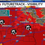
ALT With nearly saturated ground and winds becoming light overnight, conditions will be favorable for areas of fog to develop, mainly after midnight. The potential exists for some of this fog to be dense, especially near river valleys and towards daybreak when the winds will be lightest. Be careful if you are driving overnight and encounter rapidly reduced visibilities. Stay tuned for later forecasts and any updates.