

Page run by a Geospatial Engineer. Spatial Data, GIS & Remote Sensing | Exploring the intersection of ML & AI with spatial Tech 🌍 #GIS #RemoteSensing #AI #ML
Joined August 2024
- Tweets1K
- Following145
- Followers297
- Likes4.7K







Pinned Tweet
Part 1 of a series on SQL for Geospatial Data:Mastering the Basics.
The basics will cover as much as the SQL cookbook covers thus tag along even for non spatial data
tidbitsgeospatial.wordpress.…
#SpatialTidbits #100DaysOfSQL #geospatialanalysis #DataEngineer

Geo retweeted

𝐁𝐮𝐢𝐥𝐝𝐢𝐧𝐠 𝐂𝐥𝐚𝐬𝐬𝐢𝐟𝐢𝐜𝐚𝐭𝐢𝐨𝐧 𝐰𝐢𝐭𝐡 𝐆𝐞𝐨𝐀𝐈 – 𝐆𝐨𝐨𝐠𝐥𝐞 𝐀𝐥𝐩𝐡𝐚𝐄𝐚𝐫𝐭𝐡 𝐢𝐧 𝐏𝐲𝐭𝐡𝐨𝐧
Here comes my first GeoAI tutorial from 2025 - also warch out to my recent full course!
In the tutorial, we start by downloading the AlphaEarth data directly in Python, without any third-party tools, and then combine it with OpenStreetMap building footprints.
Quick recap: Google AlphaEarth is Google’s brand-new GeoAI Earth observation initiative that combines petabytes of satellite imagery and remote sensing to present large-scale, global, 10x10m-resolution multispectral (64 bands for starters) data.
Leveraging this kind of data, due to its small-scale spatial resolution and high feature variance, it's probably going to be a game-changer for data-driven urban planning. It allows data scientists and city planners alike to characterize urban-scale areas all around the world with high precision and harness a rich set of features for planning, predictive modeling, and many other applications - especially if combined with the right vector data.
🔔 𝐖𝐚𝐥𝐤-𝐭𝐡𝐫𝐨𝐮𝐠𝐡 𝐨𝐧 𝐘𝐨𝐮𝐭𝐮𝐛𝐞: zurl.co/PV6kC
🔔 𝐂𝐨𝐝𝐞 𝐨𝐧 𝐒𝐮𝐛𝐬𝐭𝐚𝐜𝐤: zurl.co/fj64n
𝐓𝐡𝐞 𝐍𝐞𝐰 𝐒𝐜𝐢𝐞𝐧𝐜𝐞 𝐨𝐟 𝐌𝐚𝐩𝐬 - thenewscienceofmaps.com/
𝐆𝐨𝐨𝐠𝐥𝐞 𝐀𝐥𝐩𝐡𝐚𝐄𝐚𝐫𝐭𝐡: zurl.co/9hNwD
#30DayMapChallenge #GeoAI #Python #GeospatialData #DataVisualization #MachineLearning #GIS #Mapping #OpenStreetMap #EarthEngine #AI #BuildingClassification #SpatialAnalysis #UrbanPlanning


Geo retweeted
Have you seen Google Flood Hub yet?
Web explorer: lnkd.in/gQQ73UgV
𝐓𝐡𝐞 𝐍𝐞𝐰 𝐒𝐜𝐢𝐞𝐧𝐜𝐞 𝐨𝐟 𝐌𝐚𝐩𝐬 - thenewscienceofmaps.com/
Thanks for the infographics and the news to @Saurav lnkd.in/d2qydGyq

This is quite interesting
@declutterKE

After 7 years as a geospatial data scientist, I quit my job.
I'm going all in to tell you stories hidden in satellite data
I've worked on cocoa and coffee supply chain monitoring, near real time flood maps with radar satellites that see through clouds, mapped trees in 3D to prevent wildfires and built pipelines that analyse crop yields at the scale of the US
But I've always kept going back to telling stories
I've done 70+ interviews of data scientists, CEOs, engineers, policy makers and artists all trying to better understand the impact of data, maps & satellites images in our lives
I've made videos seen by hundreds of thousands of people on how satellite & maps work.
So now I'm going all in
I believe the worlds need more people telling stories, of people; that statistics and data changes the world, but people and stories are what resonate.
A few weeks ago I already put a video out with @OurRadiantEarth about millions of people being miscounted in Argentina. One of the largest press outlets picked the story up, and now there's a conversation about this problem, that's what I want to go do
This is probably the scariest thing I've ever done in my life, but I'm also really excited about it
If you're a company doing cool, impactful stuff with satellite images, geospatial & data and can't get the world to pay attention, let's work together.
I have some cool stories coming up and some collaborations in the pipes.
So, if that sounds cool, I'll see you around on the internets
@AshivakaGilbert, Malungu & I are building deepQuery
It’s a knowledge base system: enterprise level to overcome the challenges of understanding your data as an organization
The Substack post summarizes our situation: how we came together

Geo retweeted

Today I’ve used Gemini in a Google Colab project and used Copilot for GitHub with Visual Studio Code, to make some small changes to complex projects created by other people. I’m giving myself a Level 1 Vibe Coders Badge (Created for me by Grok) @SpatialTidbits

Geo retweeted
Language Models Guide: Transformer Model Introduction
tidbitsgeospatial.wordpress.…

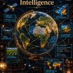
Spatial Tidbits: Where Earth Meets Intelligence:
- satellite/drone imagery use
- flood-risk map
- NDVI crop fields
- Computer Vision
- and data queries in SQL
🤖 Made with AI

Language Models Guide: Transformer Model Introduction
tidbitsgeospatial.wordpress.…

North Eastern Regions and ASAL are largely unmapped. @CommandCodeAI hand-built a WGS84 point shapefile with zero GIS dependencies, and zipped it for QGIS import.
#geospatial #QGIS


My lesson from August/September was harness engineering; coding agents
@CommandCodeAI in particular


Geo retweeted

INFORMATION IS A RIGHT. ACCESS IS POWER.
Today, on the International Day for Universal Access to Information, we reaffirm a simple principle: people cannot meaningfully participate in democracy without access to information.
From public budgets and government spending to policies and decisions that shape our everyday lives, citizens have a right to know.
Access to information enables people to ask questions, demand accountability, challenge decisions and participate meaningfully in public affairs.
When information is withheld, accountability suffers. When information is open, accessible and understandable, citizens are better equipped to hold power to account.
An informed citizen is not a spectator. An informed citizen is a participant.
#AccessToInformation #RightToKnow #InformationIsPower #CitizensFirst

Geo retweeted

One cool use for Atlas is creating "bullet time"-style effects using only a few cameras.
In this case, I was able to use 3 iPhones + my finely honed juggling skillz to synthesize a smooth camera trajectory between each pair of cameras.
Also I layered in an AI-generated beats because that's just the world we live in now. Deal with it.

Geo retweeted

atlas can reconstruct berkeley too... campanile flyaround from 10 ground level images
cc @debfx
Geo retweeted
our new model Atlas also happens to be a capable text-to-image generator, providing it with a strong foundation of “world knowledge”...
this generalizes across both single and multi view domains, meaning you can step into even highly stylized scenes with precise 3D control

Google releasing geospatial models one after the other or rather improving them is making me rethink about being a Google employee soon and how to get there
Let me start brushing up on my DSA so at to join at whatever is available at my location as I seek getting to this
😂😭

TimesFM-3 is here, marking a significant step forward in our time-series foundation model research by natively enabling zero-shot multivariate forecasting in a single forward pass.
✨ TimesFM-3 ranks first among all pretrained foundation models across major public benchmarks: Gift-Eval, FEV-Bench, and Time.
--> Native Multivariate Support: Unlike previous versions limited to univariate forecasting, TimesFM-3 jointly predicts multiple coevolving time series, capturing cross-series dependencies without requiring task-specific fine-tuning.
--> Flexible Covariates: The model natively incorporates past covariates (like historical foot traffic) and past-future dynamic covariates (like planned promotions or weather forecasts) using a clever "lookahead" token construction strategy.
--> Alternating Attention Architecture: Built on top of a decoder-only transformer, it uses causal temporal attention and full variate attention in a 2D grid to seamlessly blend temporal patterns with cross-series relationships.
--> Non-Autoregressive Decode: Using Contiguous Patch Masking, TimesFM-3 generates the entire forecasting horizon and its 9 probabilistic quantiles (10th to 90th percentile) in a single forward pass, eliminating iterative latency and error compounding.

