

Shawnee County Emergency Management Department Our Social Media Policy can be found at https://xitter.cf/t.co/7s7coLlHMr
- Tweets4K
- Following520
- Followers2.9K
- Likes1.2K


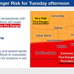

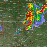




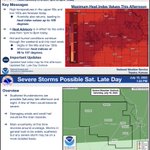


ALT This graphic displays Severe Thunderstorm watch number 682 plotted on a map. The watch is in effect until 11:00 PM CDT. The watch includes parts of Kansas and Missouri. The threats associated with this watch are a couple tornadoes possible, scattered hail up to tennis ball size possible and scattered gusts up to 80 mph likely. There are 3,728,628 people in the watch along with 1489 schools and 117 hospitals.

ALT This graphic displays a severe thunderstorm warning plotted on a map. The warning is in effect until 8:00 PM CDT. The warning includes Topeka KS, Silver Lake KS and Rossville KS. This warning is for Shawnee County in east central Kansas and Southern Jackson County in northeastern Kansas. The threats associated with this warning are wind gusts up to 70 MPH and penny sized hail. There are 178,780 people in the warning along with 64 schools and 7 hospitals.

ALT This graphic displays Severe Thunderstorm watch number 670 plotted on a map. The watch is in effect until 11:00 PM CDT. The watch includes parts of Kansas, Oklahoma and Texas. The threats associated with this watch are no tornadoes expected, isolated hail up to ping pong size possible and scattered gusts up to 75 mph likely. There are 1,345,572 people in the watch along with 700 schools and 74 hospitals.