

Established in 1898, The New York Public Library's Map Division holds over 433,000 maps and 20,000 books and atlases.
5th Ave and 42nd St., NYC
Joined November 2009
- Tweets5.3K
- Following180
- Followers6.5K
- Likes2.2K

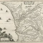


"Aethiopia Inferior vel Exterior" from "Umbständliche und eigentliche Beschreibung von Africa..." by Olfert Dapper, 1670 #SouthAfrica digitalcollections.nypl.org/…

"Regna Congo et Angola." from "Umbständliche und eigentliche Beschreibung von Africa..." by Olfert Dapper, 1670 #Congo #Angola digitalcollections.nypl.org/…

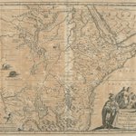
"Aethiopia Superior vel Interior vulgo Absissinorum five Presbiteriio Annis Imperior." from "Umbständliche und eigentliche Beschreibung von Africa..." by Olfert Dapper, 1670 digitalcollections.nypl.org/…

"Insvla S. Lavrentii, vulgo Madagascar" from "Umbständliche und eigentliche Beschreibung von Africa..." by Olfert Dapper, 1670 digitalcollections.nypl.org/… #Madagascar

"Insula Promontorii Viridis, Hispanis Issas de Cabo Verde, Belgis de Soute Eylanden" from "Umbständliche und eigentliche Beschreibung von Africa..." by Olfert Dapper, 1670 digitalcollections.nypl.org/…

"Insula Canariae alias Fortunatae dictae" from "Umbständliche und eigentliche Beschreibung von Africa..." by Olfert Dapper, 1670 digitalcollections.nypl.org/…

"Melite Insula vulgo Masia" from "Umbständliche und eigentliche Beschreibung von Africa..." by Olfert Dapper, 1670 digitalcollections.nypl.org/…

"Difegno Della Citta Valletta" from "Umbständliche und eigentliche Beschreibung von Africa..." by
Olfert Dapper, 1670 digitalcollections.nypl.org/…

"Isothermal chart, or, View of climates & productions" by Alexander von Humboldt, 1823 digitalcollections.nypl.org/…

"An old map of Heiankyo (Heian Castle)" Yoshiyuki Hagino, 1908 digitalcollections.nypl.org/… #Kyoto #Japan

"An old map of Heiankyo (Heian Castle)" Yoshiyuki Hagino, 1908 digitalcollections.nypl.org/… #Kyoto #Japan


"Americae Pars Borealis, Florida, Baccalaos, Canada, Corterealis" by Cornelis de Jode, 1593 digitalcollections.nypl.org/…

"Paris, ses monuments: guide pratique du visiteur" by Cartes Taride, 1925 digitalcollections.nypl.org/… #Paris

"Plan of the Central Park, City of New York, 1860" by George Hayward digitalcollections.nypl.org/… #CentralPark #NYC #Manhattan

"Map of Camp Chase. Drawn on a scale of 120 feet to one inch. by W.W. Pollard. Columbus Ohio. January 1865. M.M. Griswold, photographer" digitalcollections.nypl.org/…

NYPL Map Division retweeted

The new Worlds Revealed blogpost is hot off the press, "Urban Planning Legends: City Design Makeovers before the Olympics." Check out the timely post now: blogs.loc.gov/maps/2024/07/u…

ALT Image of Rio de Janeiro's tramway, light, and power lines in 1906
"Map illustrating the operations of the U.S. Sanitary Commission drawn by H. Lindenkohl; Chas. G. Krebs, lith. 1864" digitalcollections.nypl.org/…

"Knickerbocker Village" ~ 1935 by Fred F. French Companies digitalcollections.nypl.org/… #Knickerbocker

