

The Utah Geospatial Resource Center (UGRC) provides mapping technology services to federal, state, and local governments and other organizations.
- Tweets1.7K
- Following56
- Followers670
- Likes193
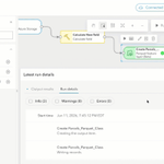






ALT A screenshot of the ArcGIS Data Pipelines interface showing a workflow configured to create a Parquet feature layer (Beta) titled "Parcels_Parquet_Class," with the latest run details and dataset settings displayed.

ALT A screenshot of a map illustrating an alignment issue created by a spatial transformation.


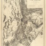
ALT This vintage topographic map depicts the Utah Territory in exquisite detail, capturing the region's dramatic mountain chains, desert expanses, and intricate river drainages mapped by 19th-century cartographers.

ALT An illustration of a diverse group of colleagues standing together and high-fiving in celebration of a shared success.

ALT This collage showcases a diverse variety of LiDAR visualizations and 3D elevation models, highlighting the power of remote sensing. The images seamlessly blend natural landscapes—including rugged mountain ranges, deep canyon walls, and forested terrain—with urban developments, architectural footprints, and infrastructure point clouds like Ferris wheels and wind turbines.

ALT This illustration depicts two people collaborating to assemble a large, yellow light bulb made of puzzle pieces. Standing on a dark background, a man on the left and a woman on the right carefully fit the final sections into place, symbolizing teamwork, problem-solving, and bringing innovative ideas to life.

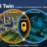
ALT This Venn diagram illustrates how location serves as the bridge between the physical and digital realms in a Digital Twin framework. The left circle depicts the "Real World" with actions like inspecting, diagnosing, collecting data, and maintaining assets, while the right circle highlights the "Virtual World" focused on measuring, modeling, visualizing, and planning. At the glowing intersection sits a central map pin labeled "Location," connecting both environments across social, natural, and built landscapes.


ALT A flat vector illustration of a young woman wearing a yellow top and dark pants, standing beside a giant smartphone screen that displays a digital map interface with location pins, route lines, and city blocks highlighted in yellow and grey tones. A potted plant with yellow leaves sits to the right of the smartphone against a dark background.

ALT An example of utility data in the Marina Bay region of Singapore (source: Singapore Land Authority, 2018)

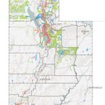
ALT An official GIS map showing government-owned land parcels across the state of Utah, with color-coded data points outlining public property distribution across counties, major cities, and rural regions.
