

Esri GIS Education - news, curriculum, software, tools and more
USA
Joined April 2009
- Tweets4.7K
- Following662
- Followers22K
- Likes1.9K




GIS Students 📢 Applications are open for:
🔸 Esri Summer Internship
🔸 Esri Student Assistantship
Read this blog to learn about Esri student program and where to apply: bit.ly/4yGkQIg

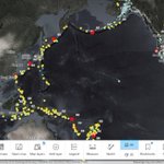
What causes earthquakes, and how do they impact communities? 🌎
Help students explore earthquake patterns, plate tectonics, and human impacts with a ready-to-use National Geographic MapMaker activity.
Explore the lesson: link.esri.com/701UU00000RSRY…

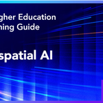
Explore GeoAI in ArcGIS 🤖🌎 This Esri Higher Education E-learning Guide for Geospatial AI provides resources covering AI, machine learning, deep learning, spatial analysis, imagery, lidar, and more: bit.ly/4s9RSid

Smarter capacity planning starts indoors. 🏫
See how Horry County Schools uses ArcGIS Indoors to turn disconnected facility data into actionable insights, helping staff make faster space allocation decisions across 58 schools.
🗺️ Read the story:
🔗 bit.ly/4hYwCbT

How has GIS education evolved over 25 years? Dr. Sowmya Selvarajan reflects on the shift from desktop mapping to GeoAI and how geospatial technology continues to shape teaching, research, and student opportunities.
Read her story: bit.ly/47sq5zZ

See how a passion for maps, nature, and technology led to an award-winning 3D GIS application that helps researchers explore bird migration in new ways. 🌎 A great example of GIS driving scientific discovery. 🐦 bit.ly/4jWbrIx

What can 3D GIS reveal about bird migration? 🌎 See how an ETH Zurich graduate used ArcGIS to build an interactive web app that helps researchers visualize animal movement, behavior, and migration in new ways. 🐦 bit.ly/4jWbrIx

How can GIS spark interest in CTE career pathways? 🗺️
Teachers Dominique Evans-Bye and Shalini Singh use National Geographic MapMaker to introduce ninth graders to GIS through engaging lessons and real-world topics.
Read their story: community.esri.com/en/discus…

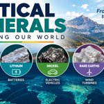
Celebrate Earth Science Week (Oct. 11–17)! 🌎 Explore how minerals shape our world with Esri Earth Science GeoInquiries and National Geographic MapMaker lessons. Help students investigate mineral resources, geology, and sustainability.
Learn more: bit.ly/3VMvAHi

Teachers! Join our webinar to discover how National Geographic MapMaker can engage students with interactive maps, 3D exploration, and ready-to-use activities for science and social studies.
📅 Nov. 17 | 5 PM PT
Register: link.esri.com/701UU00000hBgO…

What’s the key to getting students excited about GIS? Start with what they already love. 🎸🦇 From Black Sabbath to Batman, this student story shows how connecting GIS to personal interests can inspire lifelong learning. Read it here 👉 bit.ly/47PzYI1

Upcoming AI in education webinar 📣
Topic: Strategies for Integrating Thoughtful AI into GIS Teaching and Learning
When: Nov. 5 @ 10 am (PT)
Register: bit.ly/4hMbC87

The University of Tennessee Chattanooga is using imagery, GIS, and GeoAI to understand urban tree canopy loss and identify where restoration can have the greatest impact🌳
Read about their team of GIS students and researchers: bit.ly/4zrcWTA

Explore Indigenous North America with your students! 🗺️ This National Geographic MapMaker activity helps students discover Indigenous territories, cultures, and connections to the land through interactive maps.
Explore the activity: link.esri.com/701UU00000RSRY…

We are here in Denver, CO at GSA Connects 🗺️ stop by the Esri booth to chat all things #GIS and get your Esri swag 🙌


This lesson from The UCSB Guide teaches you how to:
🔥 Manage wildfire emergencies with real-time data: bit.ly/4ifej1T
Integrate real-time data with a wildfire case study in the United States.

🏫 How can GIS strengthen school safety?
Palm Beach County Schools partnered with GeoComm to map 200+ campuses and 1,700 buildings using Esri technology, helping first responders improve situational awareness and emergency coordination.
Read more: bit.ly/4jfRNXN

📣 Call for Presentations! Share how you're using GIS to innovate in education at the 2027 Esri Education Summit in San Diego.
Submit your abstract by October 23, 2026, and inspire educators worldwide!
🔗link.esri.com/27EdSummit/cfp…

🌎 At the 2026 Esri Education Summit, 7th-grade teacher Jess Winkelaar shared how she uses National Geographic MapMaker to build students’ spatial thinking skills.
Read the blog and Watch the video interview: bit.ly/4zKQfdx

Prefer to combine your fun with educational information? 🤓 “Color Me Mappy: A Cartographic Coloring Book” has maps that will help colorists slow down, relax, and learn about our world 🌍➡️ bit.ly/4yh9874
