Official account of the @LibraryCongress Geography & Map Division, the largest map library in the world. All Library accounts: https://xitter.cf/t.co/T907knoXYf

Washington, DC
Joined June 2011
This Earth Day, we’re taking a look at the Library’s incredibly cute pocket globe collection in the Geography and Map Division. 🌎 Learn more about these small treasures: blogs.loc.gov/loc/2022/05/po…
5
33
2
147
10,870
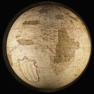
Later, Coronelli reproduced the globes at a 3.5-foot diameter scale. The Library's Geography and Map Division has a copy of the 3.5-foot globe gores cut and mounted in frames, one for each hemisphere. See more globe gores in the collections: blogs.loc.gov/maps/2025/03/g…
1
10
1
24
4,268
Globe gores are the strips of paper containing printed maps in the sizes & shapes needed for globe construction. Cartographer Vincenzo Maria Coronelli was famous for, in 1684, making the largest-ever (at that time) globes for Louis XIV, each of them 12' 7" in diameter. 🧵
5
25
1
79
5,951
Take a look at this stunning example of Indigenous mapmaking from the Library's Geography & Maps Division. This map of Disko Bay in Greenland was commissioned by the Library & made in 1925 by Silas Sandgreen, an Inuit hunter, out of driftwood & seal skin. go.loc.gov/pjpq50OW4s0
6
47
6
184
32,213
LOCMaps retweeted
Is it a map or a pile of sticks? The Marshall Islands Seafaring Charts may be one of the most unusual maps owned by the Library of Congress. Maps that defy description, created by Pacific Islanders over 100 years ago. Check it out! loc.gov/item/2010586181/locl… (2/2)
2
5
11
2,272
LOCMaps retweeted
Min Zhang is head of the Metadata and Stewardship Section of the Geography & Map Division @librarycongress. For #APAHM, staff are sharing their picks of digital materials that delight and/or surprise them. Here is Min’s selection. #AAPI (1/2)
1
1
5
1,755
The Library's huge map collection doesn't only include antique maps. We also collect modern maps. One example is this 2021 pictorial map by Veazey Studio, which celebrates the city of Atlanta's contributions to hip-hop. A perfect highlight for the #50thanniversaryofhiphop!
2
50
3
218
25,188
From the Library's Geography and Maps Division (@LOCMaps): The farthest point from the center of the Earth is NOT the peak of Mount Everest. Instead, it's located in South America. Here's why: blogs.loc.gov/maps/2020/11/e…
1
18
1
34
Go around the world with us. This is @librarycongress Geography & Map Division’s oldest (and one of its rarest) globe. This 1543 globe by Casper Vopell has a series of 11 interlocking rings, illustrating the rotation of the sun, moon and stars in the Ptolemaic tradition. – at Washington, DC
1
44
4
166
Libraries can bring you around the globe. In this case even the mini ones. @librarycongress Geography & Map Division has acquired the largest collection of 18th & 19th century miniature globes. It represents 200 yrs of globe making from some of the most important craftsman (1/2)
1
40
6
244
A lot goes into preserving fragile and historic items that are on view for the public. The “anoxic” (low-oxygen) display case at the Library that holds the 1507 Waldseemüller map is the largest in the world. Here's how it works: blogs.loc.gov/preservation/2…
1
23
1
69
LOCMaps retweeted
Take a trip through the past with the Sanborn Maps Navigator, created last summer by Library Junior Fellow Selena Qian. Learn all how Qian combined the #NewspaperNavigator dataset and historic maps here, and then try it out for yourself! go.usa.gov/xAFqY #ICYMI @LOCMaps
LOCMaps retweeted
Interested in downloading and analyzing #maps like those in the Sanborn Collection? Our friends @LOCMaps are beginning a series of Jupyter Notebooks about using @librarycongress maps computationally. Read all about it in a blog post by @reliztrent here! go.usa.gov/xwggR
1
25
2
35
Interested in redlining? We point researchers interested in #redlining and #segregation to the amazing @HOLCRedlining. Explore 100s of Home Owners' Loan Corporation maps, scans of the actual assessments, and download shapefiles! Here is #Baltimore. dsl.richmond.edu/panorama/re…
6
2
15
1858 #map celebrating the submarine cable between Europe and America with an actual size image of the cable. #maps #infrastructure
1
17
29
1912 #map of #Leipzig overprinted and with manuscript annotations to show types of public and private landownership #maps #planning
1
8
32
Here's the first scientific map of the moon, created by astronomer Giovanni Domenico Cassini around 1679. Thanks to the map, 17th-century European scientists had a greater understanding of the moon than they did of much of the Earth’s surface: ow.ly/5ySa50v5PO1 #Apollo50th
1
136
5
278
Ever feel like it's you against the world on #MapMonsterMonday? This guy, from a 1697 #map of #Venice, knows how that feels. Welcome to the work week! Vincenzo Coronelli, Atlante Veneto vol. 2. #mapmonster #mondaymotivation #mondaythoughts – at Boston, MA
Omar Ibn Said, a Muslim scholar from Senegal, wrote the only slave autobiography in Arabic in the U.S. known to exist, which, after almost 200 years, continues to have significant relevance today. Explore his journey through this special presentation: loc.gov/ghe/cascade/index.ht…
1
141
9
242
An amazing, top-secret, raised-relief map was a key to Allied #DDay success in World War II, 75 years ago this week. The Library has preserved that map. blogs.loc.gov/loc/2019/06/d-… #DDay75
7
106
4
229