Joint Cyclone Center predicted tropical cyclone track forecasting based on a tropical weather outlook for hurricanes, cyclones, typhoons & windstorms.
Global
Joined January 2015
- Tweets20.2K
- Following4.5K
- Followers12.2K
- Likes5.6K




Joint Cyclone Center retweeted

Imagine you're a teenager on social media for the first time seeing Super Typhoons.
Going into high school and college, for the next decade, you'll be learning everything for the first time, and how can't you be amazed, astounded, and excited?
Golden age of meteorology underway!


Joint Cyclone Center retweeted
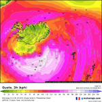
Beautiful "bomb cyclone" down to 931 mb near Iceland.
Very powerful for mid-October.


Rapid intensification well underway across the N Atlantic, with low pressure recently analyzed to 979 mb, and forecast to deepen another 49 mb over the next 24 hours to 930 mb by 14th/12Z. Primary hazards remain: hurricane-force winds to 80 kt, building seas >50 ft #MarineWx


Joint Cyclone Center retweeted

STRONG WINDS and Power Flashes here in the Okaloosa Island, Florida area as Hurricane Isaias closes in!
LSC/Mike Killian

Joint Cyclone Center retweeted

Hurricane Isaias Winds😬 #flwx @ryanhallyall

Joint Cyclone Center retweeted
INTENSE WINDS Okaloosa Island, Florida as Hurricane Isaias gets closer to landfall.
LSC/Freddie Bryant
Joint Cyclone Center retweeted

The wind is getting ludicrous. Inner eyewall is closing in. Destin, Florida 6:20pm @MaxVelocityWX @WxFront #flwx #isaiah
Joint Cyclone Center retweeted

Conditions continue to deteriorate along the coast of the Florida Panhandle, with near-whiteout conditions along Fort Walton Beach! Hurricane Isaias is expected to make landfall in this area within the next 2-3 hours.
@StormChaser_CJ