

Official account for the Illinois State Climatologist Office. Located at the Illinois State Water Survey and Prairie Research Institute
- Tweets2K
- Following1.3K
- Followers1.9K
- Likes2.5K
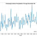






ALT Plot that shows the total precipitation each year through December 4th in Champaign-Urbana, Illinois.

ALT Graphic showing the first day of snowfall of at least 2 inches in Champaign-Urbana over the past 120 years.

ALT Graphs show month-to-date, year-to-date, and water-year-to-date precipitation totals at a CoCoRaHS gauge in Champaign County.

ALT Map of average first fall 32 degree freeze dates across Illinois. The data are from 1991 to 2020.

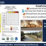
ALT Drought update infographic from the Illinois State Water Survey. The graphic includes the October 7th edition of the US Drought Monitor for Illinois, and links to the CMOR drought impact report system.

ALT Maps of precipitation departures from normal across Illinois. The maps show precipitation deficits for the 2024-25 water year and the 2025 calendar year.

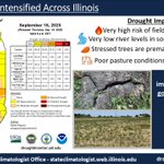
ALT Drought infographic for Illinois, updated on September 18th, 2025. The graphic shows the current US Drought Monitor map for Illinois, and a summary of current impacts.

ALT A map showing the 7 day precipitation forecast across the US from the National Weather Service, current as of September 18th.

ALT Graphic showing updated drought conditions across Illinois for September 11th, including the latest US Drought Monitor map, and the link to the CMOR system for drought impact reporting.

ALT Map of the rank of total precipitation from January through August in 2025, by climate division.


ALT Graphic showing total precipitation between January 1 and August 28 in Champaign, Illinois.

ALT Map of precipitation as a departure from average in April 2025 in southern Illinois.

ALT Map of precipitation as a departure from average in August 2025 in southern Illinois.

ALT Plot of 5-minute rainfall observations from the Illinois Climate Network station in Brownstown, in Fayette County, Illinois. The bars show the 5 minute observations and the black line shows the accumulation of total rainfall for the event.

ALT Plots of soil moisture at 4", 8", and 20" depths at the Illinois Climate Network station in Fayette County. The blue line shows the current soil moisture condition between April and August, and the black line shows the 20-year average soil moisture condition.


ALT A man sweats in the heat


ALT Bar chart reflecting the percentage chances of La Nina, Neutral, and El Nino from July-August-September 2025 through March-April-May 2026. For more information on explicit chances of exceeding Nino 3.4 thresholds please see https://www.cpc.ncep.noaa.gov/products/analysis_monitoring/enso_advisory/strengths/index.php


ALT Raining in downtown Chicago.

