

Geodynamics is a marine survey & research firm, specializing in bathymetry, geophysical surveys, GIS, and benthic habitat & cultural resource mapping.
Morehead City, NC
Joined February 2011
- Tweets38
- Following130
- Followers160
- Likes22
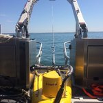
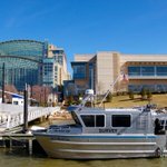





The #bathymetry behind a #surf break, explained through an @esri storymap as a companion to @surfline Rundown Shack geodynamicsgroup.maps.arcgis…
Geodynamics retweeted

Check out NOAA's "living" story map of hydrographic survey plans for this year's field season: go.usa.gov/x9SAd @NOAAcharts

Geodynamics retweeted

Busy day for #USHYDRO. @GeodynamicsNC, Silver Ships Inc. & @RenishawSpatial become our new exhibitors. Sign up at ushydro2017.com

Geodynamics retweeted

So awesome to have coastal geology represented at #NOSB16 career night huge thanks @GeodynamicsNC for participating!

Seafloor mapping to support #renewableenergy offshore in NC, published in #ESRI esri.com/mappingthenation#/d…

Geodynamics retweeted

How do reefs & shipwrecks relate 2 wind energy? @UNCims @BOEM_DOI @GeodynamicsNC @noaaocean oceanservice.noaa.gov/news/f…

Geodynamics retweeted

.NOAA's Dr. Sullivan at #COP21: It's smart and cost effective to advance work on coastal climate resilience.

Geodynamics retweeted

Bight @CapeLookoutNPS sedimentation rates >10cm/yr! See dx.doi.org/10.1016/j.ecss.20… Bathydata from @GeodynamicsNC @UNCims

Geodynamics retweeted
I can see you under there! How scientists use tools to map the seafloor 1.usa.gov/1FC9jdz #ScienceatSea

A great week of vessel demos at #usydro2015, including the Kongsberg 2040c on the RV Benthos, thanks @KOGMaritime!

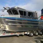
R/V Benthos headed to the #GOM for NOAA surveys...look for her on the road south! #NOAAcharts – at North Carolina, USA

Partnership with East Carolina University for BOEM Coastal Restoration Research wp.me/p4EPay-jM
Geodynamics retweeted

#ECU is partnering w/ @BOEM_DOI, @GeodynamicsNC & others on researching ways to rebuild NC coast after major storms: ow.ly/A2e6R
Geodynamics retweeted

“Our #Oceans Challenge” – Driving Sustainability thru Industry Leadership/Innovation bit.ly/1jiRymO via @GISandScience