




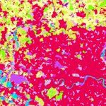

Where will it flood? The National Water Center’s new high-resolution flood prediction maps answer that for nearly the entire US population. Now in ArcGIS Living Atlas. @nwsnwc
🔗: bit.ly/4rFTz6D
What's the most valuable insight you use when evaluating a market?
📍Demographics
🛍️ Consumer spending
🚗 Traffic patterns
🏪 Competitor analysis
Learn how ArcGIS Business Analyst helps turn location data into smarter decisions. bit.ly/4qRvdX7
Ever watched a @John_M_Nelson video and wished you could ask a follow-up question? Now's your chance! 🙌🏽
Join us for a live AMA with Esri cartographer John Nelson on Nov 17.
Comment your questions below.
🔹Register: bit.ly/4hWYJH1

Ever seen a map that makes you want to lace up your boots? 🥾
This shaded-relief map brings one of Alaska's most iconic backcountry routes to life, blending GIS, cartography, and alpine artistry into a stunning visual experience. bit.ly/4ddL0tW
🗺️ Abigail McHenry

Seeking a screen-free, creative activity? 📵
“Color Me Mappy: A Cartographic Coloring Book” invites you to interact with maps in a tactile, hands-on way.
Transform iconic, real-world places into immersive coloring experiences: bit.ly/4p6nX8U

ALT Color Me Mappy book by Molly Green-Hogeweg on a green topographic background with maps of India, Petra, and London nearby.
Want a fast way to get started with GeoAI in ArcGIS? We'll give you 13. These beginner-friendly tutorials will put you on the path to becoming a deep learning model master: bit.ly/4dH1rQo
Already using GeoAI? Drop your favorite model in the comments.


New terrain analysis capabilities are here! ⛰️
With ArcGIS Maps SDKs for Native Apps 300.1, you can now calculate slope and aspect from a raster, making it easier to build apps that analyze and visualize terrain.
🔹Learn more: bit.ly/4jiJytX

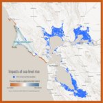
Point Reyes National Seashore is home to one of California's most dynamic coastal ecosystems. Explore how rising seas could reshape rocky intertidal habitats and the species that depend on them in the story map, Rise & Tide. 🌊
🔗: bit.ly/4bVE9ok

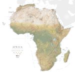
Africa, reimagined. 🌍
From the Congo Basin to the Sahara, this stunning map blends satellite imagery, terrain, and land cover data to reveal the continent in remarkable detail. What feature stands out to you? bit.ly/3V0mJ4d
🗺️Raven Maps & Images, @EVGeospatial

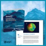
From data to action. 💧🗺️
Discover how hydrologist David Maidment uses GIS to advance water and forecasting in “Geowater: A Geographic Approach to Water Data and Forecasting”. Part of The Power of Where Collection.
🔹Explore the book: bit.ly/4pC0D3i

ALT A 3D image of the book “Geowater: A Geographic Approach to Water Data and Forecasting” appears next to a sample page titled, “The Weight of Water”.
The Mediterranean Sea is home to 17,000 species, but many are under threat. Now, a team of independent scientists is using GIS to shine a light on these endangered species and help shape smarter policies that safeguard the Mediterranean’s sea life.🪸 ow.ly/2xNV50XU6Pp

At this week’s @OSCE event, Jack Dangermond joined policymakers and technology leaders to discuss how GIS brings clarity to complex information, enabling better decisions and stronger co-operative security.

“Here’s where we’re disagreeing. And here’s where we’re not.”
🗺️ @Esri Founder and President Jack Dangermond on why maps can be a common language, and what that could mean for cooperative security.
How has your community changed over the last five years? 🏡
Discover new 2020-2024 American Community Survey (ACS) layers with updated housing, demographic, social and economic insights. bit.ly/4yXCh7J
Featured:
🔸Veteran Status in Tennessee

How do you monitor biodiversity at a national scale? Built on ArcGIS, the National Biodiversity Information System helps governments track species, monitor habitat change, and meet global conservation commitments. Guyana is helping lead this approach: bit.ly/4cxrN6s

What happens when cartography meets creativity? 🗺️
This Arizona map reimagines the state's terrain with a unique tile based design to reveal the state's terrain in a whole new way. A must-see for map lovers and LEGO fans alike! bit.ly/4x3dzRE
🔸Authored by: Atlas Guo

Esri retweeted

🥳The wait is over! The 2026 ArcGIS #StoryMaps Competition is now open.
It's a great opportunity to showcase your work — and demonstrate how GIS can drive meaningful action locally and globally.
Get the details: bit.ly/46SCWtD
Watch your data come to life over time. ⏰
New Map Viewer enhancements make it easier than ever to create dynamic time-based visualizations and uncover trends in your data. bit.ly/4h3tqdk
Want to get more out of ArcGIS Business Analyst?
Make smarter, location-informed decisions for market planning, segmentation, and analysis. Learn essential workflows in both the web app and extension in ArcGIS Pro.
🔸Learn more: bit.ly/4qRvdX7

ALT An image with a 3D version of the book Top 20 Essential Skills for ArcGIS Business Analyst. The title appears in white text to its left, while the background has violet hexagons, borrowing from the book’s cover design.
Satellites 🛰️ collect an enormous amount of information about our planet every day but much of it was locked behind complicated formats. Not anymore. @NASA teamed up with Esri to make that data easy to use. bit.ly/4zOgArQ
