






DILRMP Chandigarh retweeted

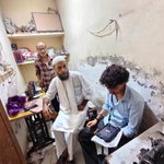
While drones and aircraft provide the "bird's-eye view," true accuracy is built on the ground. Today, the NAKSHA survey team is in Sector 15, Chandigarh, bridging the gap between digital maps and physical boundaries.
@Dilrmp_Chd @nishantyadavIAS @PIB_India @mygovindia @chandigarhadm @dc_chd
#NAKSHA #DoLR #chandigarh #groundtruthing #FieldVisit #LandRecords #dilrmp


DILRMP Chandigarh retweeted

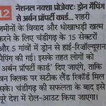
#NAKSHA pilot project- being implemented in Chandigarh for ensuring transparent, citizen-centric & dispute-free digital land records.
@DoLR_MoRD
@chandigarh_admn
@dc_chd

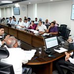
Reviewed progress of the NAKSHA Pilot Project — a major step towards transforming urban land governance through advanced geospatial mapping.
✅ Drone surveys & data collection completed across Sectors 1–17 and 5 villages;
✅Work on data validation & Urban Property Cards in progress.
✅ “One Click. Accurate Land Records. Anywhere. Anytime.” — ensuring transparent, citizen-centric & dispute-free digital land records for #Chandigarh.
👍Remarkable inter-departmental coordination seen.
@chandigarh_admn @CBC_Chandigarh @MCChandigarh @nishantyadavIAS


