

Ask nothing, get nothing, a dove with a dark ending
Joined April 2023
- Tweets282
- Following9
- Followers1.9K
- Likes0
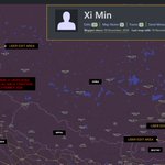





Isn't the Survey of India (SoI) boundary dataset mapped at 1:1M scale? Since the alleged crossing is under 150-m, would it be reasonable to claim a transgression without first accounting for the boundary's source scale, generalisation and positional accuracy?


🇨🇳road has actually crossed over into contested areas near taksing frontier in recent times
With @Kyangs_Thang, stumbled upon this transgression in the "gray zone" to our horror
Significant challenge to contain if repeated elsewhere
More in attached self-explanatory map
1/4

ALT Map of "taksing region" in upper subansiri of Arunachal Pradesh, India. It shows new chinese road crossing ridge and entering area beyond Tibetan claimed land and even reaching conservative flawed SoI border Serious transgression,part of gray zone warfare!
1
2
120
A closer examination of the vessel’s tracking history suggests a likely known AIS data error or possible spoofing
A fishing trawler may be transmitting the same MMSI, causing the AIS platform to incorrectly associate its movements with another vessel’s identity .. nothing else

This quoted post is unavailable.
Donnie retweeted

AI2030 was diverted to VIJP (Jaipur) following reports of a 7500 (hijacking) squawk. However, FR24 playback shows the aircraft squawking 4027 from Omani airspace until landing at VIJP. This suggests the pilot may have reported the situation directly to ATC rather than activating the hijack squawk.

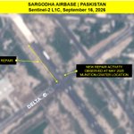
Now new imagery indicates Pakistan is repairing the second crater at Sargodha Airbase. Seems both sections struck in May 2025 are being re-built along with a full runway overhaul


Donnie retweeted

Based on this, high resolution collect from @vantortech confirm repair work at the Brahmos impact crater at PAF base Mushaf, Sargodha 490 days after it was struck.

The locations cited are roughly 180 km northwest of the actual damage site in Gyirong, near the Nepal–China border in Kora La. Whatever one thinks of Beijing, this report offers little to substantiate a meaningful link between these military posts and the damage location.

China has two military bases and a radar station near the Gyirong Port that was flooded by a collapsing glacier. China has heavily militarized this part of Tibet.
Brought to you by our product, PLA Orbat.
tertonintel.com


1
518
Donnie retweeted
If you look closely at the image shared, you can see the plane is fitted with pods on its wings, just like the Iranian Air Force RC-130H Khofash, these are likely for its EW role.


Exclusive: Beyond the CBS report on Pak shielding Iran's military aircraft, the first high-res satellite image showing an Iranian C-130 at Nur Khan base. It has a typical desert camouflage. Pak's own C-130s, also seen here are grey.📸:@vantortech
ndtv.com/world-news/exclusiv…

1/ It’s genuinely impressive how the noisiest people discussing satellite imagery seem to have absolutely zero background in GEOINT, remote sensing, or commercial tasking workflows & yet they manage to write entire essays packed with nonsense


The ISPR documentary itself says S-400 "reportedly" neutralized - implying the claim is not independently verified and is based on initial or secondhand reports rather than confirmed evidence !

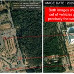
From misinterpreted images showing "hits" to rubbish claims of taking out an S-400 unit, Pak's info warfare dept is on overdrive - as the 1st anniversary arrives.
For the real S-400 story, read my book, 'The Sky Warriors: Op Sindoor Unveiled' available on Amazon: bit.ly/TheSkyWarriors
