Pinned Tweet
Thread :
1.
Belligerent China's incredible 'Infrastructure Drive' with hegemonic ambitions put India in a vulnerable position along her Northeast Frontier with Tibet.
3 New Villages popped up near the LAC bordering Shi Yomi and Upper Subansiri Districts in the last few months.
🇨🇳road has actually crossed over into contested areas near taksing frontier in recent times
With @Kyangs_Thang, stumbled upon this transgression in the "gray zone" to our horror
Significant challenge to contain if repeated elsewhere
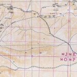
More in attached self-explanatory map
1/4
Near Taksing,
MacMahon Line, SoI border, US/Google/OSM interpretation of SoI border, LAC, Patrolling limits, 🇮🇳 & 🇨🇳 claim lines, traditional customary boundaries, historical religious kora routes and tribal land areas differ, and recent events might add more lines to it!
3/4
Duality of Google Maps in & out of 🇮🇳
For strategic context &conflicting map alignments refer
1. xitter.cf/NatureDesai/status/207…
Infrastructure dictates leverage in the Eastern Himalayas as the race to frontier grabs headlines & civilizational states race to gain geostrategic advantage
Nature Desai retweeted
1) 🧵 Recently, there have been tense standoffs between protestors & the security forces due to the proposed construction of the Siang Upper Multipurpose Project (SUMP). This has also led to intense arguments online.
Proponents for the dam claim concerns due to the Medog 60 GW hydro project being built by China upstream in the Yarlung Tsangpo gorge in Tibet.
Opposition, mainly local-led by the Adi people of the Siang claim immense loss of culture & livelihood that the SUMP project might bring to their heartland.
Thread:
Debate on the NE Frontier (Upper Subansiri) misses both geography & cartography
The McMahon Line follows the watershed, but tribal ties & religious accommodation in subansiri frontier led to poor & incorrect maps. So, SoI's IB, US LSIB & OSM lines diverge significantly
Where 🇮🇳 and 🇨🇳 claims overlap, "Areas of Differing Perception" exist - acting on the ground as active cross-patrolling zones.
Terminology matters: patrols entering these zones are 'transgressions' NOT 'incursions'
Conflating the two only breeds domestic panic & IW loss
3/4
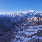
While 🇨🇳&🇮🇳 foreign ministries argue over standard names, check out Shaksgam valley as clicked by 🇨🇳 tourists from above Urdok glacier
The Shaksgam Road via Aghil pass is seen here! While we argue - the untouched valley has now become a playground for 🇨🇳 adventure seekers.
1/3
Remember Aghil Pass? The frontier on official Indian Maps, a view from there as clicked by Chinese adventure seekers while they enjoy the raw untouched beauty of Shaksgam valley, officially 🇮🇳 - gifted by 🇵🇰 to the 🇨🇳 in 1963.
2/3
xitter.cf/NatureDesai/status/178…
#Exclusive
Thread:
In a significant development, 🇨🇳 road has breached the border at Aghil Pass (4805 m) and entered the lower Shaksgam valley of Kashmir, 🇮🇳 with the road-head now less than 30 miles from 🇮🇳 Siachen
This permanently answers the question of Shaksgam for 🇮🇳
1/4
Nature Desai retweeted
2) Does that mean, India is/should be lax? Not at all.
Many of these incidences that one hears post 2020, are now due to better infrastructure developments on both sides. Both militaries are now patrolling areas that once used to be empty, more frequently.
China has also built multiple settlement townships (xiaokang 小康) in order to consolidate claims - which have, for now, been on Chinese-controlled territory since 1959 at least.
There are, as of yet, no permanent PLA posts or infrastructure on Indian-controlled areas. Hence, it's prudent for reports to clearly state so, lest it lead to mass hysteria.
Update:
My take on recent news on PLA setting up camps inside Indian territory!
There is a large area of differing perception in the upper sunbansiri frontier.
IA's perception of Border, IA LAC, PLA's perception of Border, SOI Border, Tribe's perception of border etc...
1/3
The Nah-Tagin have historically ventured across the frontier to meet their fellow tribesman in now occupied Tibet.
After 2020, the cross-border movement has been restricted by 🇮🇳&🇨🇳.
The new developments happening are completely in areas under 🇨🇳 occupation since decades.
2/3
For reference:
1. My article in Times of India timesofindia.indiatimes.com/…
2. Arunachal Observer article
arunachalobserver.org/2026/0…
Drone video of Potrang Yumtso by a 🇨🇳 Netizen. The ridgeline is the frontier and the lake lies in Tibet but 🇮🇳 villagers do go there on pilgrimage
3/3
New Find:
Long Read:
When 🇮🇳 was pounding on 🇵🇰 during Op Sindoor, 🇨🇳 quietly built a road in Pak border areas as per Sino-Pak Agreement, 1963.
🇨🇳 road bifurcates from G214, crosses Oprang pass to enter Oprang valley, merging with illegal Shaksgam valley road, while 🇵🇰 sleeps.
Timelapse showing 🇨🇳 building a bridge on Shaksgam River & entering Oprang valley in May 2025
Important to note that now 🇨🇳 has connected Khunjerab Pass (🇵🇰) with Karakoram Pass (🇮🇳), via Shaksgam Valley directly
Now, it remains to be seen, how 🇮🇳🇵🇰🇨🇳 play the great game
3/4