

Data-driven visuals and statistics focused on economics, health or human resources. Tools in posts, all visuals are original. 📊🗺️📸
France
Joined July 2023
- Tweets2.5K
- Following43
- Followers7.7K
- Likes1.7K



Pinned Tweet
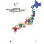
☔️ Series: Rainfall (No. 6) - Japan
Japan's rainy season, tsuyu, brings heavy rainfall from June to mid-July.
🔧 Tools: Python (Rasterio, Rioxarray, Geopandas)

🐔 Series: Chicken Density (No. 3) - Indonesia
Indonesia has a massive chicken population, supporting its huge poultry industry.
🔧 Tools: Python (Rasterio, Geopandas, Shapely)

🚗 Series: Roads (No. 6) - India
India's 6.3 million km road network, the world's second largest, connects cities and villages, driving economic growth.
🔧 Tools: Python (Pandas, Geopandas, Matplotlib)




🗺️ Series: UNESCO World Heritage Sites (No. 4) - North America
North America hosts UNESCO World Heritage Sites like Yellowstone and Chichen Itza, valued for their natural and cultural significance.
🔧 Tools: Python (Geopandas, Shapely, Contextily)

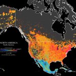
👨🌾 Series: HDI (No. 6) - North America
The Human Development Index assesses development via health, education, and living standards. The dataset contains anomalies. Values are estimates.
🔧 Tools: Python (Rasterio, Rioxarray, Shapely)


☔️ Series: Rainfall (No. 5) - Africa
Africa's precipitation varies widely, with tropical regions like Central Africa receiving heavy rainfall, while vast deserts like the Sahara experience minimal precipitation.
🔧 Tools: Python (Rasterio, Rioxarray, Geopandas)


🗺️ Series: UNESCO World Heritage Sites (No. 3) - D.R. Congo
The D.R. Congo is home to five UNESCO World Heritage Sites, including Virunga National Park, known for its diverse ecosystems and endangered mountain gorillas.
🔧 Tools: Python (Geopandas, Shapely, Contextily)


👨🌾 Series: HDI (No. 5) - Brazil
The Human Development Index assesses development via health, education, and living standards. The dataset contains anomalies. Values are estimates.
🔧 Tools: Python (Rasterio, Rioxarray, Shapely)


Yes Data retweeted
Holy cow! South Asia’s cattle density really is highest in India. HT @yesdata_ (give them a follow)

Yes Data retweeted
Wonderfully detailed map shows the Human Development Index across Europe. Concentration of development in Central Europe generally and within the big cities within each individual country.
HT @yesdata_
