

Senior Weather Forecaster Weathering Heights Consulting, Radio Vermont with 40+ years in Meteorology, Climate worry wart, weather with moral distinction. Vet.
Worcester Vermont
Joined July 2021
- Tweets1.6K
- Following66
- Followers329
- Likes193


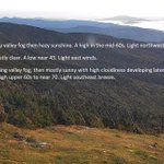



Morning #Stratus cloud lifting off valley floors. Not much smoke indicated as it's still pretty thin. #Fog, pretty dense in spots still. This looks north across the #Worcesters toward #Elmore.
Orange tint to the sun was likely this morning due to the arrival of some Canadian wildfire smoke from western prairies/Boreal forest region. Thickest late this morning per modeling. #Vermont

#Canadian #wildfireSmoke creeps south across Vermont this morning, making it a little hazier, but not yet as viewed from the the top of the #GreenMountains #sugarbush. Considerable #ValleyFog which is frequent with clear night skies thanks to the #AntiCyclone in control.


Low level moisture interacts with terrain as we peek toward the #Worcesters on this rather beautiful mid to late September morning. There were some minor hints of early fall color, best is yet to come over the next 3 weeks 4 weeks. A good drying out was in order. #Vermont
Mountain wave conditions though weak, interact with decreasing moisture but enough to see some lenticulars and even the more turbulent rotor clouds beneath. Excellent string of weather ahead. Decent amounts of sunshine daily. #Vermont
High pressure builds into the Northeast U.S. and adjacent Canada for a strong of exceptional early Autumn weather. #GreenMountainState. Next chance for showers maybe Sunday late.

Low level #moisture will get squeezed out in the form of mainly light #showers by the higher terrain today. It's will be blustery with occasional showers valleys more persistent near the mountains. #GreenMountains

Eastern New York will be the demarcation line where just cloudy weather separates rainy/foggy conditions further east across the #GreenMountainState. The #soaker shifts northeast with low pressure tracking into the Maritimes of Canada late Tuesday then fair weather high pressure.

Western fringes of "Lee" remnants now falling a part into Altocumulus standing lenticulars. Mountain wave clouds at mid levels. They "stand" even though the moisture moves through them and exits and disappears out of the "lennies" #hurricane induced #MountainWaves #Vermont
Gusty northwest winds ramp up some this afternoon with Lee's closest approach into extreme western Nova Scotia into the Bay of Fundy and adjacent New Brunswick for a second land fall. #Lee has lost tropical characteristics and was a hybrid wet Nor'easter.

Out venting of high level moisture shown to our east gradually will creep westward and overtake all of Vermont today. Impacts from #Lee include some #GustyWinds, but generally below threshold to cause impactful weather. Great weather overall for #TunbridgeWorldFair! #Vermont

High cirriform clouds shown are the leading edge of current Cat. 1 Lee churning north on a track that will take into the mouth of the Bay of Fundy later Saturday. Some breezy conditions will amp up over time maxing tomorrow afternoon. Showers confined to Essex county. #Vermont

#Showery weather today should end late to some partial clearing working in west to east with a weak #ColdFrontalPassage. Gorgeous high pressure to be the rule Thursday into Friday, but the cirrus shield associated with "#Lee" will push in later Friday afternoon. #Vermont


Heat not as bad but humidity keeps up today with more muggy nights ahead. Eventually we return to seasonal early September conditions - which can be pretty nice. However there will be rain in the forecast daily going into next week. Northern #Vermont may see dry weather Saturday

24 hour rainfall shows where the heavier thunderstorms occurred. 1.70 inches feel in Arlington, but numerous reports of greater than 1" amounts in the #ChamplainValley #Vermont. Excellent lightning shows post sunset across the #GreenMountainState.
