

Meteorologist, AMS Certified, Emmy awards for coverage of Hurricane Sandy & Irene, Undergrad degree from GT, Graduate degree from MS State.
Tampa, FL
Joined May 2013
- Tweets17.7K
- Following686
- Followers6.1K
- Likes17.1K




Tampa Bay Rays are World Series bound! ⚾️🎉
Game 1 of the World Series is scheduled for Friday against the Milwaukee Brewers. If the series goes the full distance, Game 7 will be played on Halloween.
🤖 Made with AI


Potential long track tornado developed east of Statesboro, GA.. tracked 35+ miles into South Carolina.
It's currently on the ground near Allendale, SC.
The NWS will survey and see if it stayed on the ground this entire time.

(UPDATE FRI 11PM) SOME GOOD NEWS: The storm surge in the FL Panhandle is rapidly dropping. Panama City Beach reached a peak surge of about 5.5 feet.
SURPRISING: Florida’s Big Bend region is currently experiencing the state’s highest storm surge.
Why? Two key factors: the region’s shallow continental shelf and its concave coastline, which helps funnel and pile up water as winds push it ashore.

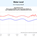
Mobile Bay has a negative storm surge of about 2 feet due to offshore winds.
Had #Isaias made landfall a bit farther west, Mobile would have experienced up to NINE feet of surge.

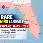
Hurricane Isaias is only the SEVENTH category 2+ hurricane to make landfall in Florida during an El Niño year.
El Niño typically suppresses hurricane activity by increasing vertical wind shear, something we've seen throughout much of this season.
The other six FL landfalling (El Nino) hurricanes:
🌀Idalia (2023), Michael (2018), Jeanne, Frances, and Charley (2004), Gladys (1968). Interestingly, SIX of these seven hurricanes have occurred since 2004!
QUESTIONS WORTH EXPLORING:
🌐Warmer oceans: Could rising sea surface temperatures be helping hurricanes intensify despite unfavorable wind shear?
🌐Gulf: Does the Gulf's geography and exceptionally warm waters make Florida more vulnerable to major hurricane landfalls during El Niño?
🌐Changing patterns: Is the apparent increase in these landfalls since 2004 simply statistical variability, or could it reflect a changing climate?


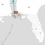
ISAIAS made landfall as a CAT 2 with sustained winds of 105 mph at 8:30CDT. The estimated minimum central pressure is 971 mb (28.67 inches). The graphic shows wind gusts over the past hour.
There is extensive damage in the western FL Panhandle. Numerous homes/businesses have roof damage, hundreds of thousands without power, thousands of downed trees.

TAMPA BAY, nearly 300 miles from Hurricane Isaias, is experiencing the SAME 2-foot storm surge as Pensacola, just 40 miles away!
Everyone living in a hurricane prone area should understand this concept: Hurricane winds rotate counterclockwise. Areas to the right of the storm's track experience onshore winds & storm surge, while areas to the left experience offshore winds and negative surge.
This is why the precise location of a hurricane’s landfall is so critical. Even a slight shift in its track can dramatically change storm surge impacts. Wind direction matters!

(FRI 8PM) CURRENT STORM SURGE: The center of Isaias is moving onshore near between Destin & Santa Rosa Beach. The NHC (8pm EDT) update had max winds of 110mph.
BOTTOM LINE:
▶️ PCB has a surge of 4.2ft & is rapidly rising.
▶️ Miramar Bch & Seaside likely have surges between 5-6 feet (extrapolated)
▶️ Mobile Bay has a negative surge
▶️ Penasacola only has a 2ft surge, the same as Clearwater (hundreds of miles away)
METEOROLOGY:
▶️ Hurricanes rotate counterclockwise. When you're in the right quadrant of the storm you receive onshore winds and surge. Left of the eye & you have offshore winds/surge. This is why Mobile is experiencing a negative surge and Miramar Beach has a current surge near 6 feet. Also why the Tampa Bay Area has a surge identical to Pensacola.

I'm noticing an interesting shift in hurricane forecasting. The National Hurricane Center is increasingly leaning on Google DeepMind's AI forecasts alongside its traditionally trusted consensus models. Private-sector AI is becoming a serious player in operational hurricane forecasting.
From this evening's NHC discussion: "The NHC forecast continues to lean more heavily on the better-performing corrected consensus (HCCA) and Google DeepMind (GDMI) aids"
(WED EVE UPDATE) Isaias is going to undergo rapid intensification over the next 24 hours. Going from a TS to a Cat 2 hurricane by Thursday evening.
➡️ WIND: Isaias’s winds will increase to 105-115 mph by late Thursday or early Friday. The storm will top off as a strong Cat 2 or low end Cat 3. Isaias will lose a bit of intensity as it approaches land due to increasingly hostile conditions. The storm at landfall will likely be a strong Cat 1 or low end Cat 2.
➡️ LANDFALL: The storm's center will mostly likely make landfall near Pensacola, FL. Though, Biloxi to Panama City are still very much in play for direct landfalls.
➡️ TIMING: Isaias will make landfall late Friday & early Saturday.
➡️ STORM SURGE: 5-7 feet for Mobile Bay to Panama City, 4-6 feet in the Big Bend, 1-3 feet for St Pete Beach & north up to Crystal River.
➡️ RAIN: The storm will be very lopsided with the majority of the rain east of the center. 5-8" of rain for the FL Panhandle
BOTTOM LINE: The storm will rapidly intensify Wed night and Thursday. The Cat 2/3 storm will move north and make landfall near Pensacola. Intensity at landfall will likely be Cat 1/2. Heavy rain, gusty winds, & moderate surge flooding in the coastal FL Panhandle will be defining elements of this storm.

HIGH CHANCE THAT WE'LL HAVE THE FIRST HURRICANE OF THE 2026 ATLANTIC SEASON THIS WEEK. Here's the when, where, & what.
🌀WHEN: Landfall Saturday
🌀WHERE IS TD9 (FUTURE ISAIAS) GOING? Current models are focusing on the area between Destin & New Orleans.
🌀HOW STRONG WILL IT BE? Large range in modeling, with forecast max winds anywhere from 50 mph to 120 mph.
🌀MY FORECAST: Going out on a limb, I think the most likely track will be toward the FL Panhandle with winds between 90-100 mph. It'll be a lopsided system with the largest rain totals east of the center. Still a lot of variables to straighten out. Stay tuned!

We will have TROPICAL STORM ISAIAS in the Gulf by Thursday. Many folks will jack up the pronunciation of this storm.
Isaias is the Spanish/Portuguese form of the biblical name Isaiah, with origins in the Hebrew name Yeshayahu. The name means roughly “God is salvation” and refers to the biblical prophet Isaiah. It's pronounced "Ee-sah-eh-us".

WE COULD HAVE A HURRICANE IN THE GULF BY FRIDAY.
BOTTOM LINE: A tropical disturbance is developing in the SW Gulf (Bay of Campeche). The track/speed of this storm will determine whether we have a lopsided tropical storm or a stronger & more symmetrical hurricane.
🌀SCENARIO A: If 92L moves slightly faster & stays north of the Yucatan Peninsula, then the storm will be able to avoid incoming dry air & hostile conditions. It will also allow strong upper level divergence to counterbalance exiting 100 mph wind shear. This means a land-falling hurricane with winds potentially between 75 & 120 mph is feasible the N/NE Gulf Coast.
🌀SCENARIO B: If 92L moves a little slower & approaches the Yucatan, that will allow time for dry air air to wrap into the center of the storm. It will also means that 92L will feel the hostile effects of El Nino's persistent wind shear, but limited divergence. The result will be a lopsided tropical storm with rain mainly east of the center of the storm.
➡️WHAT DO I EXPECT: 92L is currently in nearly ideal conditions (low wind shear, SST in upper 80s) for development. I think we will have a legitimate tropical storm or even a low-end hurricane by Thursday evening. Then the position of the storm (Location A or B on Thursday will determine whether it moves NNE as a hurricane or tropical storm.)
➡️NAME OF THE NEXT STORM: Isaias (ees-ah-ee-ahs). The media is 100% going to jack up pronunciation of the this storm. It is a Spanish name "Isaias".
STAY TUNED

