

this account is dedicated to building, nothing else
Joined September 2024
- Tweets104
- Following45
- Followers126
- Likes67


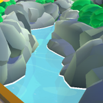


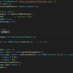
Been really busy with everything, but still managed to keep building 🐟
-Researchers now have access to Drone's real 3D location 🔄
-Environmental data integrated to each position long/lat data
-Will add a red line for the path of the marine drone
#threejs #r3f #threejsJourney
1
167
This research project is situated in a real precise location
The point in the end is to synchronize this app to an API delivering in real-time data (every 10 minutes) from a Satellite.
Researchers will be able to use it to monitor their drone 😇
130
Overview of my Sailing Simulation App :
-(lat, lon) 🌏 coordinates => carthesian coordinates 🧮
-Timestamps selectable through a nice UI via a range slider, with data from my JSON
-Coast successfully chunked and 4 levels of LODs applied🏞️
#threejs #r3f #threejsJourney

Ladies and gentleman, after weeks of research I'm proud to announce that I managed to put my whole Philip's Island coast on a R3F app
The terrain is divided into chunks and has different LODs
#threejs #r3f #threejsJourney

1
16
844
Drei's team is always there with the best tools I stg, they even provide a "Detailed" component where you can switch between your LODs based on the distance
drei.docs.pmnd.rs/performanc…
1
53
The answer was so easy; I just lost so much time using 3DTilesRendererJS to tile my Terrain.
The easiest way of doing was just doing it myself; tiling and making different LODs instead of trying to get a tool do it for you
I get decent Framerate on top of that 👌


1
1
94
Ladies and gentleman, after weeks of research I'm proud to announce that I managed to put my whole Philip's Island coast on a R3F app
The terrain is divided into chunks and has different LODs
#threejs #r3f #threejsJourney
The grid Shader used in my app is by far one of the best out there, supports anti-aliasing and handles well Moiré patterns in the distance. Check it out :
bgolus.medium.com/the-best-d…
2
194
My app is now able to convert coordinates (latitude, longitude) to coordinates in Three js 🌐
Added also a Pristine Grid to visualize the distances ⏹️
#threejs #r3f #threejsJourney
Spent a whole day on this shit and i don't even know why.
At the end I got something, but I had to place an OrthoCamera under the plane. This is too heavy.
The foam is basically useless, I shouldn't have even bothered
1
65
Now I need to add a foam effect around immerged bodies, just like here for example. I hope it'll turn out well 🫡

72
tiasma retweeted

Submitted Island Hopper for #threejsJourney challenge #17. A 3D map experience with 6 unique islands, each with a character guide sharing interesting facts, and interactions. Learned a lot building it! So many cool islands made by this creative community threejs-journey.com/challeng…


The biggest challenge here when using 3DTilesRenderer is getting the 3D tiles out of a DEM (Digital Elevation Model).
I didn't think itwould be that hard
More info in the upcoming days
1
1
146
The issue with this approach is that everything is loaded right away.
Recently I discovered this guy : xitter.cf/garrettkjohnson/status…
And I found out about 3DTilesRendererJS, a Three.js renderer implementation for the 3D Tiles format.

1
2
202

tiasma retweeted

I forgot to post #threejsJourney highlights for a month and look at everything I missed!
👉 threejs-journey.com/highligh…
With @andrewwoan @tiasmawip @Mister_Prada @tymek_dev @AckermiamLeVrai @Reyfenberg @XAFODIAN @tymek_dev @nhtoby311 @th_ebenezer @n_code99 @BlueBoxDesignCH @SkrLeen @mattvb91 @ronisuo1 @thesang_motion @AmshenShanu @EmilieGauvin_ @0xJatinChopra @arleq1n @n_code99 @chrismaldona2 @Alex_ADEdge @kyoko_NR_nr @codingnuclei

