







Pinned Tweet
Lots of snowy scenes around the region now, a very cold walk over Hadleigh downs upto the cycle track. #uksnow


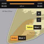
Further wet and windy weather tomorrow. Amber Warnings tomorrow and Sunday across Scotland and northern England. Locally further gusts of 40-45mph and rain for much of the day after a dry start. Remaining windy but dry with sunny spells Sunday.


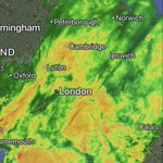
Rainfall wrap around nicely shows storm Austen. Strongest winds are on the southern flank but winds of 50-55mph quite today. Winds will ease for a time for many this morning away from the south coast with the stronger winds this afternoon and evening central & northern areas.

A broader warning now issued to cover much of the region for Friday. Although gusts will be not as strong as further South and Southwest, as mentioned below many trees are still in leaf so could still cause damage.


Warnings in place for what is now storm Austen. Likely further warnings will be issued, updated in the next day or two. With many trees still in leaf could be some damaging gusts quite widely in the South and Southwest Friday.


To far off for any certainty but worth keeping an eye on the forecast for Friday. Potentially the first named storm of the autumn if this low is being modelled correctly in the south with some heavy rain and potentially damaging winds.


After what was an extended period of warmer days in the first half of October a much more autumnal feel recent days. 8-10°c under some heavy showery rain in the east and southeast nudging westwards. An unsettled week ahead with spells of rain. Wettest week for some time to come.


We needed the rain but what a miserable day. 16mm of rain so far, currently 15.8°c, will be the first sub 20°c day since the 15th of June.

Showery rain this evening and overnight, some heavier rain into the east and more so Norfolk later tonight. Been an active thunderstorm in Cambridge this evening.


Some much needed rainfall here this morning with 10mm on the dot. Could see a few isolated thundery showers this afternoon. Then the risk of a more organised area of thundery rain but currently looks to confined to SE / eastern coasts but will see how that develops later.


Back to tomorrow morning and can see the rain appearing on the radar over France, not the stuff in the channel that’s expected to fizzle out.

Latest UKV brings another area of thundery tomorrow evening that had previously been modelled further SE. Shows rainfall totals of upto 70mm in western parts of the region by the end of tomorrow 😳


Met office have issued a warning for the below mentioned risk early tomorrow!


No thunderstorms in the end today, mentioned it was a low risk. I would say there is a higher risk tomorrow morning at least in terms of heavy rainfall for much of southern and central parts of the region. Where the warning is only for some western parts of the region.


Latest radar with some heavy bursts across Southend across towards Rayleigh. Had 2.2mm of rain here early this morning. Nothing thundery yet.

