

OA journal for all aspects of subterranean ecosystems. Focusing on biology, ecology,evolution &conservation. Published by @Pensoft on behalf of @SubterraneanBio
- Tweets668
- Following32
- Followers668
- Likes221

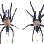






ALT Comparison image showing photos of a female (left) and male (right) tarantula viewed from above on a white background.

ALT Composite image showing a schematic and photographs of soil sampling installations.


ALT A reddish-brown centipede with a glossy body and long antennae, photographed on a rough, pale rock surface.


ALT A map of the Apulia region in southern Italy showing six distinct hydrogeological units, each represented by a different color. The units are labeled as follows: Brindisi Plain (light green), Gargano (blue), Ionian Arch of Taranto (pale green), Murgia (turquoise), Salento (mint green), and Tavoliere (dark teal). A small inset map of Italy in the upper right corner highlights the location of Apulia in black. A compass rose and a scale bar indicating 100 km are located in the bottom left corner. The map includes latitude and longitude lines for geographic reference.


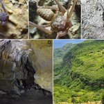
ALT A collage of five images labeled A–E. Image A: A close-up view of a pale whip spider on a rocky cave surface. Image B: A detailed close-up of a whip spider. Image C: A darker-colored whip spider resting on a stone wall in a more exposed environment. Image D: Interior of a rocky cave showing stalactites, dark shadows, and uneven rock formations. Image E: A lush, green mountainous landscape with steep slopes and visible rock layers, likely representing the external environment above the cave system.

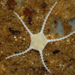
ALT Close-up photo of a small, pale brittle star on a sandy and organic substrate. The brittle star has a pentagonal central disc with five long, slender, and spiny arms extending outward in a star-like pattern. The body and arms are semi-translucent and lightly colored, contrasting against the brown, grainy background.

ALT A composite of five close-up images (labeled A to E) showing ventral and dorsal views of a small isopod.


