

Tracking severe weather in the UK. I will also post about other countries weather occasionally. Storms this year: 3 I will be an astronaut when I'm older 🔭
mars
Joined April 2024
- Tweets1.4K
- Following48
- Followers798
- Likes14.2K




More and more models are agreeing on a more southerly track of Austen, however the situation is still highly dynamic due to explosive cyclogenisis interacting with the left exit region with the jet stream and slight discrepancy on how strong this interaction will be.
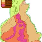
Wind gust update: As models are in a bit more agreement about the track of #stormaustin, the risk areas have been updated to include the whole of the south west under red gusts. Western, exposed and coastal areas will experience the strongest winds possibly in excess of 80mph.


Uk Storm Dude retweeted

I need 5 more lovely Weather freindly guys/gals to hit 1k
Should break through at sometime today...
Thank you for following my small but Passionate about Weather account.


My official outlook for storm Austin. A deep low pressure is set to track through the english channel on Friday. Various hazards accompany Austin: strong winds and heavy rain, potentially leading to disruption. Greatest impacts will be felt in Western, exposed and coastal areas.

ALT #ukwx #stormaustin #ukweather
Met office have just named the first storm of the year, Austin. Yellow warning are currently in place for south West England, though I expect them to be expanded and potentially upgraded. Full outlook this evening.
BBC News - Frinton waterspout may be behind wind damage, says tornado group - BBC News
bbc.co.uk/news/articles/cq1j…

I would like to bring to people's attention the possibility of 90mph+ gusts impacting the south coast. Luckily this ECMWF has the low pressure center diving 100mi south of where it was on the 00z. This post isn't to scare people but more bring to your attention.

There is a very real potential that this Friday, the uk will see its first named storm of the season. Current models have the centre tracking along the south coast at 976mb with greatest wind impacts across the south, especially coastal, western and hilly areas.
Much of the uk has woken up to a much fresher start this morning with many places struggling into the mid teens. A NW wind is also contributing to this fridged feel. It's possible that some places see their first frost of the autumn tonight, especially those at higher elevation.
Anyone fancy an extratropical cyclone in Iceland? The remnants of hurricane Isaias have undergone significant cyclogenisis over the last 24 hours dropping over 30hPa. Really cool.


Aurora will likely be visible across the whole of england tonight, however, heavy cloud cover will mean that viewing opportunities and few and far between.

Here is how to take a photo of the aurora. Obviously dont go right next to a bright room like i have done.
Its really going now! Look at this aurora! Spread the message far and wide because people need to see this.


