
Fulfilling your right to know since 1994.
Cincinnati, OH/Sacramento, CA
Joined October 2007
- Tweets30K
- Following3.2K
- Followers2.5K
- Likes896






scannerboy02 retweeted

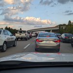
All lanes of I-70 westbound near Centerville Road (mile marker 146) are closed due to flooding in Wayne County.
Traffic is being diverted onto U.S. 27. Please take the detour of U.S. 27, U.S. 36, S.R. 9, back onto I-70. Learn more: bit.ly/3Uu6FHw


scannerboy02 retweeted
The MCS that moved from E IA to northern IN today has been preliminarily confirmed as a derecho.
Based on the preliminary info thus far it began around 12Z this morning and continued to at least 1725 UTC.
The max measured gust received thus far was 86 kts (99 mph) in Gary, IN

scannerboy02 retweeted

A MODERATE risk is in effect in our Day 1 Excessive Rainfall Outlook. More details: wpc.ncep.noaa.gov/qpf/excess…

scannerboy02 retweeted

ILN issues Damage Survey PNS (Max: EF1) at Mar 27, 7:49 PM EDT ...NWS Damage Survey for March 26, 2026 Tornado Event... mesonet.agron.iastate.edu/p.…

scannerboy02 retweeted
After conducting a storm survey, we have determined that an EF1 tornado occurred near the city of Kenton in Hardin County, OH. More details on the survey results here: mesonet.agron.iastate.edu/wx…
scannerboy02 retweeted
🧵SPC will be introducing new information in Convective Outlooks starting in early March. The following thread will offer some basic information regarding these changes. The TL;DR: outlook categories are not changing! But there will be more info for peak hazard intensity.

scannerboy02 retweeted

Pilot Peak Lookout Tower in El Dorado Co is open for the season! Thanks to more than 25 dedicated volunteers, the tower is staffed daily until 8 pm. These trained volunteers scan the horizon for smoke—providing early detection/information that helps firefighters respond quickly.

ALT Photo of a volunteer looking out from the Pilot Peak Lookout Tower in El Dorado County.

ALT Photo of two volunteers at the Pilot Peak Lookout Tower in El Dorado County.

ALT Photo of equipment used at the Pilot Peak Lookout Tower in El Dorado County.

ALT View from the Pilot Peak Lookout Tower in El Dorado County.
scannerboy02 retweeted

This year, we are celebrating 50 years of our Geostationary Operational Environmental Satellite program, known as GOES. 🛰️ GOES are our sentinels in the sky: keeping constant watch for severe weather and environmental hazards on Earth and dangerous space weather. #50YearsofGOES
scannerboy02 retweeted

NTSB investigating the Dec. 30 crash of a Cessna C-310D airplane near Peebles, Ohio.

scannerboy02 retweeted

Due to a crash that occurred just before 9:00 pm this evening on I-65 NB near the 46 mile marker in Jackson County, traffic is still being diverted onto US 31 at the Uniontown Exit (41 mm) while crews work to clear multiple engines that were spilled from a trailer on the roadway.


scannerboy02 retweeted

EMERGENCY CLOSURE OF SHURZ RD until further notice. See details here: bceo.org/.../11/emergency-cl… #WayneTownship

scannerboy02 retweeted

November 17 - 23 is Winter Safety Awareness Week❄️. Cold temps & a chance of snow are also expected this Thursday. Now is the time to get prepared! Take some time this week to winterize your vehicle & update your car emergency kit with cold weather safety essentials. #BeReady

scannerboy02 retweeted
NOAA/NWS Storm Prediction Center tornado stats have been updated through July 2024. Very active, ranking behind only the prolific years of 2008 and 2011 through the month of July.

scannerboy02 retweeted
#ILN issues Record Event Report (RER) at Nov 5, 12:25 PM EDT ...RECORD HIGH TEMPERATURE SET AT COLUMBUS OH... mesonet.agron.iastate.edu/p.…

scannerboy02 retweeted

.@NOAA: June 2024 was Earth's warmest June on record and the world's 13th consecutive month of record-warm temperatures. This ties May 2015-May 2016 for the longest record-warm global temperature streak in the modern record. bit.ly/3Lmuolm #StateOfClimate #Climate

scannerboy02 retweeted

HAPPENING NOW: Watch the #NTSB board meeting on the February 2023 East Palestine, OH train derailment and subsequent hazardous material release & fires. youtube.com/watch?v=Itra5ny_…

scannerboy02 retweeted
#ILN issues Public Information Statement (PNS) at Jun 6, 10:37 AM EDT ...BRIEF TORNADO CONFIRMED IN NORTHEAST DELAWARE COUNTY... mesonet.agron.iastate.edu/p.…
scannerboy02 retweeted

What a difference a few weeks makes. We recently pulled these images for @CAL_FIRE that show a dramatic shift from early April's lush green to late May's dry yellow grasses on the Bealville 1 camera east of Bakersfield. See the view live: bit.ly/454AMqc


scannerboy02 retweeted


Busy day for @CincySkywarn at @nws has asked us to reactivate the net for the next batch of severe weather conditions that could affect the #cincywx area shortly. We'll be on 146.88- about 2315. Ham radio operators are asked to report observed severe weather through the net.