

Sr. Technician Indian Railways, Simple & Honest. Weather Enthusiast, Not an Expert, My tweets are exhibition of my interest alone. Just Impressions
Chennai Tamilnadu India
Joined April 2010
- Tweets1.9K
- Following285
- Followers684
- Likes49.4K


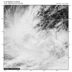

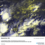
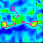


A Mesoscale Vortice within the spectrum of #CycloneAkvan. DC:Dapiya & Geokompsat


I am trying to emphasize that two energies in action where we are focused on primary convection where the strategic Circulation staying well south of it. Mesoscale systems.
1
23
782
I am trying to emphasize that two energies in action where we are focused on primary convection where the strategic Circulation staying well south of it. Mesoscale systems.

MJO not prominent over NIO basin so that #CycloneAkvan caught into the grip of Downstream Mid latitude Westerly trough. Expecting some twists in next 24-48hrs🫠. DC:CIMSS

santhakumardevarajan retweeted

Welcome to the MasRainman Live Cyclone & Atmospheric Lab. Track active tropical cyclones and invests across the Bay of Bengal and global basins in real time—featuring live CIMSS satellite intensity estimates (ADT, AiDT-V2, SATCON), cloud-top IR imagery, and interactive ECMWF IFS steering, vertical wind shear, and upper-level ridge maps with meteorological wind barbs. Use the basin buttons and forecast slider below to see how steering currents and wind shear are shaping the system's path and strength over the next 48 hours. masrainman.blogspot.com/p/cu…
santhakumardevarajan retweeted

🙏 அடையாளம் காண உதவுங்கள் – மனிதநேயத்துடன் பகிருங்கள்!
திருவனந்தபுரம் – அமிர்தா எக்ஸ்பிரஸ் ரயிலில் பயணம் செய்தபோது தவறி விழுந்து காயமடைந்த சுமார் 35 வயது மதிக்கத்தக்க இளம்பெண் ஒருவர், ராமநாதபுரம் அரசு மருத்துவக் கல்லூரி மருத்துவமனையில் சுயநினைவின்றி சிகிச்சை பெற்று வருகிறார்.
அவரது பெயர், முகவரி மற்றும் குடும்பத்தினர் குறித்த எந்தத் தகவலும் இதுவரை கிடைக்கவில்லை.
இந்தப் பெண்ணின் உறவினர்களைக் கண்டறிந்து, அவரை குடும்பத்தினருடன் மீண்டும் இணைக்க உங்கள் உதவி தேவைப்படுகிறது.
அவரை அடையாளம் தெரிந்தவர்கள் அல்லது ஏதேனும் தகவல் அறிந்தவர்கள் உடனடியாகத் தொடர்புகொள்ளவும்.
📞 தொடர்பு எண்: 7845452834
ஒரு சிறிய பகிர்வு ஒரு குடும்பத்தின் நீண்ட தேடலுக்கு முற்றுப்புள்ளி வைக்கலாம். மனிதநேயத்துடன் இந்தத் தகவலை அதிகம் பகிர்ந்து உதவுங்கள்.
🙏 உங்கள் பகிர்வு ஒரு உயிரின் குடும்பத்தை மீண்டும் இணைக்க உதவலாம்

The Mid Level Ridge looking fine, but must sustain against odd factors with altercations. DC:CIMSS

#Invest92B, which must be a likely savior for #NEM2026, glaring up with fair Convection. Present ridge set up looking good, but MJO must stay with firing up Equatorial region for sometime. Image courtesy: Dapiya Satellite
2
38
1,656
#Invest92B, which must be a likely savior for #NEM2026, glaring up with fair Convection. Present ridge set up looking good, but MJO must stay with firing up Equatorial region for sometime. Image courtesy: Dapiya Satellite
The rally of Vortices...Westerlies(Off Eq MJO) and Easterlies just beginning. The wrap up of energies signifies the probable track. South Bay near SL may be the ideal location. Just Curious🙂. DC:CIMSS
santhakumardevarajan retweeted

توقعات منهجية Atmospheric River Tracking المخصصة لتتبع أنهار الغلاف الجوي - متغير سحب الحمل الحراري واحتمالات العواصف الرعدية "نشرة تراكمية كل 24 ساعة" النموذج DWD-ICON - المشروع العلمي - توقعات 8 أيام قادمة
موجة تدفق الخصب التالية على وشك البدء .. ما شاء الله.
"رعديات/ديم".
santhakumardevarajan retweeted

இன்று தற்போது தமிழக கடலோர பகுதிகளில் தொடர்ந்து ஈரப்பத காற்று கிழக்கில் இருந்து வீசுகிறது இதனால் கடலோரப் பகுதிகளில் ஆங்காங்கே இடைவெளிகளுடன்
திடீரென்று குறுகிய நேரத்தில் நல்ல மழைப்பொழிவு உண்டு நெல்லை தூத்துக்குடி இராமநாதபுரம் மாவட்ட கடலோரப் பகுதிகளில் வரும் நேரத்தில் மழை வாய்ப்பு
santhakumardevarajan retweeted

Meanwhile GFS,CMC gearing up to initiate strong westerly anomalies over Eq ind ocean in association with MJO/Eq rossby wave. As a result, twin circulations are expected to spin on either sides of the eq.
ECM remains modest with intensity of eq westerlies but GFS,CMC seen hyper


santhakumardevarajan retweeted
What ECM AIFS forecasts trying to convey??
With every passing run ,there is a significant east-NE'ward shift in the area of big action where bulk of rainfall seen concentrating..
Turning very Interesting as it gets more & more complex..
#Elnino #NEM2026 #MJO #IOD #Bayofbengal

santhakumardevarajan retweeted

🙏 May Lord Narasimha shower His divine blessings, protect us from all evil, and fill our lives with peace and prosperity. 🦁🕉️🌸
The better scenario for whole Tamilnadu getting bounty Rainfall when a Circulation forms over the X marked region and moves NW. The graph is pure speculation and not to considered as prediction please. DC:CIMSS

MJO stranded in Phase 2 owing to robust Ocean & atmospheric response over WIO. It will slowly carry the moisture energy towards East Ph.3 in coming days. Pic Courtesy:CIMSS

santhakumardevarajan retweeted
Lot of activities in action over down south as large scale lower level convergence nearby seen supporting & this is likely to increase further in the coming days with deep convective activities as approaching upper air trough would offer explosive upper level diffluence/divergence over the same area so more & more rainfall activities expected for extreme south peninsular states of TN & Kerala ..
Convectively coupled EQ waves likely to be in action over the same region in the coming days so tropical disturbances possibilities gradually emerge in the coming days/weeks..
#Chennai #NEM2026 #MJO #Elnino #TamilNadu #Puducherry #AndhraPradesh #ChennaiRains #BayofBengal #Keralam #Tuticorin #Tirunelveli #Kanyakumari #SriLanka #Trivandrum #Rainupdate


Increased rainfall activity over South coastal TN, #keralam & #SriLanka
In response to strengthening of eq trough in its mean position,most of the large scale convergence are expected over low latitudes so most of the rain action is expected over South TN-Kerala-Srilanka during the next 4-5 days..
Coastal TN will get on & off scattered rains during late night-early morning ,also during local sea breeze intrusion after heating.
Weak disturbance in the form of cyclonic circulation/trough of low seen moving westward & this is likely to bring moist easterlies so scattered heavy rainfall likely over coastal TN-Interior TN
Seasonal Anticyclone over North central india strengthening after Mid la trough & cyclone passage , this pressure gradient would bring strong NE'ly winds so monsoon would strengthen in the coming days ..
However convergence associated with westward moving energy seen affecting only south coastal TN,Srilanka & kerala so most of the heavy rainfall would be centered over low lat..
#Chennai #NEM2026 #MJO #Elnino #91B #TamilNadu #Puducherry #AndhraPradesh #ChennaiRains #BayofBengal #Kerala

santhakumardevarajan retweeted

This seems to be the latest official El Niño forecast from ECMWF but lots of second - peak forecasts are being claimed? Note that March-April-May is when the seasonal cycle of the Pacific returns to the natural spring warming and a flatter SST gradient. This happens every year but Bjerknes feedback and the growth of El Niño, La Niña or neutral conditions tend to occur by summer based on other processes underway. Some El Niños have been making an early appearance (2023, 2026) due to westerly wind bursts kicking up downwelling Kelvin waves and warming in the east. Discharge tends to be in phase to pick up on the reduced upwelling and eastern Pacific warming to go into an El Niño and vice versa for a La Niña. There are necessary and sufficient conditions that have to be met unless it’s an ocean dynamic El Niño as in 2023 where a direct weakening of the Walker cell kicked off an El Niño. That was caused by the Indian and Atlantic Ocean warmings. Is the natural spring warming being misinterpreted as a second peak? The system knows where it wants to go before spring as was argued in this paper - nature.com/articles/nclimate…
#elnino #lanina #globalwarming #peace

santhakumardevarajan retweeted
🌦️ Daily Weather Inference – 05.11.2026 |🌀 Remnant of #CycloneMurasu is weakened to UAC | UAC at South TN & Lakshadweep | Easterly Winds are back to TN
🌧️ **Rainfall Outlook:**
Rains over Telangana & AP will subside and Monsoon Rains will pickup in South AP Tamilnadu Kerala & Interior Karnataka.
🇮🇳 **Tamil Nadu Rainfall Outlook for the Next 24 Hrs:**
⛈️ Moderate/Heavy Rains likely in Kodaikanal, Thoothukudi, Nellai, Tenkasi, Kanyakumari, Virudhunagar, Madurai, Sivagangai, Ramanathapuram, Theni, Dindigul, Kovai, Tiruppur, Valparai, Nilgiris, Erode, Salem,Namakkal, Karur,Tirupathur, Tiruvannamalai, Viluppuram. Kallakurichi, Perambalur , Ariyalur, Thanjavur, Thiruvarur, Mayiladuthurai,Thanjavur, Thiruvarur & Nagai.
🌦️ Isolated Light/Moderate Rains likely in Trichy Karaikal Cuddalore Dharmapuri Krishnagiri Pudhucherry Vellore Ranipet Chennai Thiruvallur Kancipuram & Chengalpet.
📈 The Rains will gradually pick up from tomorrow onwards.
🌀 Meanwhile, regarding the upcoming System Models Started Picking the Mid November Event.As the long term we need to monitor further to get the censes.
⚠️ This is not an official forecast. For official updates, please follow the respective official agencies.
📡 For Radar Nowcast Alerts and Updates, follow our WhatsApp Channel.
📊 District-wise & State-wise Weather Charts
Tamil Nadu • Kerala • Karnataka • Telangana • Andhra Pradesh
📱 Follow our WhatsApp Channel:
tinyurl.com/masrainman
📲 Talk to MasRainMan:
masrainman.blogspot.com
🌐 For Nowcast Alerts, Follow Us:
Facebook • Instagram • YouTube • WhatsApp Channel
facebook.com/MASrainman | instagram.com/masrainman/ | tinyurl.com/WhatsappMasrainm…
#MasRainMan #DailyWeatherInference #CycloneMurasu #NortheastMonsoon2026 #NEM2026 #TamilNaduRains #ChennaiRains #SouthIndiaWeather #RainAlert #RadarNowcast


