

Science and nature nerd. Retired meteorologist/environmental engineer. Political moderate independent. Looking for honesty, integrity, and truth.
Texas, USA
Joined April 2022
- Tweets3.4K
- Following1.3K
- Followers615
- Likes60.8K


Pinned Tweet
With climate, perspective over time is important. This graph shows estimated global average surface air temperatures for the last couple thousand years based on ice core proxies and since 1850 in red based on temperature measurements. Source:
oz4caster.wordpress.com/2014…

Hit and miss rain yesterday here in Central Texas. Mostly miss, including my neighborhood where a new dry-spell has started.

ECMWF outlandish arcs ...
The vaunted ECMWF has a major problem generating false arcs of thunderstorms, often in parallel and sometimes quite large. Here's two sets, one in central Tropical N Atlantic moving W and another N of PR moving S. Notice higher sfc pressure in the arcs.

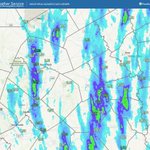
NWS wx & hazards map ~7pm CDT. Winds not very impressive so far. Red numbers are current wind gust in mph.


Isaias surface circulation center now inland based on ~10pm CDT wind reports from NWS/AWOS/ARL network. Heaviest rain now sheared well to north of surface center. Red numbers are current wind gust in mph.

Isaias circulation center still offshore based on wind reports ~9pm CDT. Heavy rain is now inland. Red numbers are current wind gust in mph.


I don't believe everything I see ...
We're gonna make a better day.
youtube.com/watch?v=bdT8ixdx…
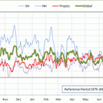
The Antarctic has been dragging the global surface temperature anomaly down the last couple of weeks, despite the strong El Niño. More graphs here:
oz4caster.wordpress.com/cfsr…


Impressive eruption of Anak Krakatau. Brown areas are low-level ash clouds. White puffs and plume are elevated explosive ash clouds combined with cloud formation.

During the ongoing eruption of #Krakatau in Indonesia, 10-minute JMA Himawari-9 True Color RGB images today showed a broad lower-altitude area of volcanic ash (shades of brown) along with pulses of higher-altitude volcanic clouds (a mixture of water vapor, ash and SO2).


One of my gripes about the ECMWF is that it produces lots of false giant squall lines, sometimes in parallel one after the other. This example show a tiny cluster of deep convection NE of Puerto Rico that spawns a growing massive squall line that propagates to S.


Here is the continuation. Several additional squall lines can be seen in NW Carib, Bahamas, offshore NC. Highly unlikely to occur.


Broad weak elongated low pressure area has developed in NE Gulf, with heavy convection and divergent outflow aloft on N side of system. Have not looked at 12z model runs yet, but previous runs did not show significant development (as happened early with Edouard).

TS Edouard rain totals over 24" last 72 hours. Up to 8" added last 24 hours. Note rain color scale is different for 24 hour vs 72 hour. More rain in forecast (see first comment).


GFS total rain forecast was too low, but much better than ECMWF, which was even lower. @RyanWeather


