

Independent journalist mapping environmental change with satellite imagery and GIS. Headed a news bureau at a national daily previously.
India
Joined November 2008
- Tweets35
- Following71
- Followers15
- Likes23


Pinned Tweet
A satellite dataset has revealed that the tallest trees in the Great Nicobar project area are in the 50 to 64 metre range. How many of them will escape the axe? My article for @frontline_india Frontline: #Nicobar #environment #deforestation #remotesensing

NEW | Giant forest trees threatened by Great Nicobar mega project
Satellite data reveals the existence of thousands of tall trees in the earmarked area of the Great Nicobar Island Development Project. It is unclear how many of them will be safeguarded.
T. Ramachandran writes.
frontline.thehindu.com/envir…

This paper finds a connection between weather forecasting accuracy levels and economic inequalities. "A seven-day-ahead forecast in a high-income country is, on average, roughly as accurate as a one-day-ahead forecast in a low-income country." nature.com/articles/s41467-0…

From barren landscape to a sea of flowers

🌸🏜️ The Atacama Desert 🇨🇱 is blooming!
After exceptional winter rainfall, dormant seeds & bulbs have brought the rare Desierto Florido (“flowering desert”) back to life in 2026.
🛰️ #CopernicusEU Sentinel-2 #ImageOfTheDay reveal the dramatic change.
🔗 eu-space.europa.eu/explore-e…

Kolkata and Bengaluru were found to have the highest number of lakes infested with water hyacinth. The researchers also studied lakes in Chennai, Mumbai, and Hyderabad. link.springer.com/article/10… #RemoteSensing #Geospatial

Ramachandran retweeted

Disasters test more than our emergency response, they expose the choices we make in our built environment.
(1/2)
#BuiltEnvironment #ClimateResilience #NepalFloods #ClimateTrends


Ramachandran retweeted

India gliding beneath the International Space Station, seen from just 70 km above Earth 🇮🇳🌍
A breathtaking perspective of our incredible planet from space.
#India #ISS #EarthFromSpace #Space
Readers added context they thought people might want to know
The video shows India from the International Space Station, which orbits at an altitude of approximately 400 km, not 70 km.
esa.int/Science_Explor…
nasa.gov/blogs/spacesta…
The European Space Agency (ESA) and the Indian Space Research Organisation (ISRO) have agreed to Cooperative Agreement for a further five years, until 8 January 2032 esa.int/About_Us/Corporate_n…

Ramachandran retweeted

The Equal Earth world map is now available in Marathi—thank you Rohit Sonawane! With this latest translation, the language tally now stands at 21. All Equal Earth maps are available for free: equal-earth.com


“The fact that the UN is debating map projections for an entire hour is already totally thrilling for cartographers, and then it was our map projection. I mean, what else can you ask for?” theguardian.com/science/ng-i… #maps #GIS #cartography


Ramachandran retweeted

We could be heading for a "Super El Niño"🦸🌀
El Niño is declared when Pacific temperatures rise 0.5°C above average. Forecasts suggest 2026 could see rises of 2–3°C.
Find out how the @IFRC is getting to reduce humanitarian impacts ➡️ ow.ly/38x750Z07JK
More flood events than drought. xitter.cf/UNDRR/status/210084236…

💧Disasters involving too much or too little water – floods and droughts – struck every region of the world in 2025, the @WMO State of Global Water Resources report shows.
Asia and Africa saw the most extreme events.
➡️ ow.ly/eTF950ZOL46 #StateOfWater


A nice interactive map that makes it possible to look at the extent of glaciers in 3D. As we know, a bunch of them are in and around the Himalayas. #maps #glaciology #GIS
xitter.cf/VAW_glaciology/status/…

🏔️ When will each glacier on Earth disappear?
We are happy to share the Global Glacier Extinction Explorer 🌍🧊, a new interactive platform developed from research involving VAW Glaciology at ETH Zurich.
👉 Explore the future of every glacier:
glacierextinction.com
Findings of ISRO’s National Remote Sensing Centre (NRSC), which analysed chlorophyll-a measurements from the Pacific. The observations were EOS-06/Oceansat-3 based. Details: isro.gov.in/EOS_06_Oceansat_… #ElNino #ISRO #Oceansat #RemoteSensing

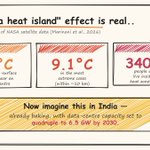
How much hotter is it likely to be if you live near a data centre? Research paper: arxiv.org/pdf/2603.20897 #AI #DataCenters #ClimateChange #India

The great thing about satellite images is that they do not lie! These images show 10 places where water is disappearing globally aje.news/opk8qk via @AJEnglish #SatelliteImagery #EarthObservation #ClimateData

Ramachandran retweeted

🐠 Highest biodiversity of any ecosystem globally
💪 Directly support over 500 million people worldwide
📈 Key indicators of global ecosystem health
Coral reefs are vital ecosystems, and fighting #ClimateChange is key to their survival.

In case you wish to download the Equal Earth map

I am pleased to announce that the Equal Earth world map is now available in Slovenian, plus 17 other languages. You can download them for free here: equal-earth.com

Surprise, surprise! A story related to map projections tops the list of most read stories on the BBC news website! bbc.com/news/articles/ce30vp… #Cartography #EqualEarth #Mercator #CorrectTheMap #UN #WorldMap


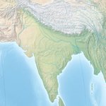
How the Indian subcontinent looks under the new Equal Earth map projection the UN just adopted #EqualEarth #Cartography #India #Maps

ALT The United Nations General Assembly has endorsed the Equal Earth projection, said to show the relative sizes of continents more faithfully than the familiar Mercator projection. This is how the Indian sub continent looks under it.