

Official X account for the National Weather Service Spokane WA. Details: https://xitter.cf/t.co/aXUBdcUoNd
- Tweets45.7K
- Following328
- Followers34.9K
- Likes12.2K


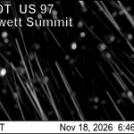




ALT NWS Spokane graphic for a Winter Weather Advisory in the Cascades and Cascade Valleys, issued Nov. 21, 2026. A map shades Winthrop, Chelan, and Wenatchee in purple. Effective 7 PM Saturday–11 AM Sunday for the Central Cascades and Waterville Plateau, and 11 PM Saturday–11 AM Sunday for Western Okanogan County. Expect 1 to 3 inches of snow in the Methow Valley and higher benches near Chelan and Wenatchee, bringing slippery roads Sunday morning.

ALT NWS Spokane forecast map of expected snowfall from Saturday night through Sunday, Nov. 21–22, 2026. Light blue shading shows under 1 inch of snow across much of Eastern Washington and North Idaho, including Spokane, Coeur d'Alene, Omak, Colville, Sandpoint, and Yakima. Darker blue pockets forecast 1 to 2 inches around Carlton, Waterville, Snoqualmie Pass, and Lookout Pass. Areas like Moses Lake, Pasco, Pullman, and Lewiston show no expected snow.

ALT NWS Spokane graphic titled "First Lowland Snow - Sat Night (11/21) to Sun (11/22)." Light snow develops Saturday into Sunday, bringing a trace to 2 inches in lowlands (outside the L-C Valley and lower Columbia Basin) and 1 to 3 inches in mountains, with winter travel conditions possible Sunday morning. Map shows chances for 1+ inch of snow: Spokane 53%, Kellogg 47%, Omak 43%, Chewelah 43%, Colville 37%, Deer Park 31%, Chelan 30%, Ellensburg 25%, Wenatchee 18%, and under 15% elsewhere.

ALT Image of snow at Blewett Pass

ALT Hayford Road Fog

ALT US-395 at Perry Street Fog

ALT 1-90 at Medical Lake Fog

ALT US-2 Fog

ALT Image of Blewett Pass from previous snow event with winter travel conditions, and forecast snow amounts from 4 PM Wednesday - Noon Thursday.

ALT Areas of fog is expected Tuesday night into Wednesday morning particularly in the Moses Lake Area, Upper Columbia Basin, and on the Spokane West Plains. Conditions will deteriorate overnight with some areas seeing dense fog and visibility down to a quarter mile or less.


ALT National Weather Service Spokane briefing (Nov. 14, 2026) warning of mountain snow above 5,000 feet. Forecasts show 2 to 4 inches at Washington Pass Saturday night through Sunday afternoon, 3 to 6 inches above 6,000 feet, and 1 to 4 inches in North Idaho's Selkirks late Sunday morning and afternoon. Key impacts include slick travel over Washington Pass and hypothermia risks for unprepared outdoor enthusiasts.




ALT Graphic showing locations forecast to be impacted by fog Wednesday Night into Thursday morning, expected impacts, and safety tips.


ALT Map of 24 hour rainfall totals ending 5 PM PST Tuesday, November 10th.


ALT Image depicting snowfall across the North Cascades.