

Official X account for the National Weather Service Spokane WA. Details: https://xitter.cf/t.co/aXUBdcUoNd
Spokane, WA
Joined January 2009
- Tweets45.7K
- Following328
- Followers34.9K
- Likes12.2K






NWS Spokane retweeted
TODAY: A nationwide emergency alert test will air on radios and TVs. This test was prescheduled and will last approximately one minute. No action is needed.
Test time ⤵️
2:20 p.m. ET
1:20 p.m. CT
12:20 p.m. MT
11:20 a.m. PT
10:20 a.m. AKT
8:20 a.m. HT
🔗 fema.gov/fact-sheet/2026-nat…

NWS Spokane retweeted

In case you heard otherwise, there is no radar outage and radar.weather.gov is fully operational! Outdated content from isolated webpages stating otherwise has been circulating, but NWS radars are operating normally.
NWS Spokane retweeted

Probabilistic forecasts show you the full range of potential outcomes. The National Weather Service’s Probabilistic Precipitation Portal website allows you to see these probabilities for rain, snow, and freezing rain all in a one-stop shop location.
🔗: wpc.ncep.noaa.gov/Prob_Preci…
NWS Spokane retweeted
The 2026-2027 Winter Season Outlook was released today, please see the following link: noaa.gov/news-release/el-nin….
Winter is approaching, are you prepared? Over the next two weeks, we’ll share tips and essential product updates to help you navigate the cold months. Stay tuned! ❄️

NWS Spokane retweeted

1/4 New Seasonal Drought Outlook with new design by @NOAA's @NWSCPC and @NIDIS
Drought develops/worsens: Interior Northwest and N. Rockies
Drought improves/removed: Southern US, Northeast, Coastal Northwest, a few others
Otherwise, drought persists cpc.ncep.noaa.gov/ @NWS

ALT Map of the NOAA National Weather Service Climate Prediction Center’s U.S. Seasonal Drought Outlook valid September 17 through December 31, 2026, showing widespread persistent drought across the northwestern United States, along with widespread drought improvement and removal across the southwestern, central, and eastern regions. Areas of new drought development are forecasted primarily across part of the Washington and Oregon border, northern Idaho, and northwestern Montana.


NWS Spokane retweeted
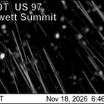
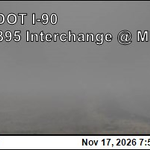
I90 is closed in both directions in the town of Ritzville due to visibility concerns and multiple collisions. Please avoid the area.


NWS Spokane retweeted

I-90 is closed in both directions in the Town of Ritzville due to lack of visibility and multiple collisions beginning at 2:46 pm on Sept. 25, 2026 until further notice. Expect long delays.
NWS Spokane retweeted
Living in or near the mountains means being ready for rapidly changing conditions in any season. Don't just rely on a standard car emergency kit. Customize your supplies for high-elevation hazards!
Being prepared makes the difference between a minor inconvenience and a dangerous situation. 🏔️❄️🚗
#MountainSafety #CarEmergencyKit #NationalPreparednessMonth


NWS Spokane retweeted

. @NWSBoulder IMET en route to #UpperSmithFire near Bonners Ferry, ID #IDwx #IDfires @NWSSpokane inciweb.wildfire.gov/inciden… Photo courtesy @inciweb

NWS Spokane retweeted
. @NWSReno IMET en route to #PtarmiganFire near Mazama, WA @WAwx #WAfires @NWSSpokane @OkaWenNF inciweb.wildfire.gov/inciden… Photo courtesy @inciweb

NWS Spokane retweeted
. @NWSReno IMET on site at #ModriteFire near Inchelium, WA #WAwx #WAfires @NWSSpokane inciweb.wildfire.gov/inciden… Map courtesy @inciweb

NWS Spokane retweeted
. @NWSMissoula IMET en route to #LittleGiantFire near Leavenworth, WA #WAwx #WAfires @NWSSpokane @OkaWenNF inciweb.wildfire.gov/inciden… Photo courtesy @inciweb

NWS Spokane retweeted
. @NWSEureka IMET and @NWSBinghamton IMET trainee en route to #BradeenHillFire near Inchelium, WA #WAwx #WAfires @NWSSpokane @waDNR_fire inciweb.wildfire.gov/inciden… Photo courtesy @inciweb

NWS Spokane retweeted
. @NWSBurlington IMET en route to #LittleGiantFire near Leavenworth, WA #WAwx #WAfires @NWSSpokane @OkaWenNF inciweb.wildfire.gov/inciden… Map courtesy @inciweb

NWS Spokane retweeted

#HamiltonFire URGENT!!! Evacuation upgrade for several areas. Northeast Winthrop is now under Level 3 evacuate. Air support is continuing their work. Wind gusts continue to be around ~30 MPH. Air quality remains near 150 in the Winthrop area. #wawx


NWS Spokane retweeted
An El Niño Advisory has been issued and you may have recently heard the term "Super El Niño". One of our meteorologists explains the terms NOAA uses to describe ENSO intensity and some basics of what El Niño is and is not.
The forecast calls for El Niño to strengthen into the winter months. See the advisory: cpc.ncep.noaa.gov/products/a…
More at noaa.gov/news-release/el-nin…
NWS Spokane retweeted

Enhanced color imagery from @NOAA's #GOESWest (#GOES18) 🛰️ is helping us continue to monitor an upper-level low over California and the Great Basin, bringing scattered severe storms and heavy rain across the region. Today, a #SlightRisk of severe thunderstorms exists across parts of the Pacific Northwest, with threats including damaging wind gusts, large hail, and a few possible tornadoes.
Latest: spc.noaa.gov
NWS Spokane retweeted

PSPS // A public safety power shutoff (PSPS) is a proactive power outage intended to prevent potential fires during extreme weather events. Learn more: ow.ly/J3CQ50Z2NEt