

North Mississippi Storm Chasers & Spotters. Social Media. Primary spotter network for local media, with working relations with multiple emergency agencies.
Union County, MS
Joined April 2009
- Tweets22.4K
- Following305
- Followers3.6K
- Likes1.2K



Pinned Tweet
We would like to announce that we can now accept your tax-deductible donations. We currently offer 3 ways:
1. Visit our website and click donate. (link in bio)
2. Text NMSC to 53555
3. Visit givebutter.com/Y3o6N9
Your donation supports us during the storm season and some community projects that we plan to announce in the coming weeks.

On this date: November 21–22, 1992, a deadly tornado outbreak struck Mississippi. An F4 tornado tracked 128 miles through 7 counties, killing 12 and injuring 122.
Statewide, 15 people died and 269 were injured.
Images via @NWSJacksonMS / Carion Ledger


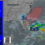
A large complex low offshore the Southeast U.S. has centers over the Gulf, west-central Florida, and the western Atlantic; it has a 30% chance to become subtropical/tropical in 48 hours and 30% in 7 days.

1
144
Live look from our Forest Skycam, sponsored by MaxxSouth Broadband: hazcams.com/station/forest-m… #mswx


For those noticing smoke around the Jackson metro right now, it is coming from a controlled burn in the Bienville National Forest in Scott County today. The smoke plume extends as far north and west as Yazoo County.
2
220
North MS Storm Chasers 🌪🇺🇸 retweeted

Some dixie alley statistics for yalls feed. Unless something really crazy happens, we will probably end off the year in Mississippi with 1 EF3 and 1 EF2. The only modern years where there was only 2 or less sigtors in Mississippi was, 1951,1959,1960,1964,1989,2007, and 2016. – at Starkville, MS
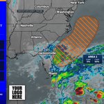
Several broad lows along a front near central Florida may gain subtropical or tropical traits as they move north-northeast; 30% chance in 48 hours, 40% in 7 days.

1
158
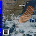
Broad low over southeastern Florida and the northwestern Bahamas has disorganized showers and thunderstorms. It has a 30% chance to develop in 48 hours and 50% in 7 days.

1
180
Disorganized showers and thunderstorms over the Bahamas and Florida front could spawn a non-tropical low east of Florida on Friday. 30% chance to develop in 48 hours and 60% in 7 days.

1
146
Atlantic Tropical Weather Outlook for Atlantic from 6 AM CST Thursday through 1:47 PM CST Thursday. #1 48h 20% / 7d 60%.

1
163
Atlantic Tropical Weather Outlook for Atlantic from 12 AM CST Thursday through 7:10 AM CST Thursday. #1 48h 0% / 7d 60%.

1
184


One of the most stunning sunrises I've ever seen on our Rolling Fork Skycam sponsored by Southeast Broadband.

4
191
Frost Advisory has been issued for Perry, Greene | Temperatures: 33-37 F | Expires Sunday, 11/15/26 at 8 AM.

1
143
Frost Advisory has been issued for Perry, Greene, Stone +1 more | Temperatures: 34-37 F | Expires Saturday, 11/14/26 at 8 AM.

110
Event Expanded - Freeze Warning for Issaquena, Warren | Temperatures: 32 F | Expires Saturday, 11/14/26 at 8 AM.

123
Freeze Warning has been issued for Wayne | Temperatures: 29-32 F | Expires Saturday, 11/14/26 at 8 AM.

1
123
Freeze Warning has been issued for Lauderdale, Colbert, Franklin | Temperatures: 26 F | Expires Saturday, 11/14/26 at 8 AM.

1
165
Freeze Warning has been issued for Bolivar, Sunflower, Leflore +28 more | Temperatures: 28 F | Expires Sunday, 11/15/26 at 3 AM.

1
1
175
